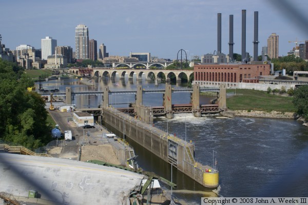
Despite not being well known, the dam is still a fairly large structure. It has a 24-foot head, which means that the water behind the dam is 24 feet higher in elevation than water in front of the dam. While there is no hydro-power at this dam today, we can expect to see it in the future. Studies are underway to install a linear turbine in the gate next to the boat lock. The 275 foot long main dam structure features 4 Tainter gates. The lock is 56 feet wide by 400 feet long, which is about two-thirds the size of a typical Mississippi River lock. The original dam at this location was built in 1897 as a hydropower dam. That structure was removed in 1959. The current dam was built as part of the lock & dam project.
Update—Lock & Dam #1, as well as both the Upper and Lower Saint Anthony Falls Locks & Dams, were closed twice during 2012 due to high water flows following unusually large rainfalls in central Minnesota. The first closing was to recreational users on May 28 and May 30 for commercial users. The locks were reopened on June 8. They were closed again on June 22 for recreational use and June 24 for commercial use, then reopened on June 28. The US Army Corps of Engineers closes the locks to recreational users when the flow hits 30,000 cubic feet per second, and closes to commercial traffic at 40,000 cubic feet per second.
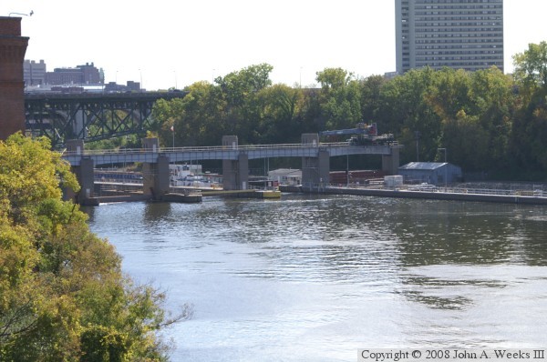
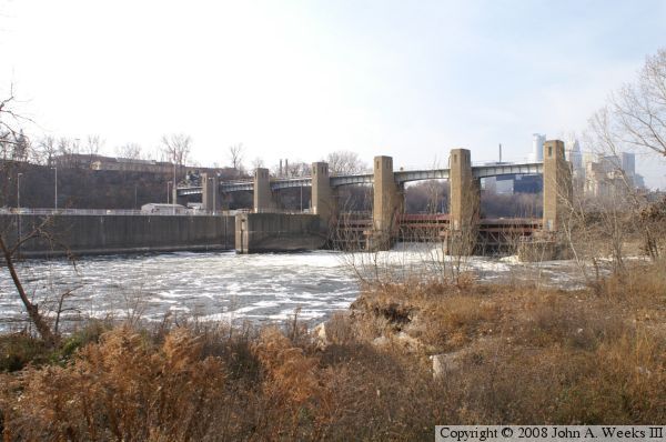
The photo above is taken from the east side river flats. This area is open to people who have business at the University of Minnesota Tandem Accelerator Lab. This is the only legal spot I could find to take a photo of the downstream side of the Lock & Dam.
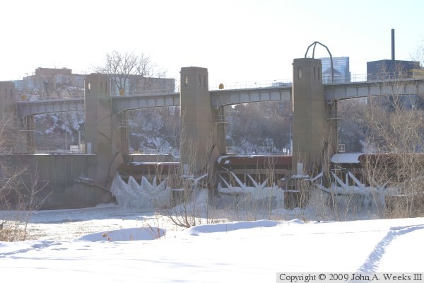
The photo below is another view of the downstream side of the Lower Falls structure. It was taken from the 10th Avenue Bridge. This photo is only possible with the collapse of the I-35W bridge, which would normally block the view of the lock & dam. Note the nice view of the Stone Arch Bridge and the 3rd Avenue Bridge in the background. The lock and this section of the Mississippi River was closed from August 1, 2007 to October 5, 2007 following the I-35W bridge disaster.