US-8 is the major highway that runs east and west across northern
Wisconsin. On the Minnesota side of the border, US-8 and US-61
were once the key routes feeding the Twin Cities from the north.
That role is now handled by I-35.
US-8 crosses the Saint Croix river at an interesting spot. It is
the very north end of the Saint Croix Dalles area, a spot where
the river has cut a deep channel through a stretch of very hard
rock. Most of this channel was cut when glacial Lake Duluth
emptied. This left a deep gorge for the river to flow through.
It also resulted in a very narrow but very deep river. The Saint
Croix often runs 70 feet deep in this area, with pools that are
over 100 feet deep.
The US-8 bridge is a somewhat uncommon steel girder design. It isn't
that steel girder bridges are uncommon, it is that they are rare in
Minnesota. The state Department of Transportation greatly prefers
to use pre-stressed concrete girders. The use of steel does add some
interesting features and color under the bridge. That really adds to
the appeal of an otherwise uninteresting bridge located in a very
interesting and scenic location.
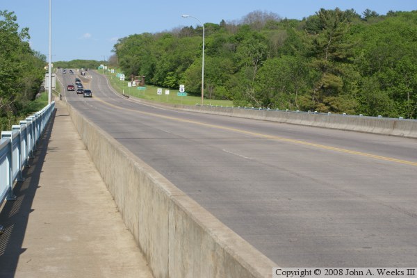
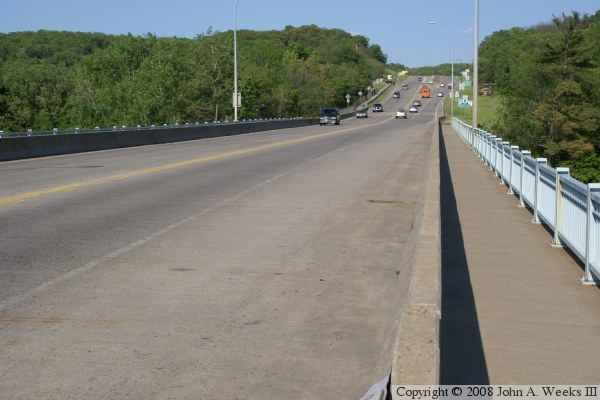
The photo above is a view looking towards the Wisconsin side of the river
crossing from mid-span on the north side of the US-8 Bridge.
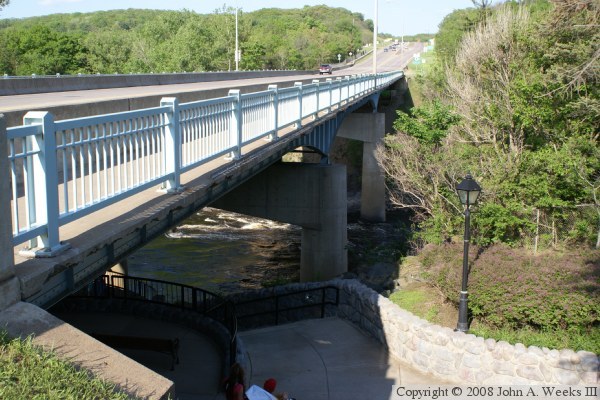
The next 4 photos are views of the bridge as seen while walking on the trail
that passes under the west end of the structure. The photo above is the
south face of the bridge as seen from the bridge deck level. The photo
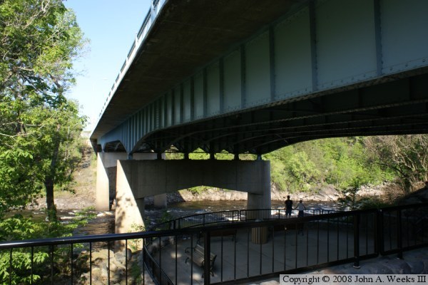
below is the same view, but seen from the observation deck approximately
20 feet below the bridge deck.
These two photos are the final two of a four picture series showing a walk
on the trail under the west end of the US-8 Bridge. The photo above is a
view from directly under the bridge. The photo below is the north face of
the bridge.
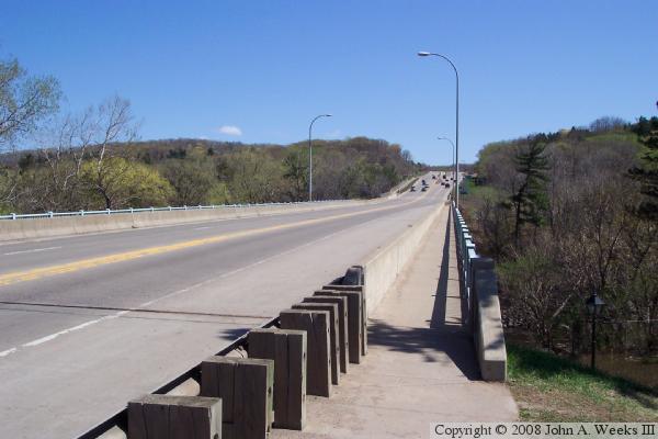
These two photos are views of the bridge deck looking to the east towards
Wisconsin from the sidewalk on the south side of the structure. The photo
above is from the west end of the bridge taken during early early spring,
while the photo below is from mid-span taken in late summer.
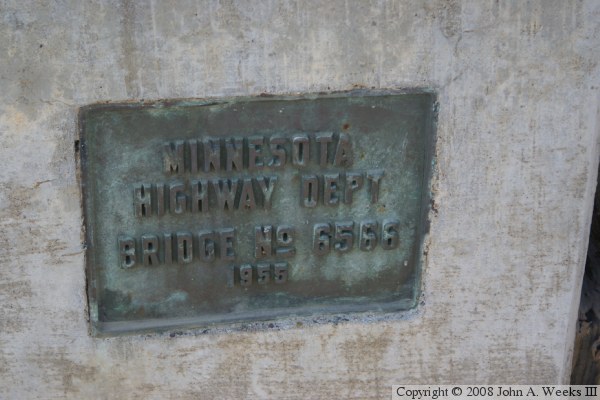
The photo above is the view from an overlook on the west bank of the
Saint Croix River located just downstream of the bridge. The photo below
is the bridge plate on the Minnesota side of the structure.