| Highways, Byways, And Bridge Photography |
Rock Island Swing Bridge
Former CSAH-24 Mississippi River Crossing
Inver Grove Heights, MN to Saint Paul Park, MN
|
• Structure ID: |
NBI: 5600. |
|
• Location: |
River Mile 830.3. |
|
• River Elevation: |
686 Feet. |
|
• Highway: |
Former CSAH-24. |
|
• Railroad: |
Former Rock Island Railroad. |
|
• Daily Traffic Count: |
3,900 (1998), 0 (2005). |
|
• Daily Traffic Count: |
0 Trains Per Day (Closed). |
|
• Bridge Type: |
Steel Truss w/Swing Section. |
|
• Length: |
1,661 Feet Overall, 442 Foot Swing Span. |
|
• Width: |
Single Track, 18 Foot Roadway. |
|
• Navigation Channel Width: |
192 Feet Upstream, 194 Feet Downstream. |
|
• Height Above Water: |
19 Feet. |
|
• Date Built: |
Opened 1895, Rebuilt 1970. |
The Rock Island Swing Bridge is unique in that it was the last operating toll
bridge in the Twin Cities metro area, and it was the last operating swing
bridge for automobile traffic. Highway traffic used the bottom deck, while
trains used the upper deck. That is a relatively unusual configuration given
that trains normally use the lower deck of a shared bridge.
The traffic deck was only about one and a half lanes wide, so two cars were
only barely able to pass on the bridge. For many years, the bridge operated
in a one-way configuration, with the traffic direction alternating every few
minutes. In later years, the toll booth was moved from the west end to the
middle of the bridge, and the bridge operated with two-way traffic. The final
toll when I last crossed this bridge was 75 cents. That was in the mid-1990s
when the Wakota bridge was being rebuilt. In fact, the extensive backups on
the Wakota bridge drove a lot of car traffic to this old toll bridge.
The bridge was built in 1895 by the Pittsburgh Bridge Company for the South
Saint Paul Beltline Railroad. The Beltline was formed in 1889 to operate rail
traffic in the vicinity of the Saint Paul Union Stockyards. The stockyard,
founded in 1886, would become one of the largest stockyard operations in the
world. The Beltline became the Minneapolis & Saint Paul Terminal Railway
in 1903 when several of these industrial railroads were consolidated. The
Chicago, Rock Island, & Pacific Railway purchased the Terminal Railway in
1904, gaining control of the swing bridge at Newport.
While the Rock Island had many glory years, it was caught up in a cycle of
competition, excess capacity, flat revenue, and increasing costs in the
decades after World War II. The railroad attempted to merge with the Union
Pacific in the 1960s, but every other Midwestern railroad filed protests
over the proposed merger. The merger was finally approved in 1974, but by
that time, the railroad had deteriorated to the point where Union Pacific
was no longer willing to make the investment to keep it running. The Rock
Island attempted to continue operating. It finally collapsed after a strike
all but stopped the trains in August, 1979. The courts rejected the
bankruptcy reorganization plan in early 1980, leading to the liquidation of
the company.
Entrepreneur Alfred Roman, along with his wife Joan, bought Rock Island
Bridge from the bankruptcy receivers in 1980 with the intent to operate the
structure as a toll bridge. The state of Minnesota had no provisions for a
private person to own a river bridge, so a special law was passed to allow the
bridge to be operated by a private concern. While the highway deck continued
to operate, no trains used the bridge after the Rock Island shutdown.
An inspection in 1999 found a bad section in the bridge. The Romans could not
afford the repair, so the bridge was forced to close. That was a sad day. In
retrospect, it would have been great to have an alternative to the massive
traffic jams that were seen in mid and late 2000s due to the Wakota Bridge
replacement project. Local kids set fire to the bridge in 2006, further
damaging the structure. The Romans have since stopped paying taxes on the
bridge, resulting in ownership of the bridge reverting to Washington County.
The county is looking at removing the bridge, a project that would cost
several million dollars to complete.
When this bridge was open to auto traffic, it was maintained in the
closed position, and only opened when a river boat needed to pass.
Today, the bridge is maintained in the open position. Another
uncommon feature of this bridge is that when it is open, there
are two navigation channels, one on either side of the pivot
point of the swing span. Despite remaining open and having two
navigation channels, the bridge is considered to be a navigation
hazard and a security threat to the nearby refinery. The US Coast
Guard has formally ordered that the bridge be removed due to being
a navigation hazard.
Bridge is also known as the Saint Paul Park Bridge, Newport Bridge, and
the JAR Bridge (for Joan and Alfred Roman, the former owners). To find
this bridge, head south of I-494 on Concord Blvd, then make a left
to head east on 66th Street East. The bridge will be about a half
mile down the road. The road is blocked off, and it is illegal to
trespass on the bridge. The best view of the bridge is from the
marina just north of the bridge. When you get to the end of 66th
Street, make a left, head into the marina, then loop back towards
the marina restaurant. There is no public access to the east end
of the bridge.
Update—the National Park Service sponsored a bridge open house
on October 25, 2008. This gave the general public a chance to get a
guided tour of the structure. An unexpectedly large number of people
turned out for the tours, giving the Park Service hope that there is
a large amount of interest in saving at least part of this old bridge.
Update—on the morning of November 21, 2008, it was noticed that
a 200 foot section of the bridge on the Washington County side of the
swing span (eastern end of the bridge) had collapsed under its own
weight into the floodplain. The collapse underscores how badly the
bridge has deteriorated, and may dash the hopes of the National Park
Service to save part of the structure.
Update—the Veit Companies has been awarded a contract to demolish
and remove the Rock Island Swing Bridge. Major work on the project was
undertaken in March, 2009, with the removal of the eastern approach,
the swing span, and the western-most bridge span. Several of the fixed
spans were removed in April and May, leaving little hope of saving any
of the bridge for future reuse.
Update—as of August, 2009, this old bridge might yet get a second
lease on life. A pre-demolition survey found that two of the bridge truss
spans were still in reasonable condition and could potentially be saved.
The city of Inver Grove Heights submitted several grant requests. Nearly
a million and a half dollars of money was pledged to their proposal to
create a 670-foot long pier using the two remaining 140-foot long bridge
spans, plus building two new spans (one of 140 feet, the other 250 feet
long). A problem with this plan has cropped up in that ownership of the
bridge is in dispute, and the city is unable to obtain the title on the
remaining portion of the bridge. Meanwhile, the US Coast Guard is
demanding that the demolition be finished and the river be cleaned up.
In fact, Dakota County had scheduled the final phases of the demolition
for June, 2009. The state legislature stepped in and passed a bill
prohibiting that work from moving forward. The city of Inver Grove
Heights has won a stay of execution for the bridge, but now must sort out
the ownership among 10 governmental agencies before the grants expire.
A side effect of the legislative action is that crews are unable to remove
the old swing span pier from the river, which presents a major obstacle
to safe river navigation.
Update—the bridge restoration project is moving forward as of the summer
of 2010. Crews are installing two long prefabricated bridge spans on the
west end of the structure to connect the remaining spans to the west bank
of the river. The remaining bridge spans will be refurbished and have a
fishing deck installed. The opening it scheduled for November.
Update—disaster stuck the Rock Island Swing Bridge on November 4, 2010.
With construction of the public pier conversion only three weeks from being
complete, a spark from a cutting torch set the historic bridge spans on
fire. The fire burned for nearly 4 hours, finally being brought under
control by fireboats and water drops from a helicopter. A section of the
bridge deck has fallen into the Mississippi River. As this was written, it
has not been determined what, if anything, can be salvaged, or if there are
any insurance options to repair the damage.
Update—as of mid-April, 2010, the Rock Island
Swing Bridge Recreational Pier is nearly completed and almost ready
to open to the general public. Click here for
coverage of the rebirth of ‘this old bridge.’
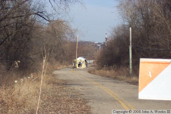
This photo from the spring of 2005 shows the entry road and the
toll booth. The entry road is blocked off with a white and orange
barricade, a pile of dirt, and section of guard rail placed across
the roadway. Despite years of disuse, the pavement marking is still
visible. The power lines appear to have been removed.
Fast forward to the fall of 2006, and the toll booth has been removed.
It must have been pulled out fairly recently given that there is no
grass growing in that area yet.
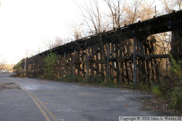
A view of the railroad trestle on the west side of the river crossing.
The bridge has a very unusual configuration of having road traffic on
the bottom and rail traffic on the top.
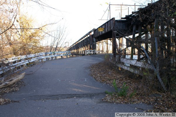
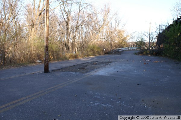
Here we see the entry road as it makes a sharp S-turn to enter
the bridge on the west side of the Mississippi. A section of guard
rail is missing, something that is common further out on the bridge.
Here is a close-up of the damage from the summer 2006 fire that
was set by trespassers. A 22 foot section of the rail trestle
was destroyed. Notice the large fence section on top of the
rail bridge to try to keep trespassers from walking out on the
railroad tracks.
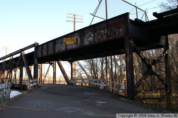
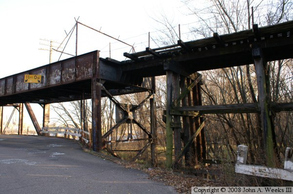
This is another view of the roadway as it enters the bridge. The
sign indicates that there is exactly 11 feet of vertical clearance.
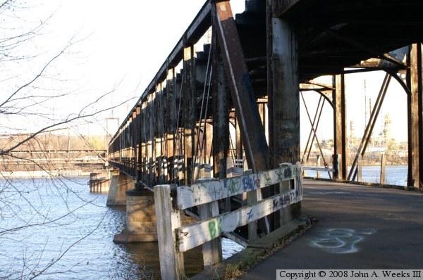
Here is a view along the outside of the fixed span of the bridge.
The piers appear to be in excellent condition, as least the parts
that are above the waterline. The steel looks to be in pretty
good condition, too, despite some surface rust and missing paint.
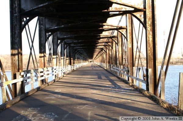
Here is a look down the infinite corridor of time, space, and dimension.
The bridge deck appears to be blacktop pavement put down over corrugated
steel sheets. It is in excellent condition. The railings, however,
have seen better days. A good fraction of the railings are gone, and
the remaining railings look to be unsafe.

A quick look back shows what an automobile driver would see as they come
to the end of the crossing. I recall this sign as being yellow with a big
black arrow. However, people tell me that this was actually an advertising
sign.

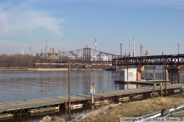
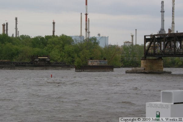
This photo is a view downstream of the bridge. We see a few small
islands, a few abandoned houseboats and a pair of river going tow
boats.
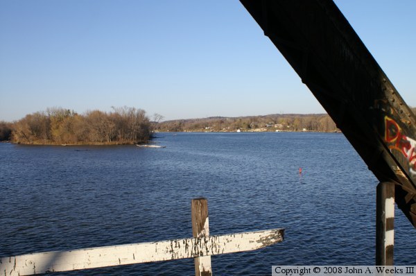
A look up river shows just how wide the great river is despite being
so far north. There is a large marina located just to the left of
this photo.

Looking upward, we see that the railroad track is set off to one side
of the upper deck. I have no idea why that was done. There isn't
enough space for a parallel railroad track, so I would have expected
that the rail line would be centered. The full width of the 442 foot
long swing span is seen in the distance.
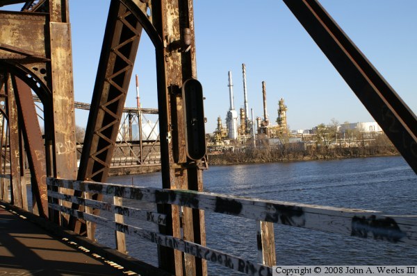
This fixture was once a stoplight that warned motorists that the
swing span was about to open, or that it was currently open.
Vandals have taken a toll on anything that can be broken or removed
by hand. In the background, we can see a portion of the refinery
in Saint Paul Park. The Rock Island bridge enters Saint Paul Park right
behind the refinery, and the road to the bridge circles 3 sides of
the complex. These roads have been identified as a homeland security
threat, so they have been closed and blocked off.
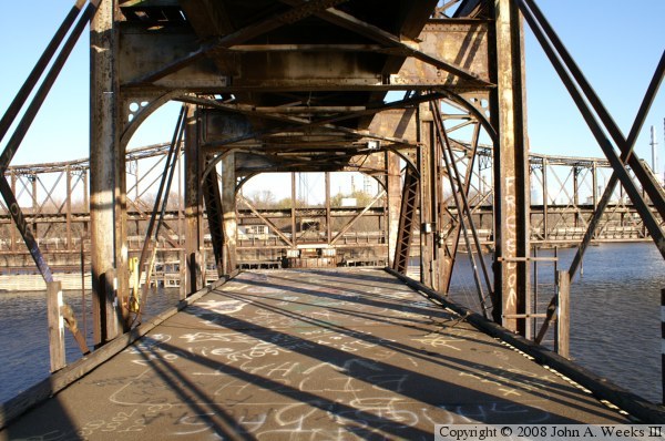
The roadway simply ends where it would meet the swing span. There
are no barricades or fences. Then again, this place is posted for
no trespassing, so there should be no need for any human comforts.
It looks like there was an attempt to put a cable across the roadway,
but it is laying on the pavement rusting away. It is also rather
windy out here given that the bridge deck is sitting high above the
water and there are no trees or objects to slow down the wind.
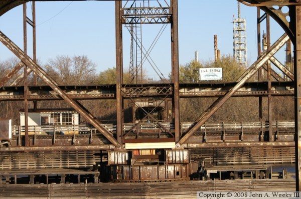
This is a close-up view of the swing span at its pivot point. The
bridge tender house is hung off of the side of the
swing span. These days, the span is left in the open position all
the time. Despite the bridge being closed, river traffic is still
forced to navigate through a relatively narrow gap. A sign stating
that this is the JAR Bridge is positioned just above the railroad tracks.
Note that the fixed bridge structure on the east side of the river is
visible, and that the roadway does have a barricade (look for the yellow
pipes). In addition, the stoplight on the east end is still intact.
The east portal has not seen the visitors and vandals that are common
to the west side, apparently due to the security at the refinery.
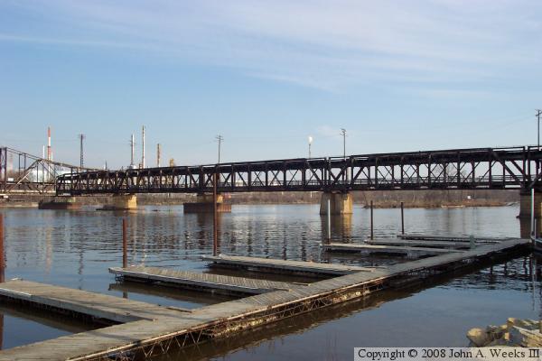
This is a view of the fixed portion of the Mississippi River span as seen
from the marina just upstream from the Rock Island Swing Bridge.

This photo shows the portal on the east end of the bridge. The road on the
east end of the bridge has been abandoned and turned over to the Marathon
Oil Corporation refinery. Since 9/11, the refinery operators believe that
they are a potential terrorist target, so they are very diligent about
security. Anyone attempting to look at or photograph the east side of
the bridge was quickly intercepted. This structure collapsed in November,
2008, and was removed in March, 2009.

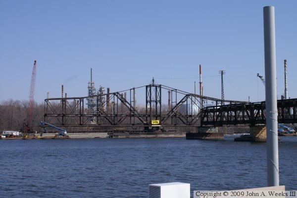
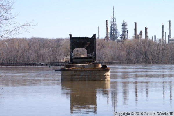
This photo shows the swing span in the closed position as part of the
demolition on March 8, 2009. This is the first time that the bridge has
been operated since it closed to traffic in 1999, and the last time that
the bridge was closed before the swing span was demolished.

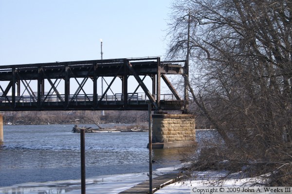
This is another view of the bridge in the closed position. Part of the
western fixed spans are in view. The eastern fixed spans have been fully
removed.
This view on March 14, 2009, shows the swing span back in the open position.
The end sections of the truss have been removed from both ends of the span.
Barges are in position in the main navigation channels to support the
demolition. It is critical that this work be complete before the start
of the river navigation season.
The western-most span of the western fixed section of the bridge has also
been removed. This view is the western-most bridge pier.
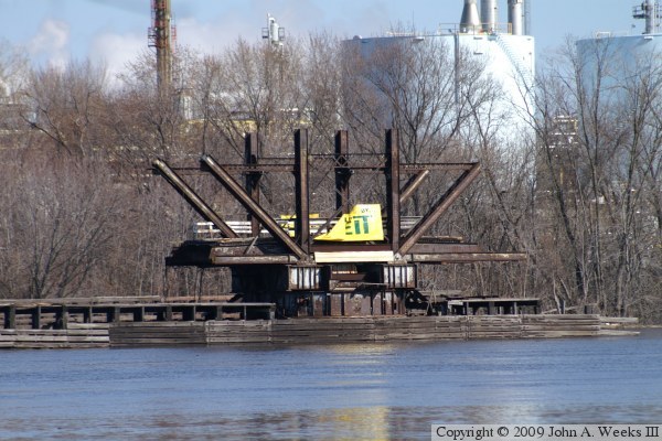
A very small section of the swing span remains standing on the afternoon
of March 29, 2009. The work barges have been moved to shore due to the
high water levels and debris flowing down the fast moving river.
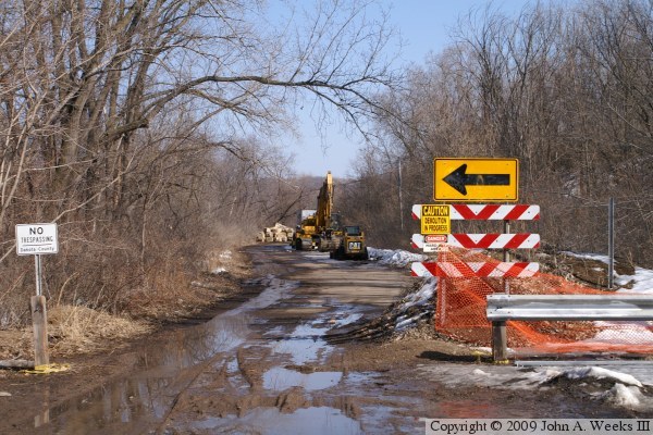
The approach road at the west end of the bridge is being used to stage
equipment for the demolition project, and for parking for the construction
crew.

The demolition of the swingspan was complete as of April 9, 2009.
Demolition of the fixed spans continued in April and May of 2009. Only
two spans remain near the middle of the Mississippi River.
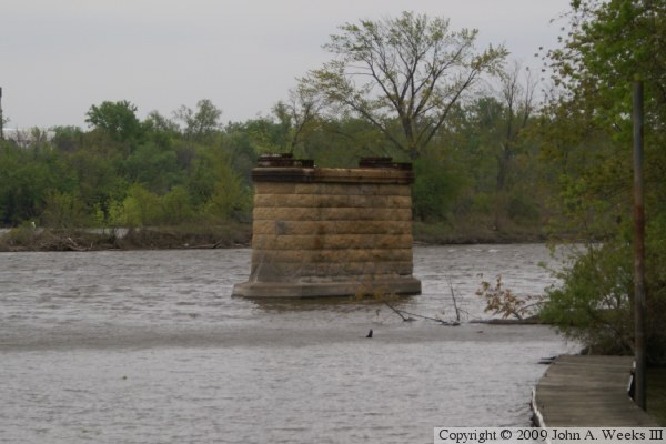
This is a close view of the western-most bridge pier, where the spans
on either side of the pier have now been dismantled.
This is a view of the mid-river piers.
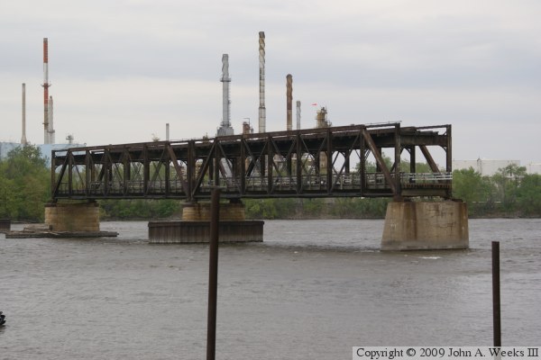
This is a view looking east directly across the Mississippi River through
the remaining truss spans of the Rock Island Swing Bridge. This photo was
taken in March, 2010, during a period of high water. Note that only 4 rows
of stones are visible on the pier, whereas the photo above from the summer of
2009 shows 8 rows of stones above the waterline.

This view is looking slightly southeast across the Mississippi River. Part
of the abutment on the east end of the bridge is visible in the distance.
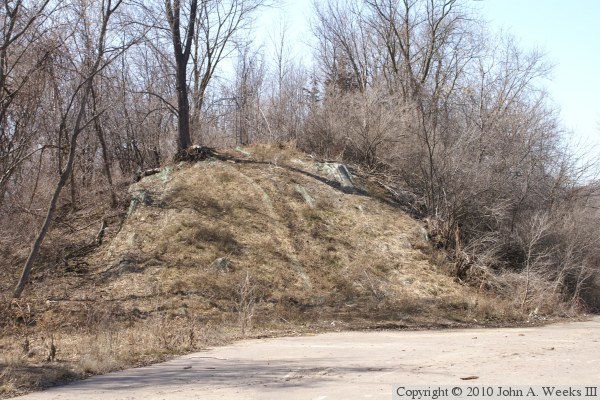
This is a view looking west towards the railroad embankment leading to
the old bridge. The embankment is mostly intact with only a small amount
of earth having been removed. A wooden trestle carried trains to the west
end of the steel structure.
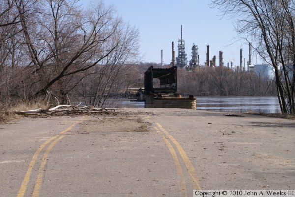
This photo is a view looking east from the roadway leading to the former
location of the toll booth. It is interesting to compare this view with
a photo from near the top of this page. It appears that the roadway leading
to the bridge portal has been removed, as has about 50 feet of causeway
that once supported the bridge trestle.
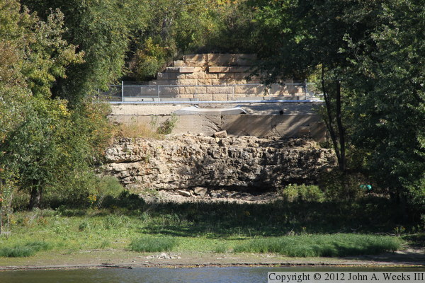
This photo is the east bridge abutment as seen from the east end of the
Rock Island Swing Bridge Recreational Pier. The railroad tracks landed
at the top of the cut stone structure. The silver pipe is sitting on the
apron where the traffic lanes once divided and went on either side of the
railroad embankment. A series of small piers carried a trestle-like
series of short bridge truss spans across the small island between the
pier and the river so they would meet with the east end of the swing span.
The Rock Island Swing Bridge was connected to the rail line on the west side
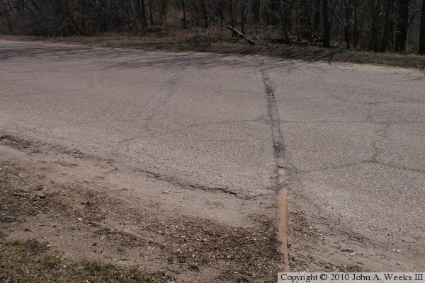
of the Mississippi River by a large wye-track. The northern branch of the wye
crosses 66th Street East about 1200 feet west of the bridge. The rails are
still in place, having been simply paved over with asphalt.

This view is looking northwest towards 66th Street East along the northern
branch of the wye-track. Here, the rails are overgrown with grass and
brush, with small trees growing between the ties.

This photo was taken from the same vantage point, but is looking east towards
the direction of the Rock Island Swing Bridge. The path along the tracks
had been brushed out sometime in 2010 and appears to be well worn. I don't
know who brushed out the tracks, but the path was probably made by folks
looking at the old bridge since the normal entry road was blocked off for
construction.
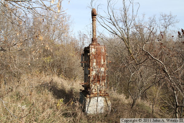
A rusty old signal control box is still standing along the abandoned
railroad line leading to the Rock Island Swing Bridge.
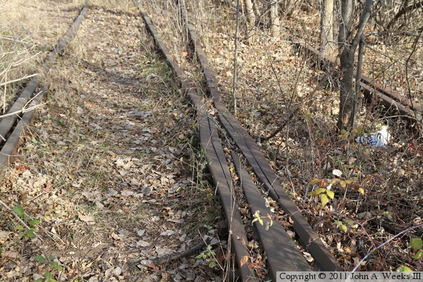
The two legs of the wye-track meet about 500 feet west of the bridge. While
the northern branch of the wye has been brushed out, the southern branch has
not, as evidenced by the small tree growing between the rails on the right
side of this photo.
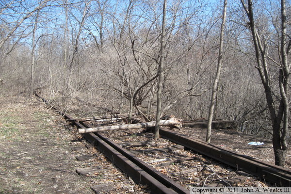
Here is a view of the switch points where the wye-track legs meet just
west of the old Rock Island Swing Bridge. This switch is located on a
fairly tall fill some 30 feet above the swamp that is located to the south
of the tracks. Again, note the 3 inch diameter tree growing between the
rails, and a 5 inch tree just to the right side of the rails.

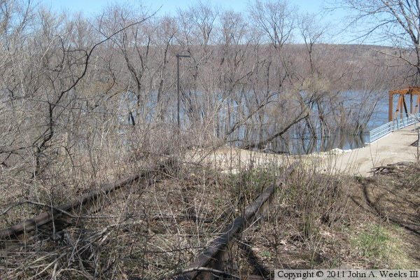
The photo above is the concrete base of another signal control box, however,
the control box is long gone. The photo below is the end of the tracks
where the old Rock Island Swing Bridge once stood. The embankment was
cut back over 100 feet, and fill that was in the river was removed when
the old bridge was removed. While this is the end of the line, it is not the
end of the story for the old Rock Island Swing Bridge. Click
here for the story of the remarkable rebirth of the
bridge ruins as the
Rock Island Swing Bridge Recreational Pier.
|
