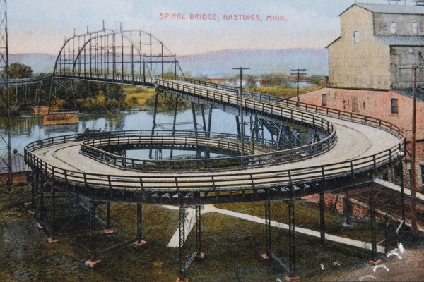
At Hastings, there is a tall bluff on the north side of the Mississippi
River. A conventional bridge would have required a long approach on
the southern side. The problem is that a long approach would cause
traffic to bypass downtown Hastings. Building a spiral solved the
problem—it allowed traffic to enter and exit from Main Street
downtown Hastings, yet the approach gained the elevation needed to
allow the bridge to be level. When built, this was the only spiral
wagon and automobile bridge in the US, and only 2 are known to have
been built in Europe.
The old bridge served for many years. But due to neglect, the steel
rusted, and towards the end, the bridge could only support 4 tons,
which prevented truck traffic from crossing the river. The new bridge
was built shortly after WWII. The old bridge was given to the City of
Hastings, but they could not afford to maintain it. An effort by the
citizens also failed to raise the needed money. As a result, the old
bridge was removed in the mid-1950s. As soon as it was torn down, the
city realized they had made a mistake. The Spiral Bridge was a symbol
of the city for decades. Now days, when someone in Hastings wants to
tear down a historic building, the cry goes out to remember what
happened to the spiral bridge.
Hastings residents Steve and Sylvia Bauer took that cry to heart. They
collected historical buildings from around Hastings and founded the Little
Log House Pioneer Village. A star attraction in the village is a replica
of the Spiral Bridge, complete with a model of the Mississippi River.
Note—the statistics at the top of the page are for the real spiral
bridge as it once existed. The replica is built to a smaller scale than
the original.
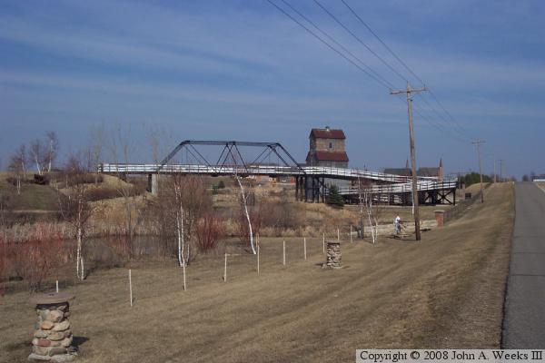
The photo above is a view of the replica bridge looking northeast from the
edge of 220th Street. To find the replica Spirla Bridge, head south out of
Hastings on US-61, then turn to the east on 220th Street. The replica will
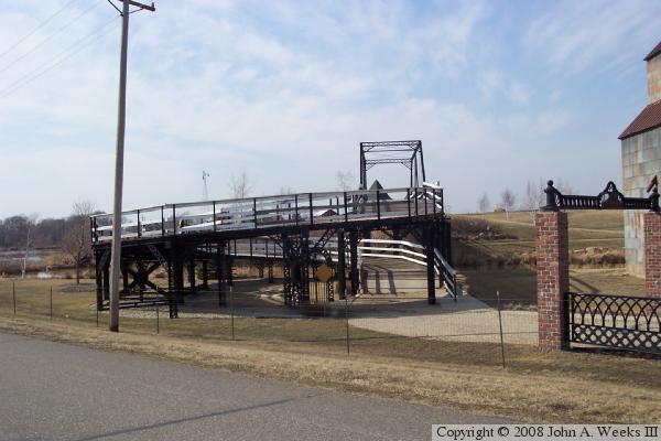
be about one-half mile east of highway US-61. The photo below is an end view
of the replica Spiral Bridge.
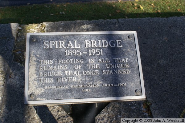
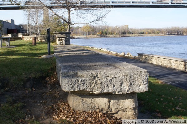
The photo above is the marker erected at the site of the former Spiral Bridge
along the waterfront in Hastings. The photo below is the only remaining
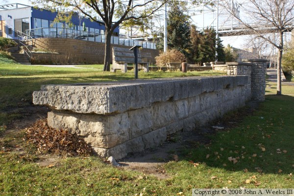
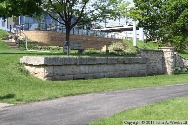
footing of the Spiral Bridge. This footing is located on the Hastings side of
the river in a park that runs along the Mississippi River. One can see a
rectangular depression in the top of the capstone where one of the metal legs
of the bridge once rested.
These two photos are views looking southwest towards the Spiral Bridge pier.
Since the pier runs east and west, the front side is always in a shadow. The
photo above is from later afternoon in 2008, while the photo below is from
early morning in 2011. The building in the background is the American Legion.
The image above is clipped from a photo of a guide sign located at the Great
River Road Visitor Center in nearby Prescott, Wisconsin. It is from a period
postcard showing the Spiral Bridge from Hastings looking north across the
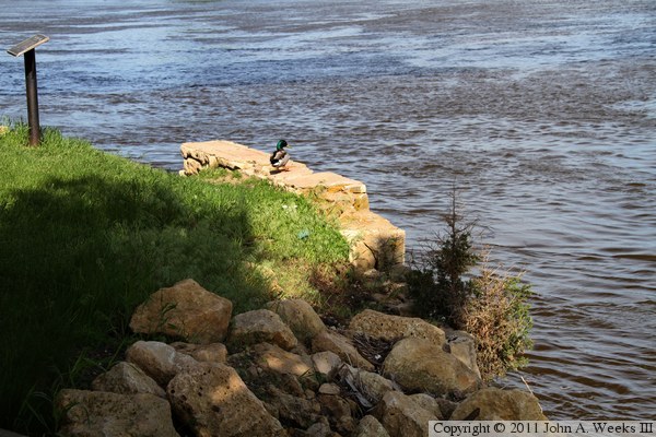
Mississippi River. The photo below is the remains of the ferry boat
landing on the Hastings side of the Mississippi River. The ferry was in use
prior to the Spiral Bridge opening in 1894.