| Highways, Byways, And Bridge Photography |
Camden Bridge
37th/42nd Avenue Mississippi River Crossing
Minneapolis, MN
|
• Structure ID: |
NBI: 27549. |
|
• Location: |
River Mile 857.80. |
|
• River Elevation: |
801 Feet. |
|
• Highway: |
37th Avenue NE to 42nd Avenue N. |
|
• Daily Traffic Count: |
10,300 (2001). |
|
• Bridge Type: |
Steel Plate Girder. |
|
• Length: |
1,686 Feet Overall, 244 Foot Longest Span. |
|
• Width: |
4 Traffic Lanes, 70 Feet. |
|
• Navigation Channel Width: |
244 Feet. |
|
• Height Above Water: |
22 Feet. |
|
• Date Built: |
Opened July 1977. |
The Camden Bridge connects 37th Avenue NE in north central Minneapolis
to 42nd Avenue N in northwest Minneapolis. The city blocks are
different sizes on each side of the river, resulting in 37th Ave on the
east side of the river being about one-half of a mile north of 42nd Avenue
on the west side of the river. A second result is that the bridge runs
at an angle to help these two streets join at the river crossing.
The Camden Bridge also connects two sections of the city parkway system.
The west side of the city has Theodore Wirth Parkway, Victory Memorial
Parkway, and Webber Parkway. The central and east side has Saint Anthony
Parkway, the East and West River Parkways, and the soon to be built
Granary Road. These two parkway systems are connected on the north
end of Minneapolis by the Camden Bridge as part of the Grand Rounds
Scenic Byway.
The Camden Bridge was built in the late 1970s, and opened in July of
1977. It is a steel plate girder bridge. That is, the main beams are
made of steel. But rather than being steel I-beams, the beams were
manufactured by cutting large steel plates to size, then welding on
upper and lower webs to make a custom-built girder. The major reason
for using a plate girder for a beam is that you can make the beam thicker
near the piers and thinner at mid-span, which saves materials and allows
the bridge to be lighter. Steel is the preferred materials when long
spans are required. The 1977 bridge replaced a 4 section steel truss
bridge built in 1913.
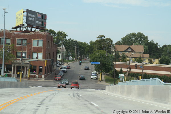
The west end of the bridge is a little bit of a roller coaster. The bridge
has to clear a railroad track between the river and I-94. The railroad track
itself is elevated, and crosses a side street near the bridge. This
configuration can be seen in a photo below. From the high point, the bridge
has to connect to Lyndale Ave immediately west of I-94. I-94 runs in a trench,
and Lyndale is the same elevation as the side street on the east side of the
freeway. That means in the space of the width of the I-94 Interstate highway,
the bridge has to descend from its high point down to street level.
Update—in late 2009, it was announced that the Camden Bridge would
receive a long awaited rehabilitation. The rehab project was designed in
2004, but has been on hold due to a lack of funding. Money became available
with the American Recovery And Reinvestment Act, so the project has been
the green light to start around March 15, 2010. The work includes a total
deck replacement, drainage system, approach panels, crash railings, sidewalks,
pedestrian railings, and a new paint job. The original plan was to keep the
bridge open with one lane in each direction for the two year duration of the
project. However, it was decided to close the bridge completely when it was
determined that the project could be completed in nine months saving nearly
$2-million. The bridge could reopen in just six months. The paint job
will be deferred to 2011. One impact of the bridge closing is that it
prevents fire trucks from providing assistance across the river. The impact
is even greater with the Lowry Bridge also being closed. As a result, part
of the savings will be used to fund additional fire crews at stations on
each side of the Mississippi River.
Update—the Camden Bridge reopened at 2:00 PM on Saturday, August 21, 2010,
after being closed for 4 months and 9 days for rehabilitation, well ahead
of schedule. The sidewalks and access stairs were still being worked on,
and opened a few weeks later. The bridge is scheduled to be painted in 2011.
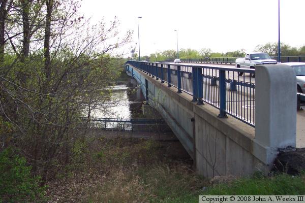
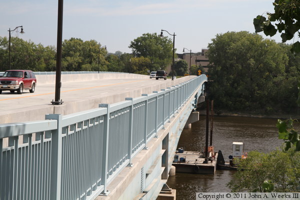
The photo above is a view from the east end of the bridge. The photo
below is a view from the boat landing just downriver of the Camden
Bridge. The boat landing has a fishing pier extending into the river,
which makes the photo appear to be taken from mid-river. Note the
distinctive decorative ridges on the steel.
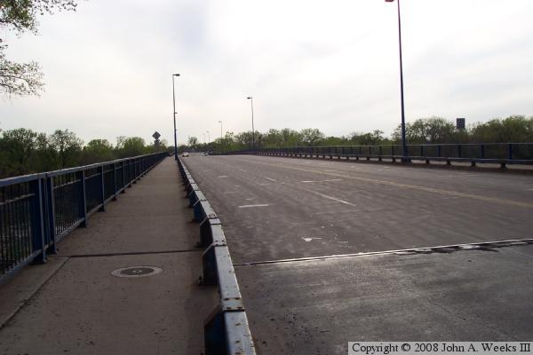
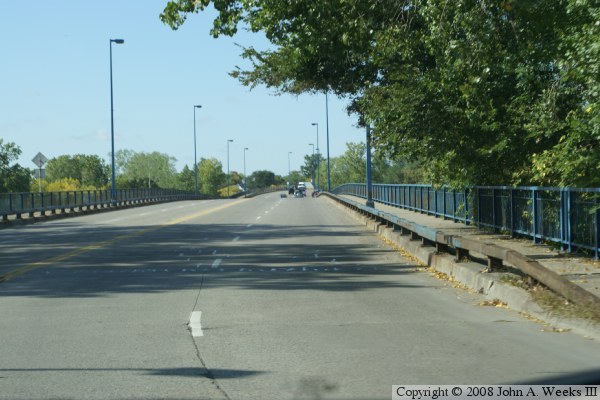
The photo above is a view of the top deck of the bridge looking west.
Note the metal curbing used to project the sidewalks. This type of
guardrail is unique as far as any other bridge over the Mississippi River.
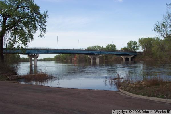
The photo below is another view from the boat ramp just down
river. In this view, the river water is high and has totally flooded
the boat ramp.

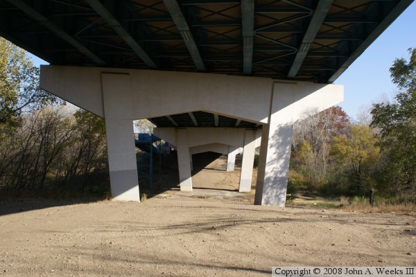
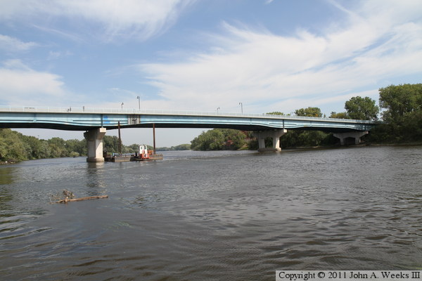
The photo above shows the reason for the second hump in the bridge. The
bridge crosses over the Canadian Pacific Railroad mainline, which itself
is located on a bridge over Soo Line Avenue, the access road to the
regional park and boat landing.
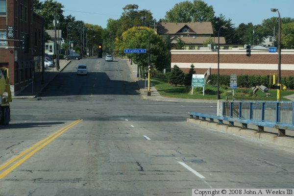
The photo below is the first of seven views showing a crossing from east
to west on the Camden Bridge. In this first photo, we see that 37th Avenue
NE makes a curve just before the bridge. Saint Anthony Parkway intersects
37th Avenue just to the left of the photo. Also visible is a sign for the
Grand Rounds Byway, which crosses the Camden Bridge.
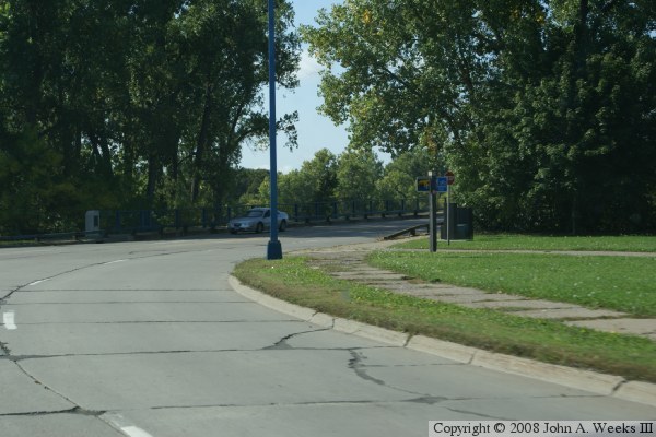
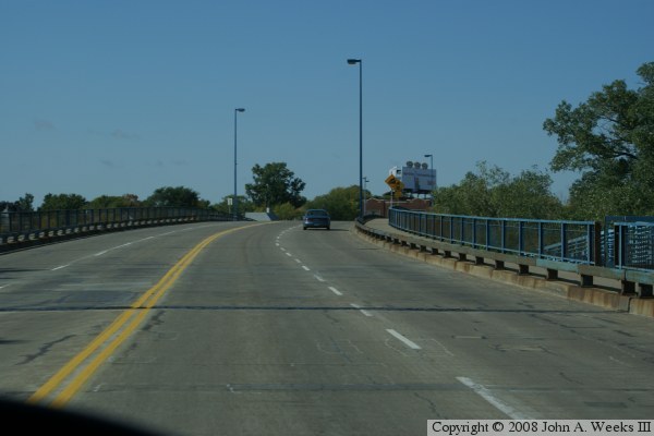
The photo above is a view of entering the bridge from the east end.
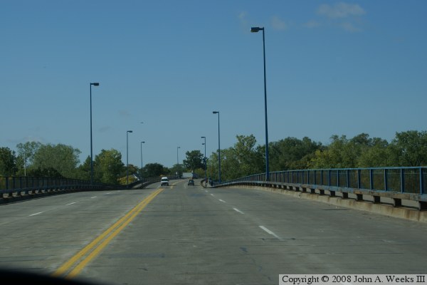
In the photo below, we are traveling west towards the peak of the first
hump in the bridge. This hump is the main span crossing the Mississippi
River.
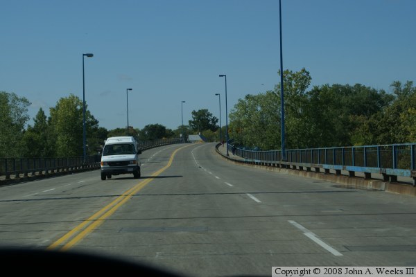
In the photo above, we are at the peak of the hump at mid-channel of the
main span crossing the Mississippi River. We are now headed down hill
to the swale in the bridge. In the photo below, we are at the bottom
of the swale, and are headed up the second hump in the bridge. Notice
the gap in the railing and the walkway exiting the bridge in mid-span.
In the photo above, we are at the peak of the second hump in the bridge.
This hump travels over the Canadian Pacific Railroad mainline. The
Canadian Pacific has a major yard located just west of the bridge.
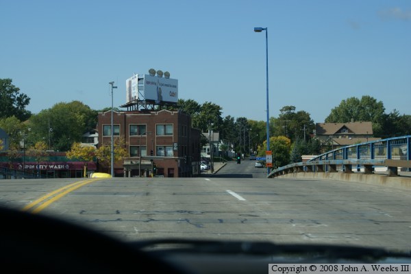
In the photo below, we are approaching the end of the bridge on the
west side of I-94 at Lyndale Avenue. The bridge has a very steep slope
on the west end. The reason is that the road has to be high enough to
pass over the railroad tracks, yet has to drop down to connect to Lyndale
Ave, and make that change in elevation is a space that is exactly as
wide as the I-94 Interstate Highway.

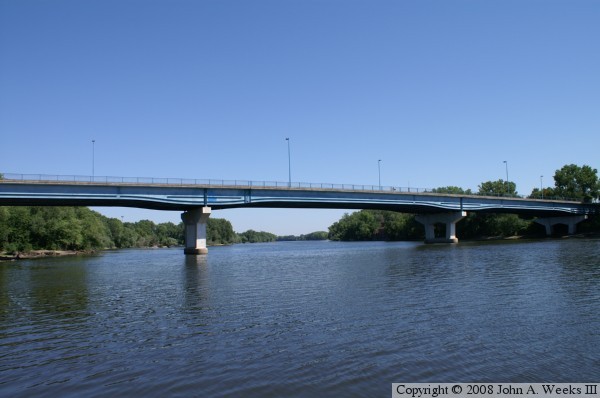
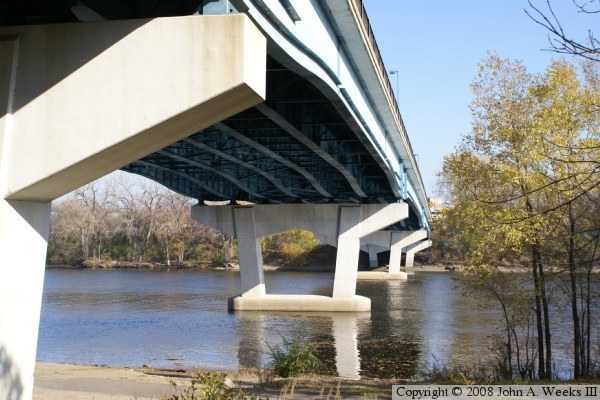
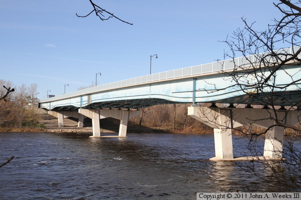
The photo above is a view of the Camden Bridge taken from the edge of the
west bank of the Mississippi River. The photo below is a detail view of
the underside of the bridge.
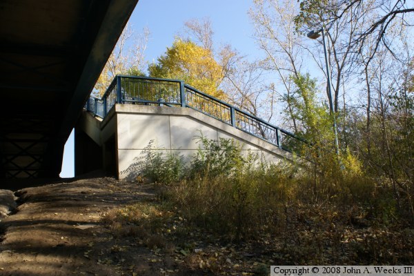
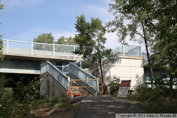
The photo above shows the sidewalk and steps that connect the mid-span
exit on the downriver side of the bridge to the North Mississippi Regional
Park. The photo below shows the bicycle path that connects to the mid-span
exit on the upriver side of the bridge.
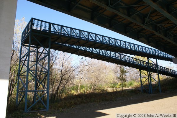
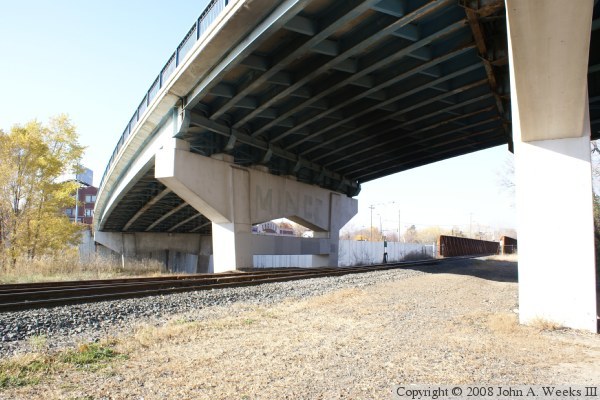
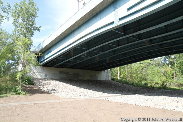
These two photos are views of the span over the North Mississippi Regional
Park. The photo above is a profile view that shows where the bicycle
ramp is located. The photo below shows the piers and the metal work under
the bridge.
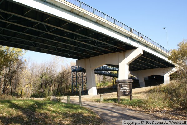
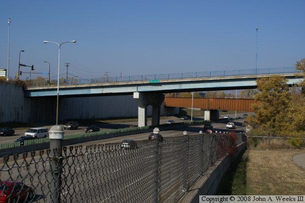
These two photos show the span over the Canadian Pacific Railroad and
Interstate highway I-94. The photo above shows the railroad track and
the curve in the bridge. The photo below shows the spans that carry
traffic over the Interstate highway. Note that the railroad also crosses
I-94. The end of the bridge is visible in the photo above, while the
side of the bridge is visible in the photo below.
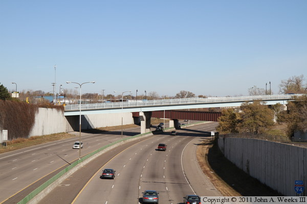
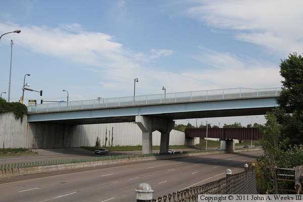
These two photos are views looking north towards the west end of the Camden
Bridge as it passes over Interstate highway I-94. The photo above was
taken in November, 2010 from the nearby 41st Avenue overpass over I-94.
The photo below was taken from Soo Avenue North, which skirts the east side
of the Interstate. Note that this bridge appears to be freshly painted,
likely done during the Summer 2010 construction project. Also note that
the bridge railing and street lights have been replaced.
These two photos, and the 15 that follow, were taken one week after the
Camden Bridge reopened to traffic in August, 2010, following the Summer 2010
rehabilitation project. The photo above is the abutment on the west side
of the river where the bridge briefly touches down before the spans that
cross the railroad tracks and Interstate highway I-94. The photo below
is a main bridge pier on the west shore of the Mississippi River.


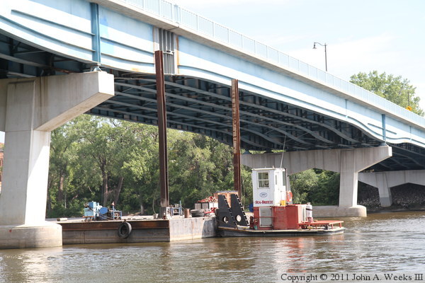
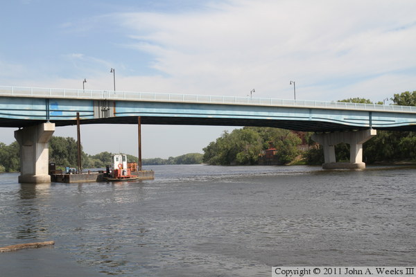
The photo above is a view of the downstream south face of the Camden Bridge
as seen from the west bank of the Mississippi River. The photo below is
a closer view of the construction work above the main river navigation
channel. The vertical steel beams are placed through a hole in the bottom
of the barge and driven into the river bottom to keep the barge in place
so it can safely support equipment below the bridge.
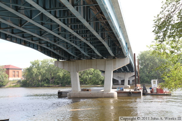
The photo above is a view of the underside of the Camden Bridge as seen from
the west bank of the Mississippi River. The photo below is a walkway on the
west side of the river that connects to the sidewalk on the south side of
the bridge. The walkway remained closed for several weeks after the traffic
lanes were opened.

The photo above is looking west along the south face of the Camden Bridge.
The vantage point is the stairway shown in the previous photo. The photo
below is looking west down the length of the bridge deck, also a view from
the same stairway.


These two photos are views looking east along the railing on the downstream
south side of the Camden Bridge. The photo above shows the bridge deck clear
of any cars, while the photo below shows cross traffic. The walkway was
closed, so I was unable to walk any further onto the bridge. Note that
the new bridge deck features a concrete barrier between the traffic lanes and
the sidewalk, a feature that is not present in the 2008 photos above.
Decorative street lamps were also installed during the rehab project.
These two photos are looking upriver to the north from a fishing dock located
400 feet south of the Camden Bridge. The photo above is a wide view of the
overwater spans, while the photo below is a close view of the main river span.

The photo above is another view looking north from the fishing pier located
between the Camden Bridge and the nearby Canadian Pacific Bridge. This view
shows the expansion joint and bearing work that was completed on the main
river span. The photo below, and the three that follow, show a typical
crossing of the rebuilt Camden Bridge heading westbound. This photo is
entering the bridge on the east side of the Mississippi River.

These two photos continue our crossing heading westbound. The photo above
is from the midpoint of the river spans. The photo below is at the bottom
of the dip between the river spans and the Interstate highway I-94 span.
The new concrete barriers and street lamps are prominent in these photos.
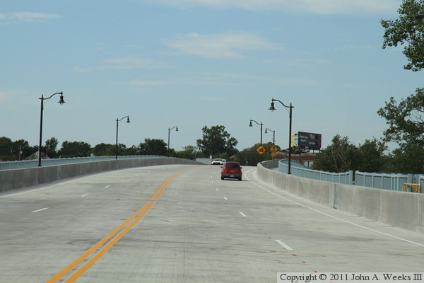
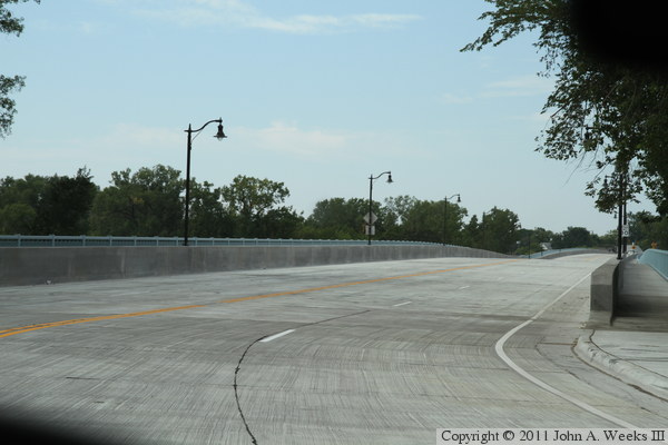
The photo above is the last of four photos showing a typical bridge
crossing heading westbound. In this photo, we are heading down the steep
span over Interstate highway I-94 towards the stoplights at Lyndale Avenue.
Despite the grade looking very steep in this photo, side views of the
highway span look much more gradual. The photo below is looking east along
the downstream south face of the Camden Bridge as seen in November, 2010.
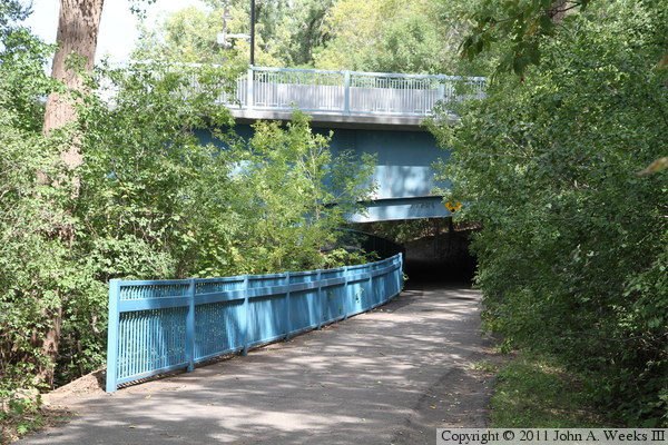
These two photos are views of the trail that runs along the east river
bank passing under the Camden Bridge. The thick brush hides the bridge
very well. The photo above is looking north under the bridge, while the
photo below is looking south towards the bridge.

|
