| Highways, Byways, And Bridge Photography |
Lock & Dam #2
Mississippi River Lock & Dam
Hastings, MN
|
• Structure: |
Lock & Dam #2. |
|
• Location: |
River Mile 815.2. |
|
• Dam Width: |
4,110 Feet Overall, 722 Foot Longest Structure. |
|
• River Elevation (Pool): |
686 Feet. |
|
• River Elevation (Outflow): |
673 Feet. |
|
• Water Fall: |
13 Feet. |
|
• Annual Lock Traffic: |
9,427 Vessels, 7,292,000 Tons (2005). |
|
• Date Opened: |
November 30, 1930. |
Lock and Dam #2 is located in Hastings, Minnesota, about a mile north
of the US Highway 61 bridge. Access is from the west side of the river.
There is a very nice park along the riverfront, and an excellent
observation platform.
The original lock settled and tilted, which lead to the construction of a
second lock. The original lock is no longer used. The new lock is 110
feet wide by 600 feet long, and was completed in 1948. The lock and dam
project includes a small power plant that is owned by the City of Hastings.
The power plant generates 4.4-megawatts of electricity. The city submitted
a license request in 2008 to add two additional power generators at the
lock & dam. They would be located on a barge mounted at the output
of the current generators. This would reuse the water flowing through
the dam a second time.
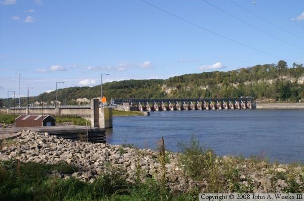
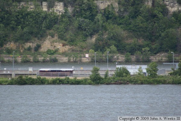
The photo above is an overview of the project looking northwest. The
dam is built close to the east bank of the river, which is located
very close to the river bluffs.

The photo above shows the official project sign and gives a view of the
observation deck. The photo below is a view of the main dam structure.
It features 19 Tainter gates. A Tainter gate is a large curved metal
plate that is mounted on a pivot arm. The plate can be raised or lowered
to block the river at different heights. The pivot arm allows the gate
to be moved and transfers the force of the river water to the fixed
concrete foundation.

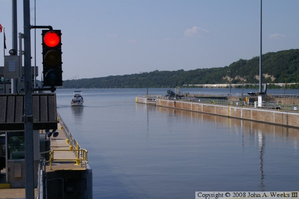
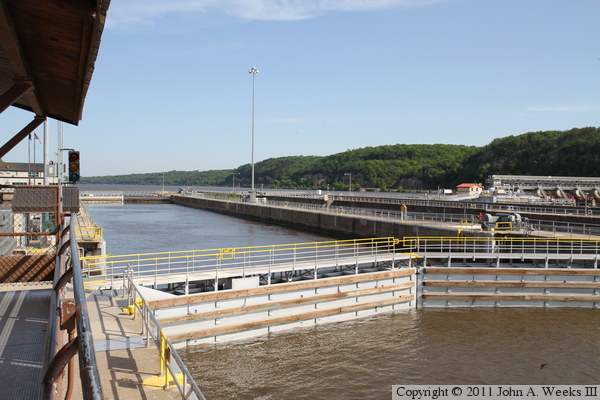
The photo above is a view of the upstream entrance to the lock. The lock
doors fold back into a recessed area in the lock wall. The photo below
is a view of the lock doors at the downstream exit of the lock. The
motor equipment controls the opening and closing of the doors.

The photo above is a close view of the lock wall and the signs placed
for boat crews. The photo below is the outlet of the lock and a view
of the river looking downstream towards Hastings.
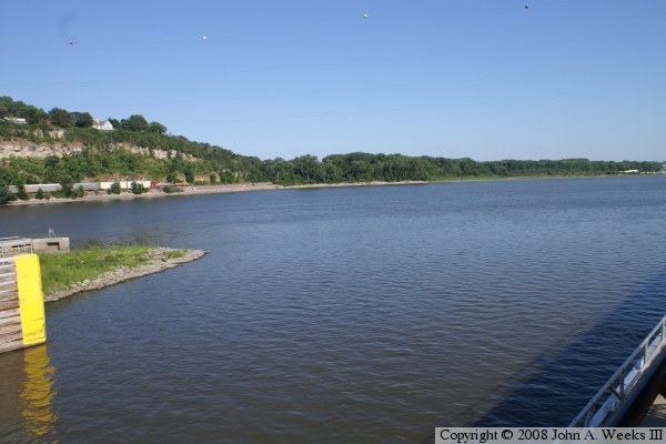
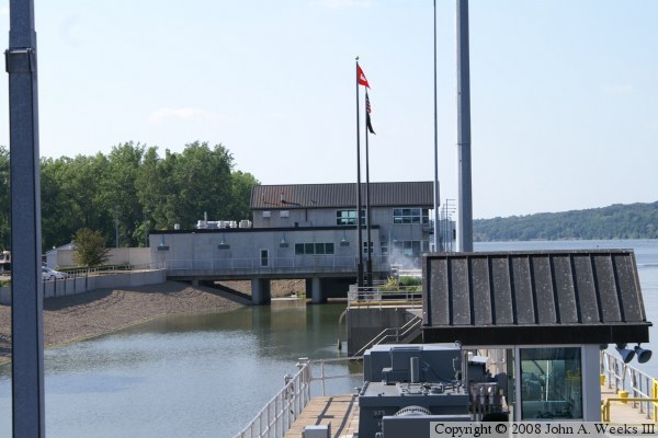
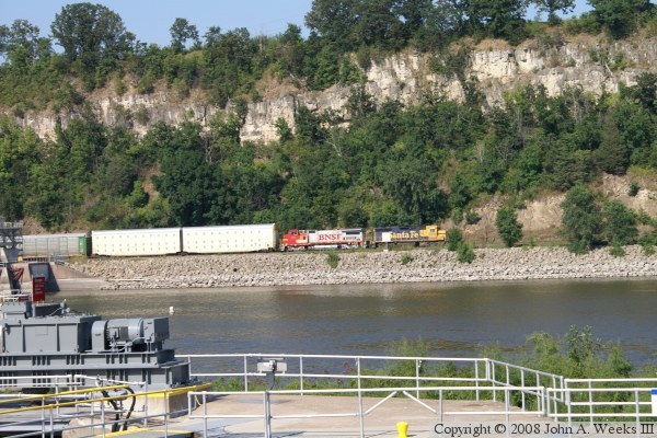
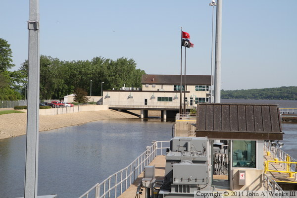
The photo above is a view looking upriver. The lock & dam offices
and control structure are built on pilings over a river backchannel. The
photo below is view to the east side of the river. A BNSF train is headed
south along one of the two major rail lines that parallel the river.
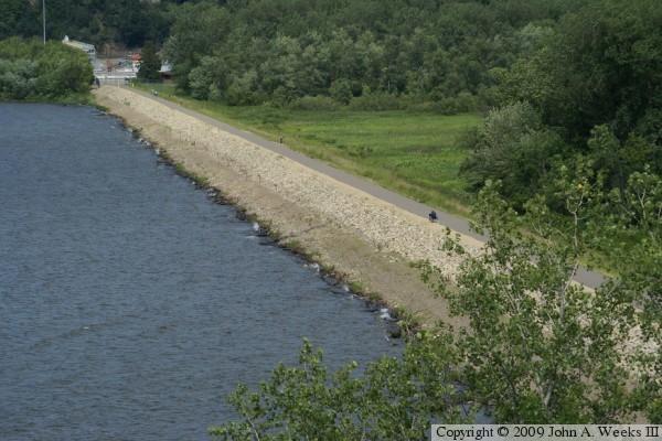
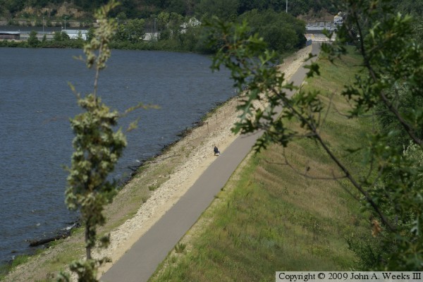
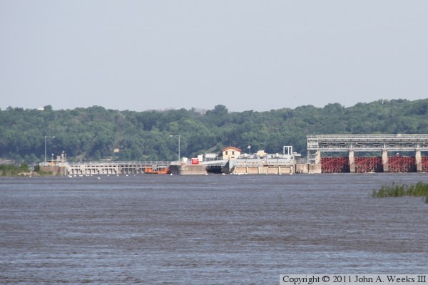
These two photos are views of the earthen embankment that forms the southern
2,600 feet of the river dam. The photo above is a view from upriver of the
dam, while the photo below is from downriver of the dam. Both photos were
taken from the river overlook on the bluffs along the south side of the
Mississippi River.
The photo above is looking northeast across the river. The structure is the
west walls of the lock structure. The photo below is a view of the lock
from between the trees where the embankment ends at the lock structure.
A tow boat with a small crane is currently locking through the dam.
The photo above is the main dam control structure as seen looking northeast
from the observation platform. The downstream doors of the boat lock are
visible in the foreground. The building with the red roof at the far left
side of the control structure is sitting on top of the hydroelectric plant.
The photo below is looking upstream to the northwest down the length of the
boat lock.
The photo above is looking upstream towards the US Army Corps of Engineers
administration and operations building. This facility needs a good view of
the boat lock, so it was built on pilings over top of a channel adjacent to
the boat locks. The photo below is the public observation deck.


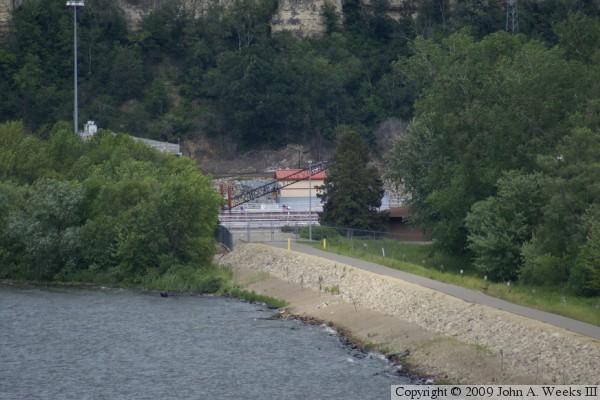
The photo above is a guide sign near the observation deck. The photo below
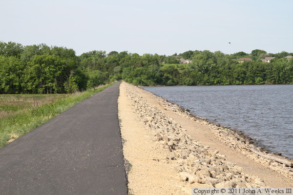
is looking southwest along the earthen dam embankment leading to the Hastings
side of the Mississippi River. This embankment is 3,000 feet long. There is
a paved bicycle trail on the embankment, with access from both Eagle Bluff on
the Hastings side of the river and a trail that runs along the riverfront
in downtown Hastings.

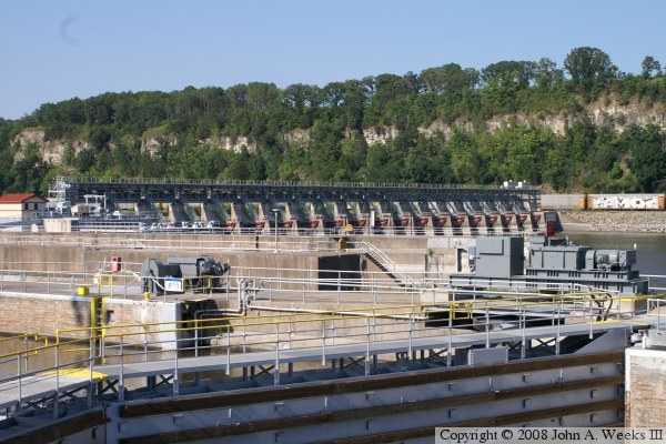
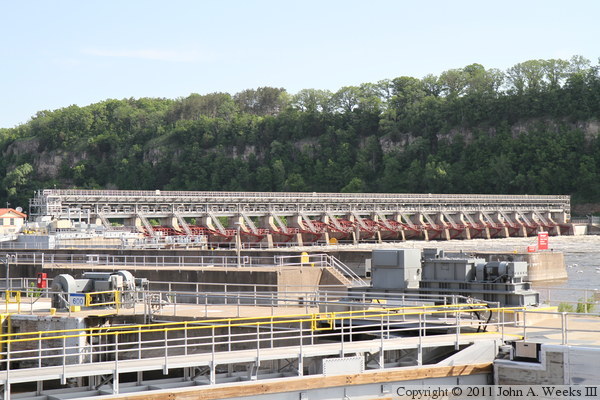
The photo above is another view of the main dam control structure. This
structure is 722 feet long and consists of 19 tainter gates, each 30 feet
wide. The photo below is the hydroelectric plant that is located between
the boat lock (left) and dam control structure (right). The generators are
owned by the city of Hastings and were built to produce 4.4-megawatts of
electricity. Two additional in-stream hydrokinetic turbines were installed
on a barge in 2009 and positioned to generate additional power from the water
that flows out of the hydropower plant. That has increased the power output
to 4.7-megawatts. This barge can be moved out of the way and stored safely
in the auxiliary lock during periods of high water and flooding. The barge
is not in position or operating in this photo due to high spring water levels.
|
