| Highways, Byways, And Bridge Photography |
Wabasha Street Bridge
Wabasha Mississippi River Crossing
Saint Paul, MN
|
Northbound Span |
|
• Structure ID: |
NBI: 62555A. |
|
|
|
Southbound Span |
|
• Structure ID: |
NBI: 62555B. |
|
|
|
Statistics Common To Both Spans |
|
• Location: |
River Mile 839.50. |
|
• River Elevation: |
686 Feet. |
|
• Highway: |
Wabasha Street. |
|
• Daily Traffic Count: |
6,250 (1997). |
|
• Bridge Type: |
Concrete Box Girder. |
|
• Length: |
1,252.5 Feet, 396 Foot Main Span. |
|
• Width: |
2 Traffic Lanes Per Span, 2 Spans.
Each Span 47.7 Foot Traffic Lanes Plus A 12 Foot Walkway. |
|
• Navigation Channel Width: |
316 Feet. |
|
• Height Above Water: |
52 Feet. |
|
• Date Built: |
Open To Traffic In 1998. |
The City of Saint Paul desired to build a signature
bridge at this location when the old Wabasha Bridge became obsolete.
One style that was seriously considered was a cable stayed bridge. While
it would have been grand, it would have cost too much. The city settled
on a pretty basic bridge style. Once the bridge was built, pastel green
and pink trim and lighting was added to the bridge to jazz it up
a bit. While the bridge opened to traffic in 1998, many of the
decorative features and metalwork items were not completed until late 2001.
The National Bridge Inventory considers this to be two
separate bridges. The northbound lanes on the east span are assigned
NBI number 62555A, while the southbound lanes on the west span are
assigned NBI number 62555B.
Update—a 20 year old Saint Paul man was taken to the hospital in
critical condition on July 28, 2011, after falling from the Wabasha Bridge.
He was crossing the traffic lanes between the sidewalks with a group of
of friends. He jumped over the railing at the center of the bridge no
knowing that this was two independent bridge spans. He fell between the
gap between the bridges, and landed on Raspberry Island after falling 55 feet.
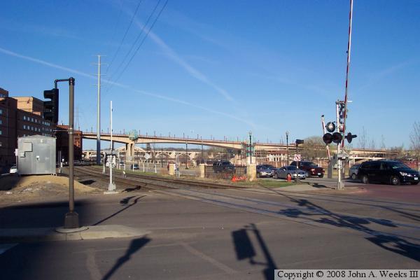
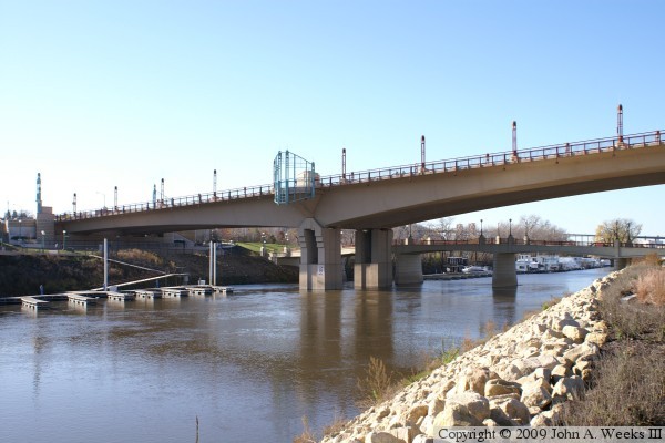
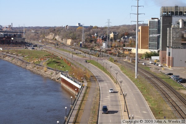
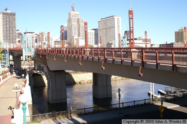
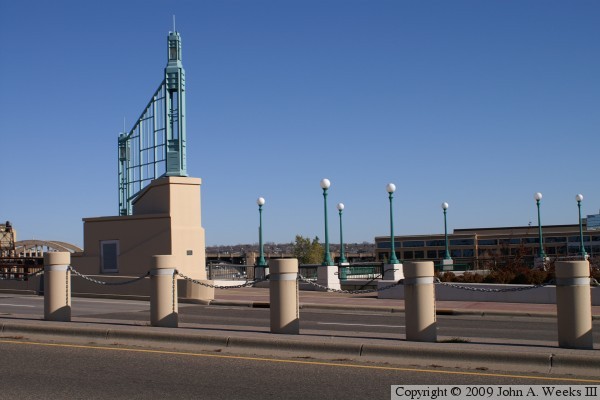
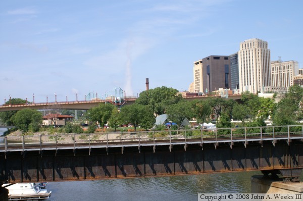
The photo above is a view of the bridge from the corner of Shepard Road
and Ontario Street looking to the east. The Robert Street Bridge is
visible in the background.
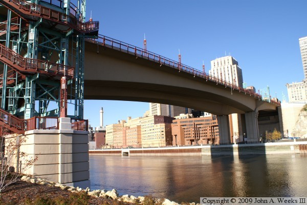
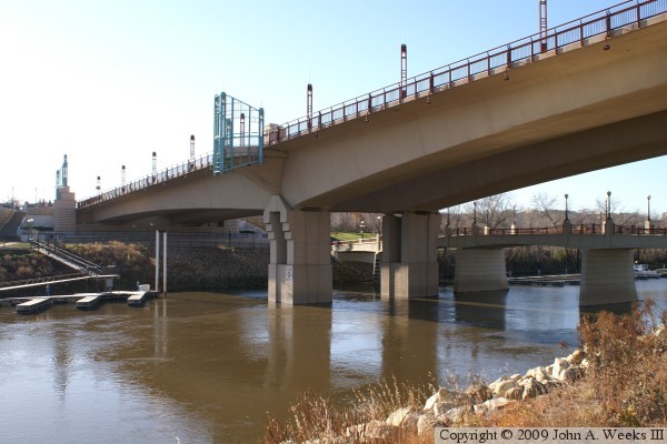
These two photos are looking northwest across the Mississippi River towards
downtown Saint Paul from Raspberry Island on the south side of the main river
channel. The photo above is a view of the main channel span, while the photo
below is the north bridge abutment. These photos were taken on a bright
autumn day. It was necessary to overexpose the bright parts of the photos
in order to see detail in the shaded areas.
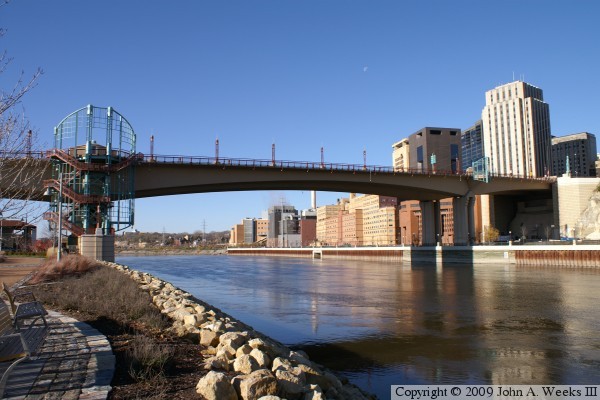
These two photos are looking west towards the Wabasha Street Bridge from
Raspberry island. The photo above is a view of the main river span from
the north side of the island. The photo below is a view of the bridge span
over Raspberry Island as seen from the band shell on the east end of the island.

These two photos are views of the spans over the south channel that flows
between Raspberry Island and the West Side neighborhood of Saint Paul. The
bridge in the background is the access road to the island.

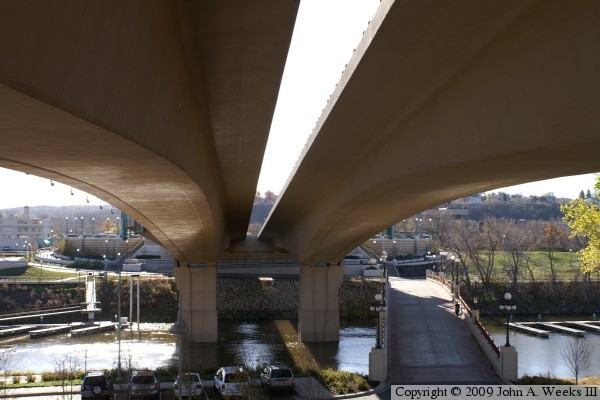
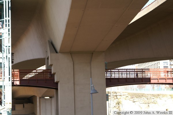
These two photos are views from under the spans of the Wabasha Street Bridge,
both taken from the pedestrian bridge that connects between the spans under
the bridge. The photo below is looking north across the main channel of
the Mississippi River. The photo below is looking south across the south
river channel.

The photo below is looking north across the south river channel towards
Raspberry Island from the walkway under the bridge at the south abutment.
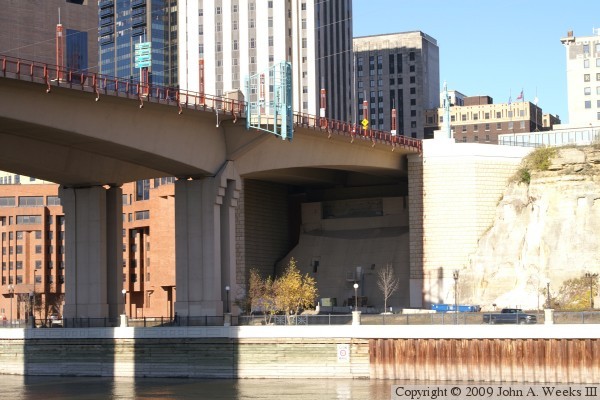
The photo below is looking south from the edge of Kellogg Street across the
main channel of the Mississippi River along the east face of the Wabasha
Street Bridge.
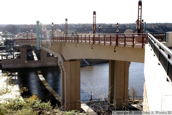

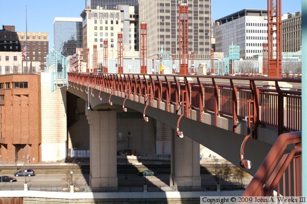
These two photos are views from the bridge deck. The photo above is looking
downriver towards the east. The Great Western, Robert Street, and Lafayette
Bridges are visible in the distance. The photo below is looking upriver to
the west. The Smith Avenue High Bridge is visible on the left side of the
photo.
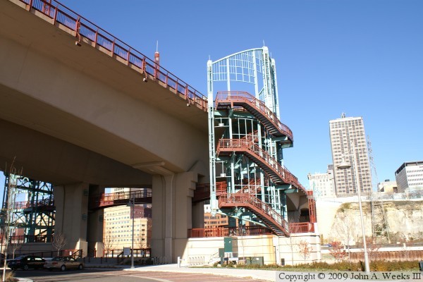
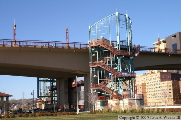
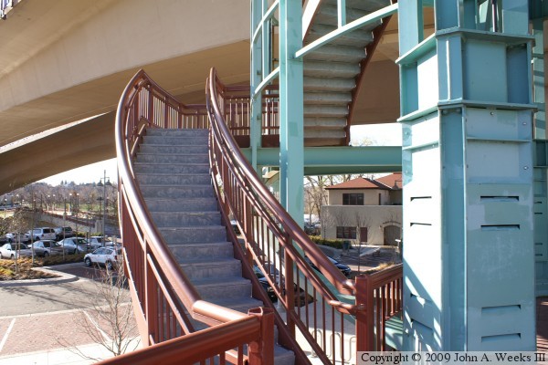
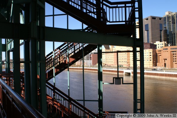
These two photos are views of the pedestrian stair towers on Raspberry
Island. The photo above is looking north, while the photo below is looking
west. Note the catwalk under the bridge between the two stair towers.
The photo above is the first flight of stairs, which runs parallel to the
river channel between the legs of a main bridge pier. The photo below is
the first bridge landing on the stair tower as seen from the plaza on the
west side of the structure.
These two photos are the stairway leading from the ground level to the
catwalk level. The photo above is the lower flight, while the photo below
is the upper flight leading to the catwalk level. These two photos are
from the east stair tower.
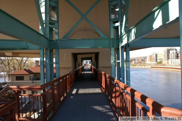
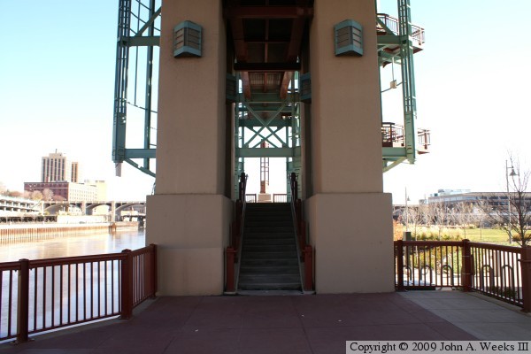
The photo above is looking west along the catwalk that spans between the
two stair towers under the traffic deck. The photo below is a view of the
catwalk from the Raspberry Island parking lot. The catwalk also passes
through the legs of a main bridge pier.

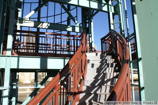
These two photos are the next set of stairs leading up towards the bridge
deck on the stair towers. The photo above is the first flight leading
upward from the catwalk level. The photo below is the 2nd flight above
the catwalk leading to a landing that is just below the bridge structure.
Two flights lead from this landing to the bridge deck.


These two photos are views looking north along the bridge structure from the
stair towers on the first landings below the traffic deck. The photo above
is a view along the east face of the bridge, while the photo below is along
the west face of the structure.

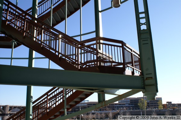
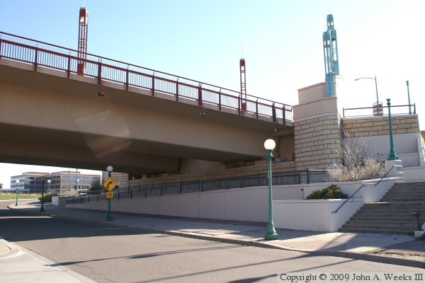
These two photos are the stair landings on top of the bridge deck. The photo
above is looking northeast at the landing on the east side of the northbound
span. The photo below is looking west across the bridge decks towards the
landing on the west side of the southbound span.
The photo above is the east stair tower landing as seen from the sidewalk
on the west side of the southbound span. The photo below is a view from the
bicycle lane on the highway side of the inner bridge railing. Note that
there is a set of observation bump-outs located to the north of the stair
tower landings, and a similar blue steel decoration on the plaza at the
north end of the bridge.

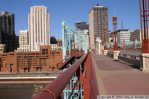
These two photo are looking northbound from the stairway landing on the
northbound bridge span. The photo above is looking down the pedestrian
sidewalk. The photo below is a wide-angle view from the same location
showing the Saint Paul skyline.

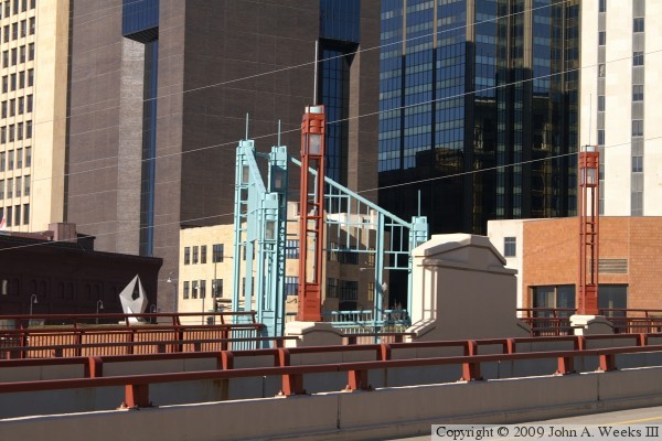
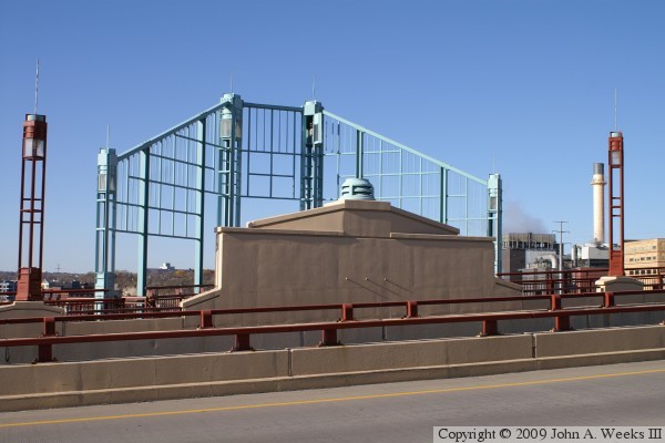
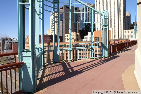
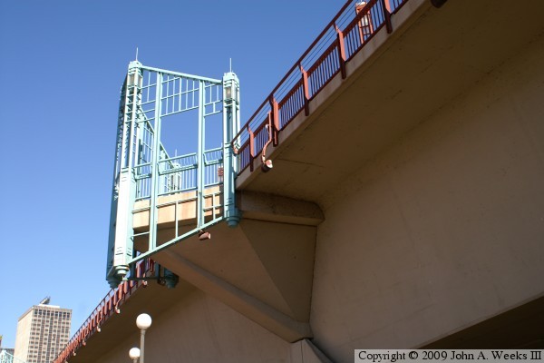
These two photos are views of an observation bump-out on the west side of
the southbound bridge span. The bump-out is marked with a decorative steel
structure that is painted a pastel blue. The photo above is a view from the
sidewalk on the northbound structure, while the photo below is the same
bump-out as seen from the southbound bridge span.
The photo above is an observation bump-out on the southbound bridge span
located south of the stair tower. The photo below is the observation bump-out
directly opposite this location on the northbound span
The photo above is looking north along the outside bridge railing on the
southbound span towards the stair tower. The photo below is looking north
down the length of the southbound span from the southbound bicycle lane.
The building with the red digit ‘1’ is the former First Bank
tower, now a US Bank building, a longtime Saint Paul landmark.
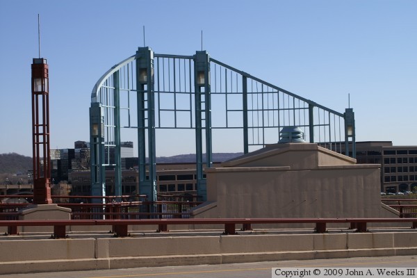
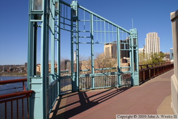
These two photos are views looking to the north along the upriver west face
of the Wabasha Street Bridge. The photo above focuses on the west stair
tower as seen from the southern observation bump-out on the southbound
bridge span. The photo below is a wide angle view of the bridge as seen
from the plaza at the south end of the structure.
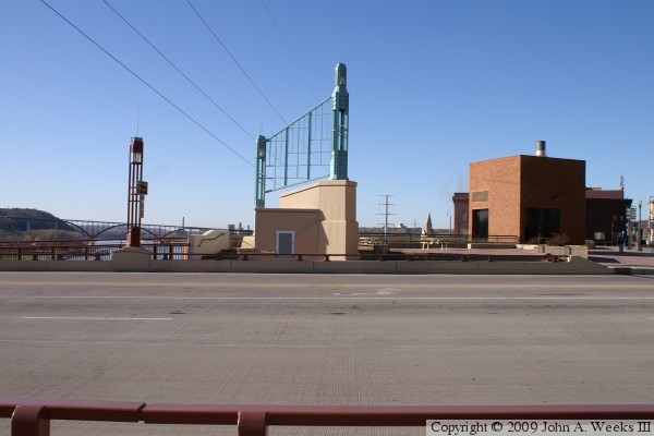
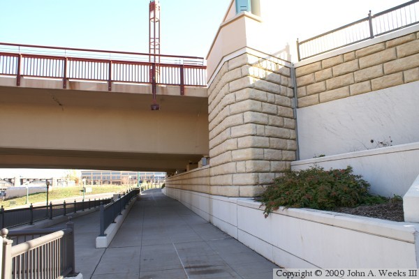
These two photos are views of the stairwell structures at the north end of
the bridge. The photo above is looking north towards the stairwell structure
for the northbound bridge span. The photo below is looking west across the
bridge deck towards the stairwell structure for the southbound bridge span.
The bridge spans are hollow. These stairwells allow access to the interior
of the bridge.

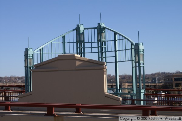
The photo above is a view looking west across the plaza at the north end of
the bridge. The photo below is a view of the north end of the bridge as
seen from the southbound bicycle lane. The traffic lights control the
intersection of Wabasha Street and Kellogg Boulevard.


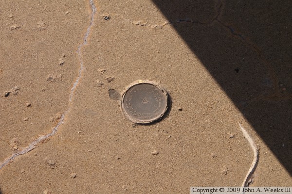
The photo above is a commemorative plaque attached to the northbound stairwell
structure. The photo below is a geodetic marker embedded in the sidewalk
near the north end of the southbound bridge span. MN-DOT places these
markers on many structures to define a location where repeatable surveys
can be established.


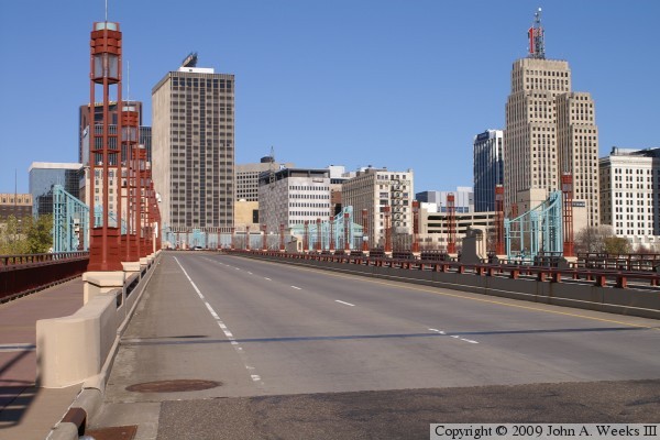
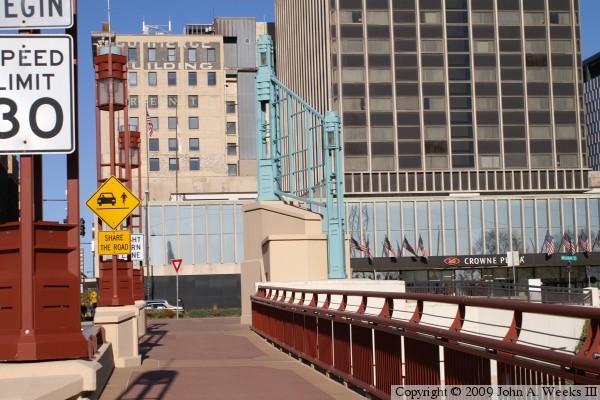
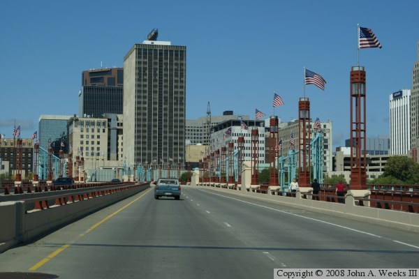
The photo above is a street level view of the Wabasha Bridge looking
north from Wabasha Street near the intersection with Water Street. The
photo below is the first of three photos showing a typical crossing of
the Wabasha Street Bridge heading north. In this photo, we are just
entering the south end of the bridge.

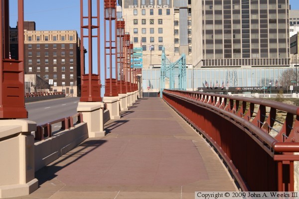
In the photo above, we continue our trip across the Wabasha Street Bridge.
We have reached the halfway point in our crossing. We are just passing
Raspberry Island and we are heading towards the curve in the bridge. In
the photo below, we nearing the north end of the bridge at Kellogg Avenue.


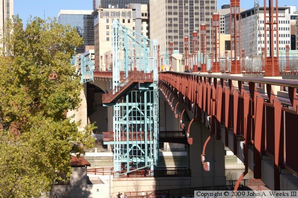
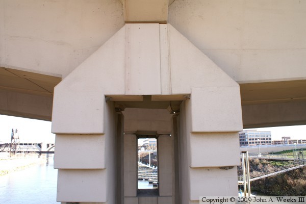
These photos are two views from under the Wabasha Street Bridge. The photo
above is the pier structure on the north side of Raspberry Island. The
bridge has two stair towers made out of decorative metal, a pedestrian
bridge between the towers, and a staircase leading down to Raspberry Island.
We also notice that the bridge really is two parallel spans. The photo
below is looking south across the west channel of the Mississippi River.
The Raspberry Island Bridge is visible on the right side of the photo.

The photo above is a view of the Wabasha Street Bridge from near the
Great Western Lift Bridge. The photo below is a view of the Wabasha
Street Bridge from the parking lot located at the southeast end of the
bridge.

|
