| Highways, Byways, And Bridge Photography |
I-35W Bridge
I-35W Minnesota River Crossing
Bloomington, MN to Burnsville, MN
|
• Structure ID: |
NBI: 5983. |
|
• Location: |
River Mile 11.5. |
|
• River Elevation: |
689 Feet. |
|
• Highway: |
I-35W. |
|
• Daily Traffic Count: |
98,000 (1996). |
|
• Bridge Type: |
Steel Girder. |
|
• Length: |
1,446 Feet. |
|
• Width: |
103 Feet Wide, 6 Lanes. |
|
• Navigation Channel Width: |
200 Feet. |
|
• Height Above Water: |
54 Feet. |
|
• Date Built: |
Opened 1960. |
Prior to the Interstate Highway System being built, the key highway
route into the south side of Minneapolis was US Highway 65. US-65
crossed the Minnesota River on a narrow 2-lane bridge. In the late
1950s, MN-DOT began to upgrade US-65 to a 4-lane highway in the
south metro area. The 4-lane would run from MN-5 (current I-494)
down to MN-13 in Burnsville along Lyndale Avenue.
As the MN-65 project was underway, Congress passed the Interstate Highway
Act. As a result, the MN-65 project was recast as Interstate I-35W in
the metro area. As part of the project, a large bridge would be needed
to span the Minnesota River. To keep traffic moving year around, the
bridge would have to be above the 100 year flood plain and span the
entire flood plain. The plan that was developed was to build a long
earthen causeway through the flood plain in Burnsville (on the south
side of the river), then construct a nearly 1,500 foot long steel
girder bridge over the main river channel. A small fill would be
needed on the north side of the bridge, followed by a large cut to help
reduce the grade heading over the river bluff on the north side of the
river.
When this bridge was opened in 1960, I-35W extended south only as far
as MN-13. Locals called this the bridge to nowhere. As the rest of
I-35W in the south metro area came online throughout the 1960s, traffic
picked up on I-35W. A major shopping center was developed in Burnsville,
which lead to housing, light industry, and service businesses locating
south of the river. By 1980, traffic jams at the I-35W bridge were
becoming a serious problem.
MN-DOT began to address the traffic problems in the early 1980s. The
first project was to redeck the I-35W bridge. While the bridge was having
a new deck installed, the piers were made wider, and two additional lanes
were installed on the bridge. This would allow for a future where the bridge
would have 3 traffic lanes in each direction. However, shortly after the
bridge project was completed in 1984, it was discovered that there was a
sub-soil problem near the bridge approaches. This problem would prevent
the new lanes from being opened to traffic.
The sub-soil problem caused the expansion problem to languish of several
years. Finally, in 1990, Governor Rudy Perpich ordered MN-DOT to do an
analysis of the problem in order for the legislature to get a handle on
how big the problem was. The resulting study found that the problem turned
out to be a minor issue. The sub-soil problem was fixed in the early 1990s.
In the mid 1990s, the highway median was removed through Bloomington, and
two lanes were added to the center of the highway. When these new lanes
were completed, the additional lanes were opened on the bridge over the
Minnesota River.
While the bridge itself is in no danger of flooding, the causeway on
the south end is prone to flooding. The highway was fully under water
in the 1965 flood. After being raised a few feet, the highway has
not flooded since, but MN-DOT has had to build temporary dikes along
the causeway on several occasions. The last of which was the 2001 flood.
A row of gravel was laid down. Plastic was put down covering the gravel,
and sandbags were used to keep the plastic in place.
There is a large hill on the north end of the bridge. Northbound
traffic tends to slow down going up that hill, especially trucks.
On the southbound side, people see the bridge in the distance as
they drive down the hill, and they tend to get scared and slow down.
Making the situation worse is that the bridge makes a big hump, so
you cannot see traffic from one end of the bridge to the other. The
result is that I-35W traffic jams often start at this bridge.
Note—This is not the I-35W bridge that collapsed. Click
here for complete coverage of
the I-35W Mississippi River bridge disaster.
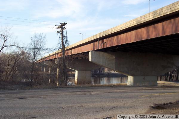
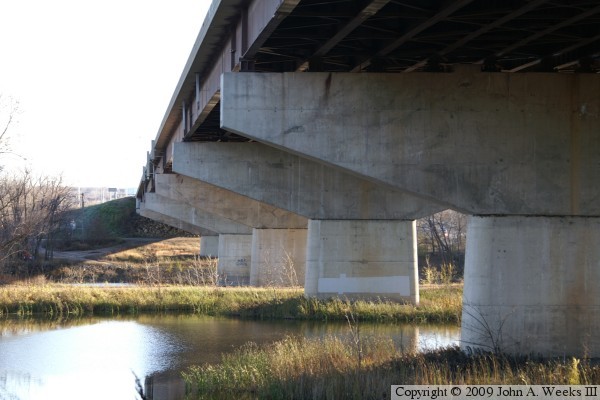
The photo above is a view of the I-35W Minnesota River Bridge from
under the southwest corner of the bridge looking north. The bridge
has a span over Black Dog Road, then two piers in the water near the
riverbank, and several more spans over the flood plain on the north
side of the river. The photo below is the northernmost three bridge
spans which pass over a stormwater runoff pond.
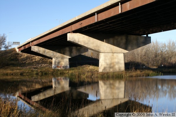
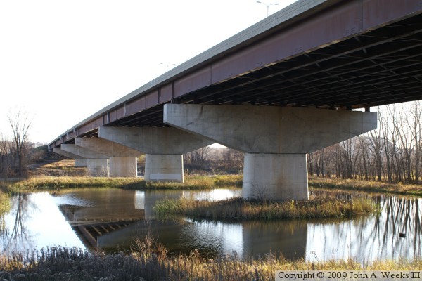
These two photos are looking towards the southeast at the upriver face of
the I-35W Bridge. Both photos show the main river channel spans. The
photo above is from near the bridge, while the vantage point in the photo
below is from a bit further upriver.

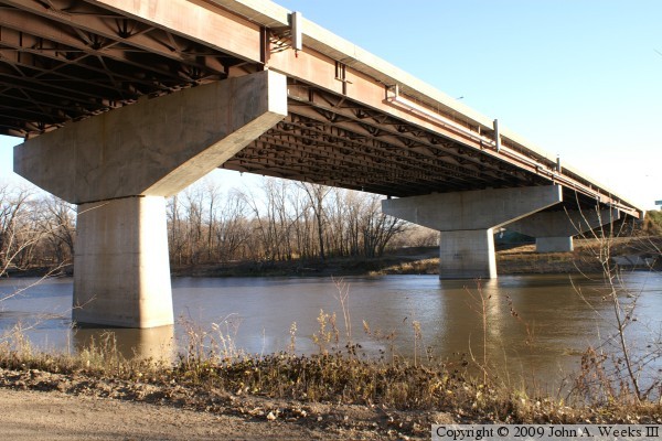
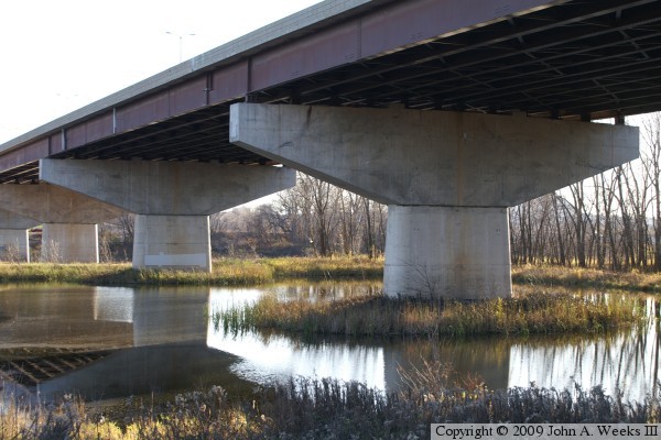
These two photos are looking south along the face of the bridge structure.
The photo above is the upriver face of the bridge, while the photo below is
the down river face on the east side of the structure. The water in the
foreground is a stormwater settling pond. The river channel is towards the
far end of the bridge.
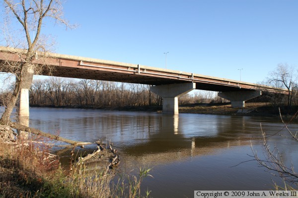
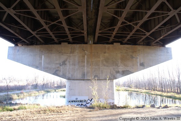
The photo above is a view of the bridge as seen from near the northeast
corner of the structure. The photo below is a closer view of the bridge
pier that sits in the middle of the settling pond under the north end
of the structure.
The photo above shows one of the river navigation lights on the north side
of the river channel. The photo below shows the drainage system over the
main river channel span. The drainage pipes were rebuilt as part of
maintenance performed on the structure during 2009 as part of repaving I-35W
and adding toll lanes to the highway.
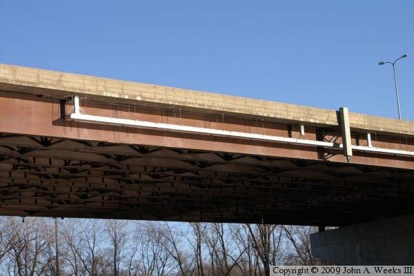

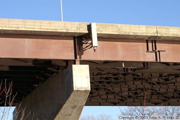
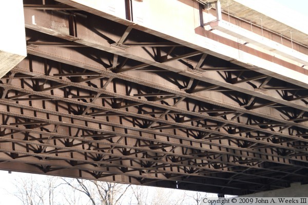
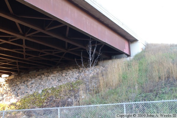
These two photos are views of the steel structure under the bridge deck. The
bridge was originally built as two parallel decks sitting on a single set of
piers. Each span had 4 steel girders. Later, the piers were rebuilt wider,
and 2 more girders were installed on each side of the structure. The original
girders have vertical stiffeners and are supported by X-shaped cross braces
on the bottom of the girders. The newer girders have a different style of
cross braces running between the steel plates.
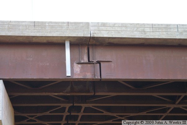
The photo above is looking south at the first pier on the north end of the
bridge. It is possible to just barely notice where the newer concrete was
installed to widen the piers. Look for a vertical line on the left side of
the pier where the concrete is lighter between the second and third steel
girders. The photo below is a joint where the steel girders meet. This is a
lap joint where the bridge is able to expand and contract. It is interesting
that this joint does not sit on top of a bridge pier. Also notice that the
joint is at a slightly different location on the older girders toward the
middle of the bridge.
The photo above is the east side of the bridge abutment on the north end of the
structure. The photo below is the location of the old Lyndale Avenue bridge
prior to the Interstate bridge being built in 1960. The land has been regraded
and landscaped on both sides of the river, so there is no longer any signs of
the old bridge other than a smooth spot on the riverbank.


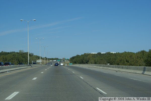
These two photos are the first of a 3 photo set showing a typical crossing of
the Minnesota River using the I-35W Bridge heading south to north from
Burnsville traveling to Bloomington. The photo above shows our approach to
the south end of the bridge. In the photo below, we are halfway across the
river channel. This view gives an idea of the size of the large hump in the
bridge as we cross the structure.
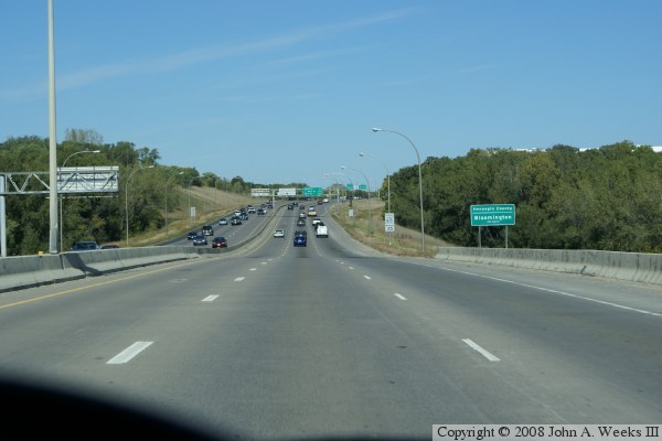
The photo above is the last photo of a 3 photo set showing a typical crossing
of the I-35W Bridge heading south to north. In this photo, we are nearing the
north end of the bridge, heading towards a small dip in the road prior to
starting the uphill grade into Bloomington.
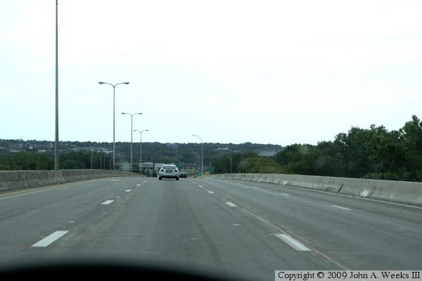
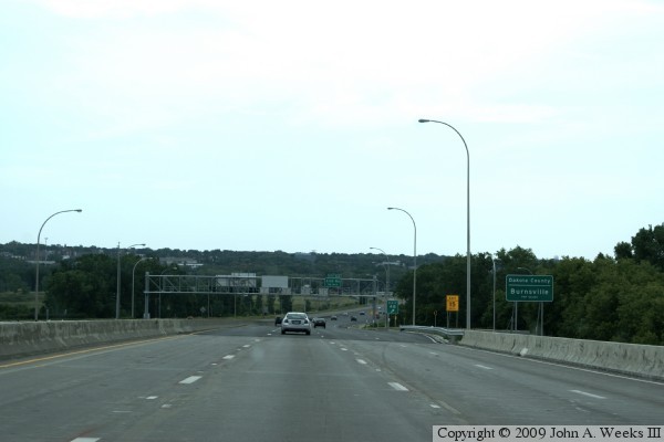
The photo below is the first of a three photo series showing a typical crossing
of the I-35W Minnesota River bridge heading southbound. These photos show the
bridge after it was re-stripped in 2009 with four southbound traffic lanes. In
the first photo, we are approaching the north end of the bridge.

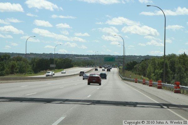
These two photos are the last of a three photo series showing a typical
crossing of the I-35W Minnesota River bridge heading southbound. In the photo
above, we are approaching the center of the river span. The photo below is
approaching the south end of the structure.
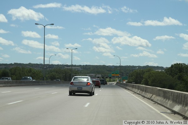
These two photos are two more views heading southbound on I-35W across
the Minnesota River bridge. These were taken on a sunny summer morning
as opposed to the hazy afternoon in the 3 photos above. The photo above
shows the downgrade and swale leading to the bridge, while the photo below
is a view from near the middle of the river channel span.
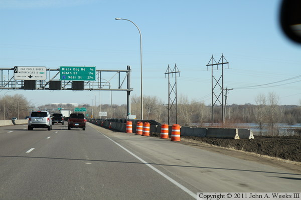
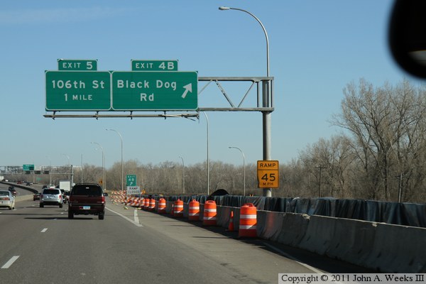
These two photos, and the photo at the bottom of this page, are views of a
temporary dike constructed on the east side of the northbound lanes of
Interstate highway I-35W during the spring flood of 2011. The dike
began about a half mile south of the river bridge, and extended north
for about 1,500 feet. The photo above is the south end of the dike, while
the photo below is a view traveling northbound alongside the dike. The
photo at the bottom of the page is the north end of the dike as it
crosses the exit ramp for Black Dog Road.

|
