| Highways, Byways, And Bridge Photography |
Cedar Avenue Bicycle Bridge
Cedar Avenue Minnesota River Crossing
Bloomington, MN to Eagan, MN
|
• Structure ID: |
NBI: 9600F. |
|
• Location: |
River Mile 7.9. |
|
• River Elevation: |
686 Feet. |
|
• Highway: |
Cedar Avenue Bicycle River Crossing. |
|
• Daily Traffic Count: |
0 (Bicycle Traffic Only). |
|
• Bridge Type: |
Steel Frame (Main Channel), Steel & Concrete Girders. |
|
• Length: |
1,427 Feet Overall, 350 Foot Main Span. |
|
• Width: |
???. |
|
• Navigation Channel Width: |
331 Feet. |
|
• Height Above Water: |
55 Feet. |
|
• Date Built: |
Opened 1980. |
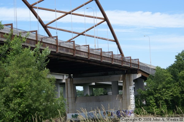
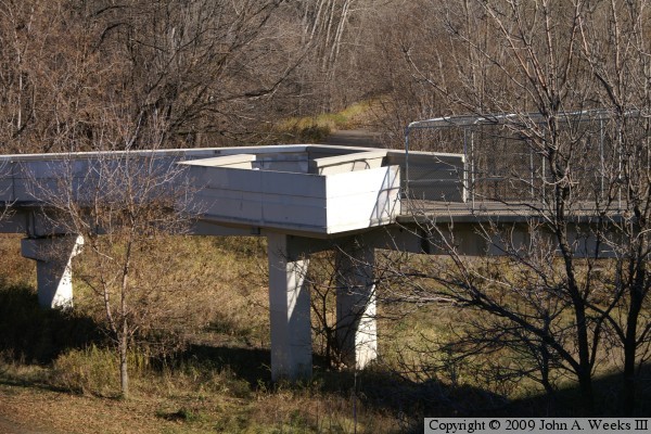
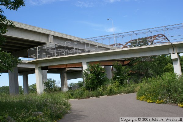
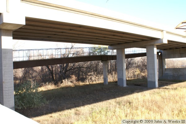
The Cedar Avenue Bicycle Bridge is a structure that is attached to the east
side of the northbound span of the MN-77 Cedar Avenue Bridge between Eagan,
Minnesota, and Bloomington, Minnesota. While the main span is attached to
Bridge #9600N, it is recognized as a separate bridge in the National Bridge
Inventory.
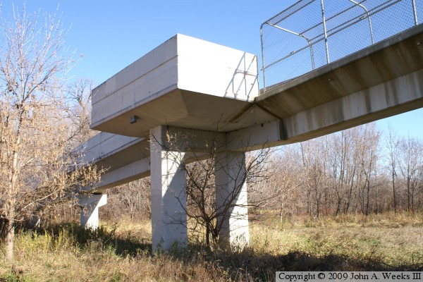
The bicycle bridge is sharped like a large letter Z. On the south side of the
river, the bridge lands on Fort Snelling State Park near a boat landing. The
first section is a series of concrete girder spans that run at a right angle to
the highway bridge. It rises to about 30 feet above the ground. The next
section is a steel girder span that climbs from the 30 foot level to the 55
foot level. The main span is 350 feet long, and it is supported using large
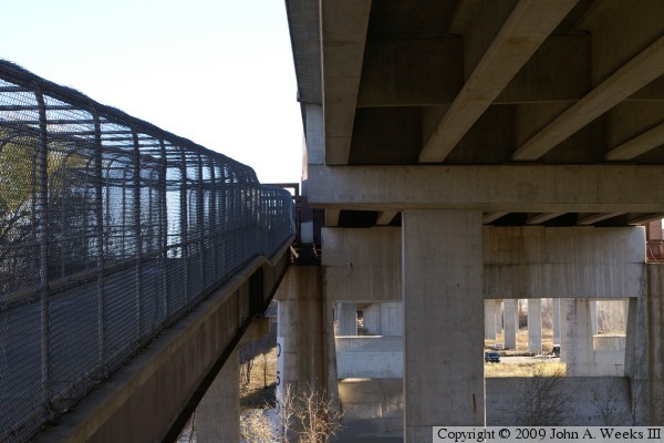
rectangular brackets that are attached to the highway bridge. These brackets
can be seen in the photo above, which is a view looking to the northwest from
the downstream side of the bridge on the south side of the Minnesota River.
Moving north, the next section is a steel girder span that lowers bicycle
traffic from the 55 foot level to the 30 foot level. The final spans again
run at a right angle to the highway bridge, but this time, they pass under the
highway spans (rather than away from the highway bridges). The final
concrete span lands on an island in the middle of the river and exits onto the
roadway that once connected the Long Meadow Bridge to the old Cedar Avenue
swing bridge.
Once bicycles arrive on the island in the middle of the river, they were
expected to use the Long Meadow Bridge span of the Old Cedar Avenue bridge to
cross the backchannel and arrive in Bloomington. That worked very well until
the Long Meadow Bridge was found to be structurally unsafe and had to be
closed. The Long Meadow Bridge is barricaded on both ends. The bicycle
bridge, however, remains open to allow access to the trails on the island and
in the river bottoms area. It is possible to head east from the bicycle
bridge and exit the river bottoms area near the visitors center for the
Minnesota Valley National Wildlife Refuge across the highway from the MSP
Airport. That is a lengthy trail that best reserved for experienced bicycle
riders, and it can only be attempted when it is relatively dry.
A project to remove the Long Meadow Bridge has been approved and funded. The
funding bill states that any money left over from that project may applied
towards building a new bridge. Several other grants have been offered to help
complete a new Long Meadow Bridge, but the city of Bloomington has been
finding that strings are attached to these offers. As a result, the bridge
project is stalled as of the summer of 2009.
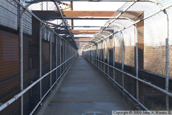
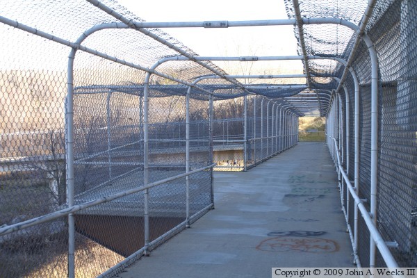
These two photos are the first of a six photo series showing a typical bridge
crossing heading northbound. The photo above is the concrete girder span
on the south end of the river crossing. The view is looking to the west
towards the highway spans. The photo below is the steel girder spans on
the south side of the main channel.
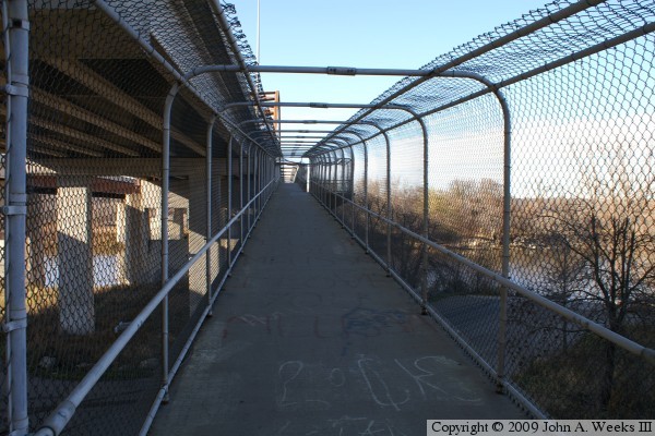
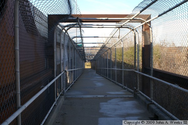
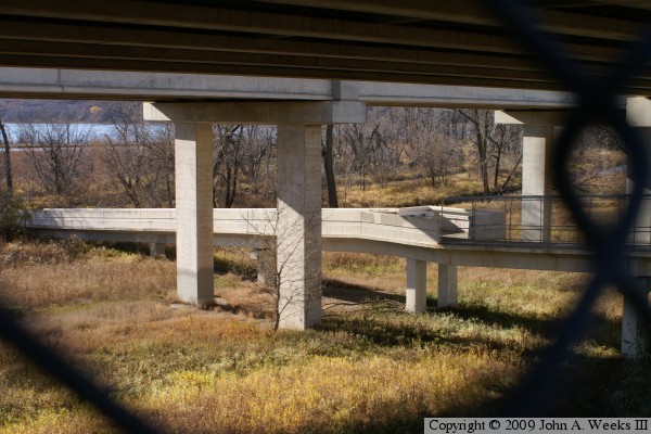
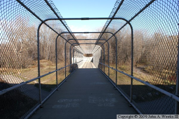
These two photos continues our northbound river crossing. In the photo above,
we are standing next to one of the observation platforms looking to the north
towards the main channel span. The photo below is just entering the main
channel span. This section of the bridge is attached to the side of the large
tied arch of the northbound highway bridge.
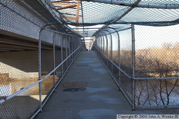
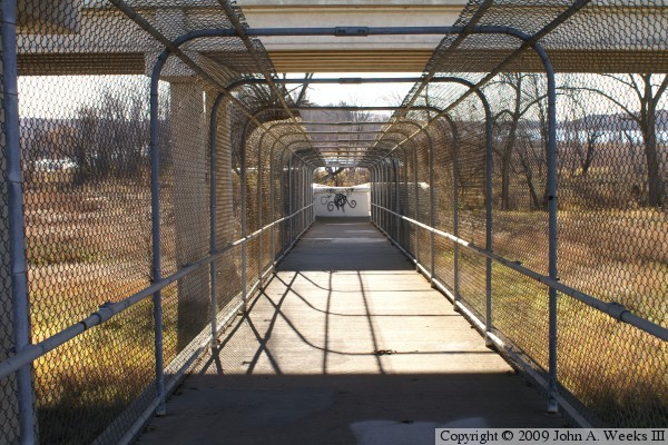
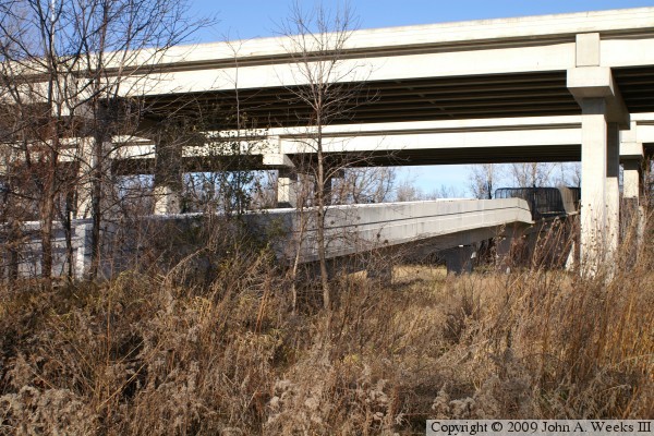
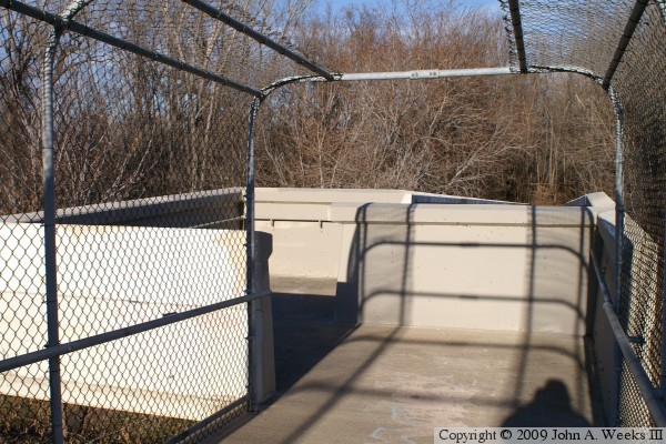
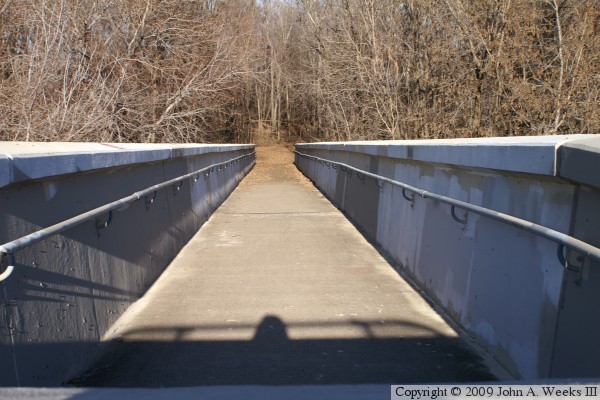
These two photos are the final two photos of a six photo series showing a
northbound bridge crossing. The photo above is the end of the main channel
span looking down the length of two sections of steel girder spans. The
photos below is looking to the west down the length of a section of concrete
girder span. The white concrete at the end of this bridge span is the
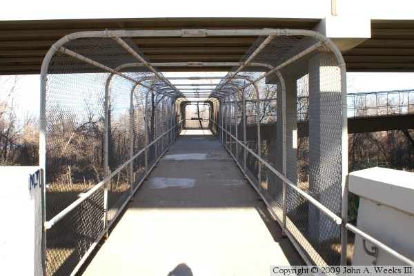
observation deck and transition from the chain link fence to concrete
railings. These spans pass under both highway bridge spans.
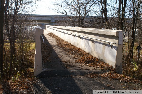
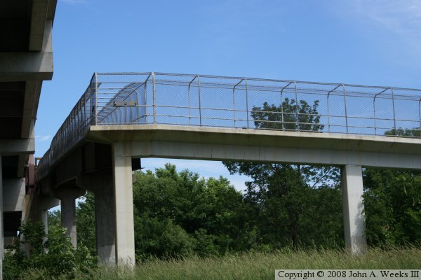
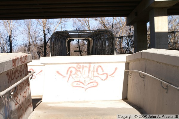
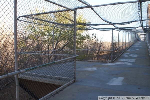
The photo above is an observation deck on the south end of the bridge. The
photo below is the same observation deck as seen from the ground. The
observation deck includes a barrier that prevents ATVs from using the bridge.
The photo above is a view of the concrete girder spans as seen from near the
main channel span. The photo below is the same bridge spans on the north side
of of the main channel of the Minnesota River, this time, seen from the ground.
The photo above is the upper precast concrete girder span on the south side
of the river channel. The photo below shows the concrete girder span meeting
the lower steel girder span at a right-angle. These spans cross a parking
lot for the boat landing that is part of the Fort Snelling State Park. A
state park vehicle permit is required in order to park in this lot.
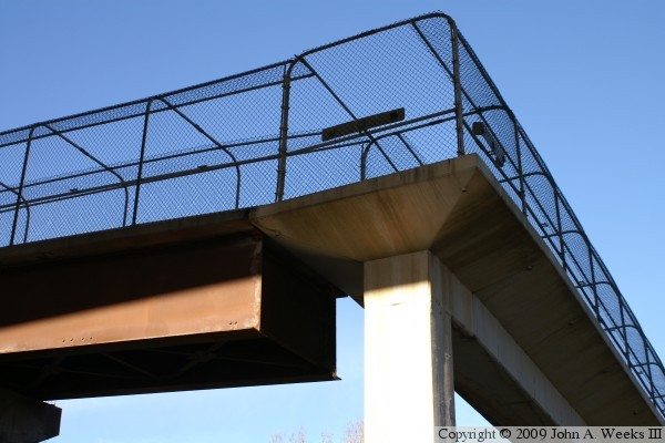
The photo above is a close view of the transition from the concrete girder
span to a steel girder span. Note that the ends of steel girders do not rest
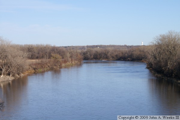
on a bridge pier. The photo below is a view looking downstream from the
center of the main channel of the Minnesota River.
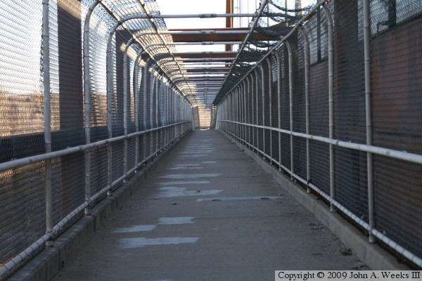
These two photos are the first of a 14 photo set showing a typical bridge
crossing heading southbound towards the parking lot on the south side of
the Minnesota River. The photo above is looking east up the first concrete
girder span on the north end of the bicycle bridge. The photo below is
approaching the fist observation deck.
These two photos continue the series showing a southbound bridge crossing.
The photo above is the transition between the concrete bridge railings and
the chain link fence railings. The concrete girder spans on the north side of
the river channel pass under both highway bridges. The photo below is a look
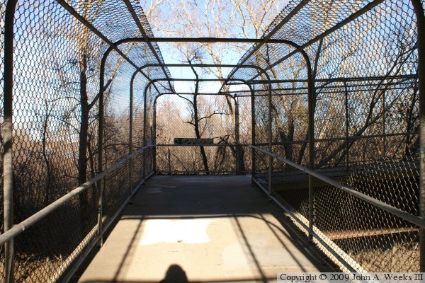
ahead at the steel girder spans as they climb towards the main channel span.
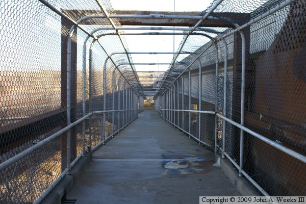
These two photos continue the series showing a southbound bridge crossing.
The photo above is the right hand turn where the bridge transitions from the
concrete girder spans to the steel girder spans. The photo below is a side
view of the steel girder spans as they climb towards the main channel span.
These two photos continue the series showing a southbound bridge crossing.
The photo above is the second observation deck when heading south. It is
located over the center support pier for the steel girder spans. The photo
below is looking down the length of the main channel span. This span is
flat and level as it runs along side the large horizontal steel tie beam
that is part of the highway bridge arch structure.
These two photos continue the series showing a southbound bridge crossing.
The photo above is looking down the length of the two steel girder spans on
the south side of the main channel span. The photo below is the third
observation deck when heading southbound.
These two photos continue the series showing a southbound bridge crossing.
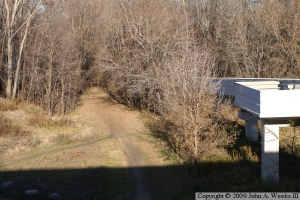
The photo above is looking east off of the side of the bridge. The trail
below connects the entrance to the bridge to the parking lot near the boat
ramp for the Fort Snelling State Park. The photo above is looking east
down the length of the uppermost of the concrete girder spans.
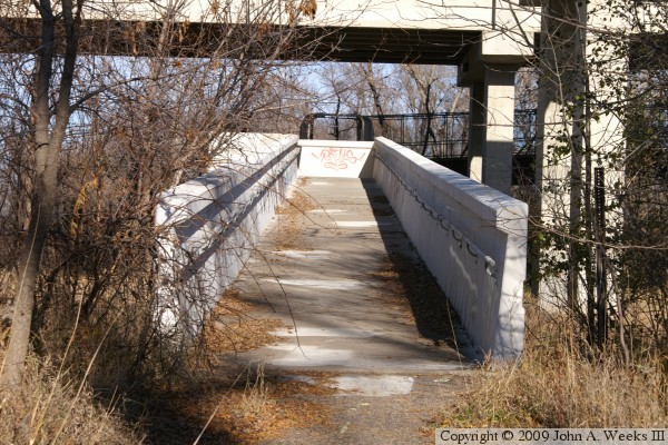
These two photos are the last of a 14 photo set showing a typical bridge
crossing heading southbound towards the parking lot on the south side of
the Minnesota River. The photo above is the transition back to bridge
spans with concrete railings, and the 4th and final observation deck. The
photo below is are the final concrete girder spans and the landing on the
south end of the bicycle bridge.
|
