| Highways, Byways, And Bridge Photography |
Dan Patch Line Bridge
Former CSAH-34 Minnesota River Crossing
Bloomington, MN to Savage, MN
|
• Structure ID: |
N/A. |
|
• Location: |
River Mile 15.3. |
|
• River Elevation: |
691 Feet. |
|
• Highway: |
Former CSAH-34. |
|
• Daily Traffic Count: |
Closed To Auto Traffic. |
|
• Railroad: |
Twin Cities & Western Railroad. |
|
• Daily Traffic Count: |
0 Trains Per Day. |
|
• Bridge Type: |
Center Pivot Swing Bridge. |
|
• Length: |
489 Feet (Estimated), 260 Foot Swing Span (Estimated). |
|
• Width: |
One Rail Crossing, Formerly One Traffic Lane. |
|
• Navigation Channel Width: |
103 Feet. |
|
• Height Above Water: |
20 Feet. |
|
• Date Built: |
1908. |
This rail line was known as the Dan Patch Line when it was built in the early
1900s. Dan Patch was a famous local race horse that broke the 2-minute mile
barrier, a feat that was unmatched for 50 years. Dan Patch was owned by
Marion W. Savage. The city of Savage is named after this famous horseman.
Savage also founded the International Stock Food Company.
The Dan Patch Line was built as the Minneapolis, St. Paul, Rochester and
Dubuque Electric Traction Company. Rail cars also carried the name
Dan Patch Electric Lines. Despite the name, the line was never electrified,
and it never reached beyond Northfield. The line went bankrupt in 1916. It
was reincorporated as the Minneapolis, Northfield and Southern Railroad in
1918. The railroad was purchased by the Soo Line in 1982, which was
subsequently purchased by the Canadian Pacific Railway. The tracks north
of the Minnesota River are operated by the Twin Cities and Western Railroad
under a trackage rights agreement. The TCWR eventually purchased the Dan
Patch Line Bridge to ensure that the railroad has future access to the port
of Savage given that the TCWR hopes to grow by bringing grain shipments to
the elevator located on the south side of the Minnesota River.
While the railroad line is still intact, local railfans report that there has
not been a train run over the Dan Patch Bridge since the mid-1990s. However,
a 2003 photo on Google Earth seems to show the bridge closed with a train
having just passed over the bridge. At any rate, there has been a derailer
bolted to the tracks on the north side of the river since before my first visit
to the bridge in 2005. The swing span is locked in the open position to allow
river navigation traffic to pass. Barge traffic travels the Minnesota River as
far as the grain elevators located just upstream of the swing bridge. Despite
the low volume of rail traffic, the Dan Patch Line Bridge was refurbished
and converted to allow remote control operation in 1996. A further construction
project in 2012 and 2013 saw the south approach trestle rebuilt.
A traffic deck was once attached to the east side of the railroad deck.
This provided a single lane for cars to cross the river. As a result,
the bridge was somewhat dangerous to cross, and the single lane was often
a traffic bottleneck. The traffic deck was considered to be obsolete and
was closed in the early 1980s. It was later removed from the structure.
Given the proximity of the I-35W river crossing and the planned
Bloomington Ferry Bridge, this river crossing was not considered to be
critical. There has been no proposal to build a new highway bridge at
this location.
The Dan Patch Bridge may once again carry commuter traffic in the future.
A proposal was developed in 2000 and included in a MN-DOT plan for future
commuter rail lines in the Twin Cities area. A bill was introduced in 2008
to move the planning forward. The rail line would carry heavy rail
commuter traffic into downtown Minneapolis from Northfield, Lakeville,
Savage, Bloomington, Edina, and Saint Louis Park.
Road scholar Adam ‘Froggie’ Froehlig has done a bit of research
on the history of this former highway crossing. On the Hennepin County side,
the road was first designated CR-55A. It later became CR-134, and then
was given the designation CSAH-134. CSAH stands for County State Aid
Highway, which is the upper tier of county road that is maintained very
close to state highway standards. The Scott County side opened without
a highway number. It then became CR-134, then CR-16, and finally
CSAH-31. Today, the northern approach road is called Normandale Blvd,
and the southern approach road is named Vernon Avenue.
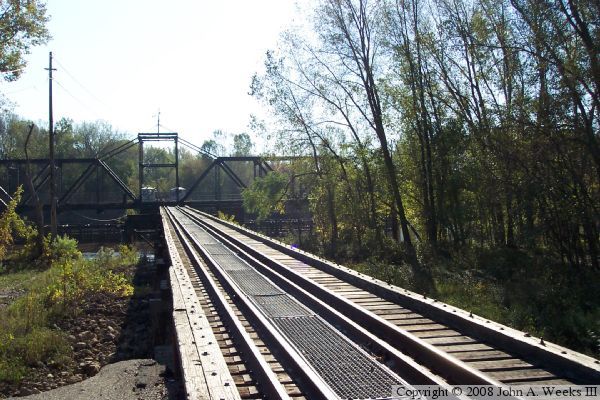
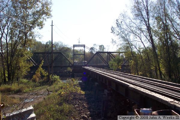
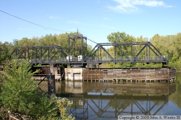
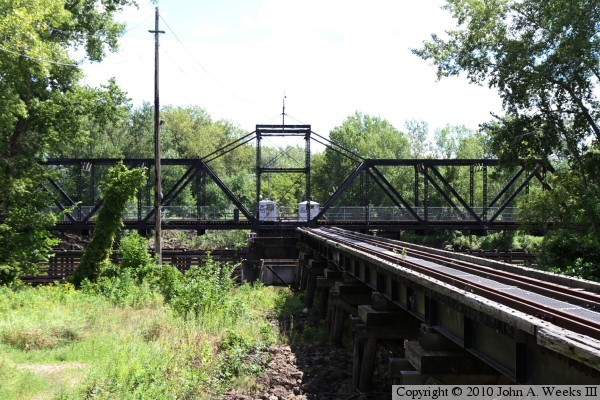
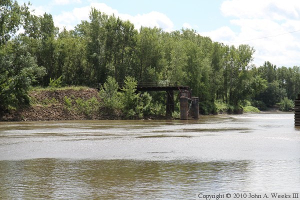
The photo above is a view of the swing span looking south from the roadway on
the north side of the river. The traffic deck was located on the left side
of the railroad tracks.
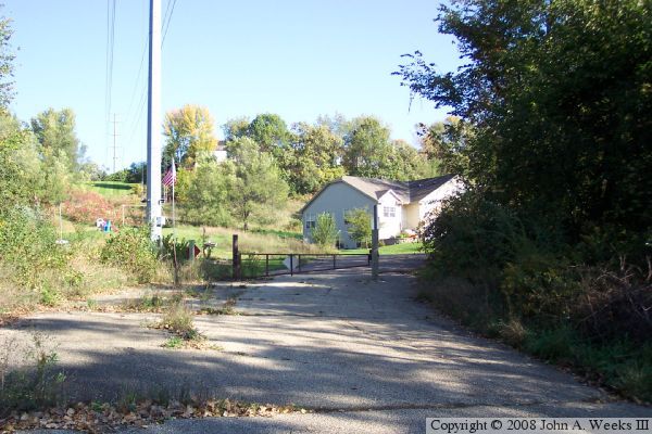
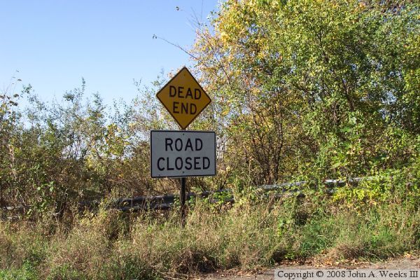
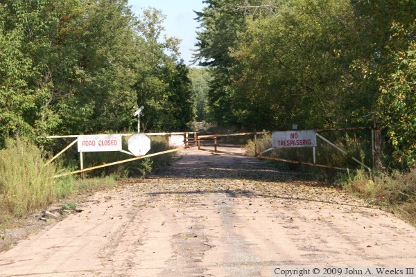
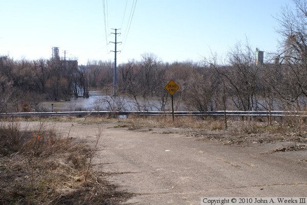
The photo above is view of the gate that now blocks off the road leading to
this former Minnesota River highway crossing. The entrance road has been made
into a cul du sac, lined with very expensive townhomes. The photo below is a
dead end and road closed sign left over from the period after the bridge was
closed, but before the road was blocked off and turned into a cul du sac.
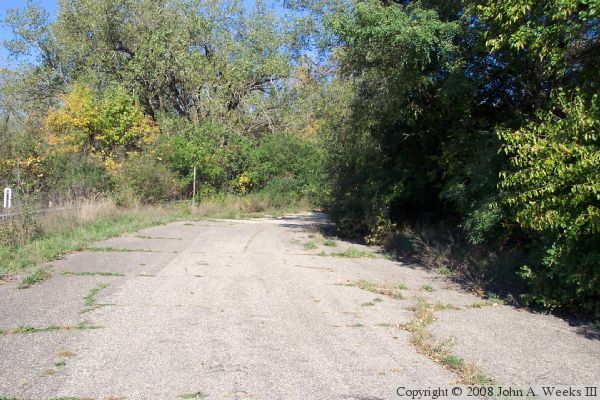
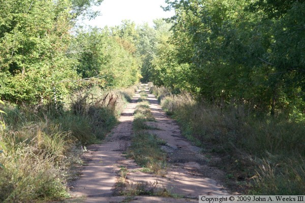
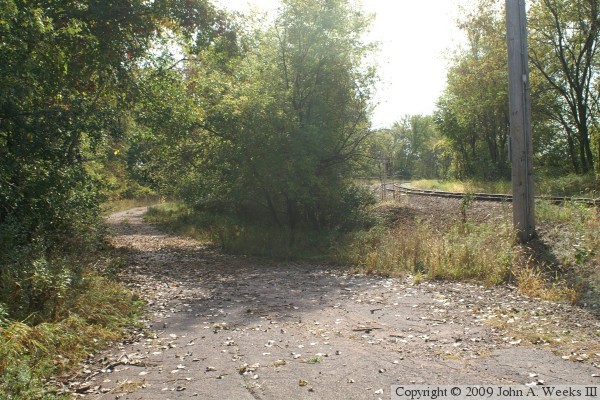
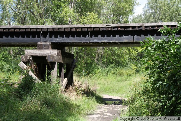
The photo above is a view of the entrance road to the bridge. It is still in
relatively good condition despite 15 years of disuse. The trees and grass are
starting to take over. Notice the guard rail off in the weeds. The photo
below is a view of the railroad track as it descends the river bluffs down
towards the bridge. This line is no longer heavily used. In fact, local
railfans tell me that there has not been a train on this bridge since the late
1990s.
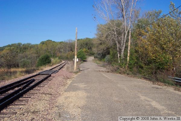

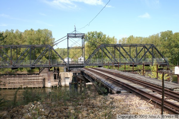
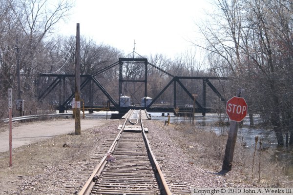
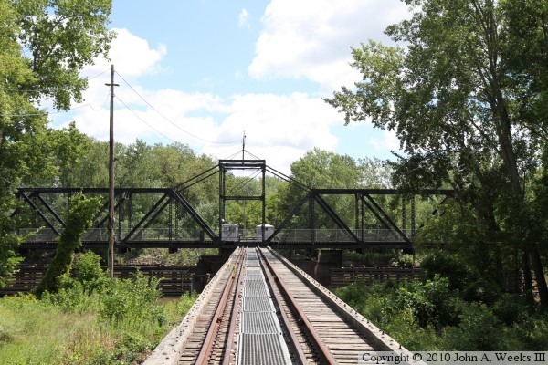
The photo above is the railroad tracks leading up to the Dan Patch Bridge.
A stop sign on a rail road line is an unusual site. The bridge is maintained
in the open position at all times except when a train is crossing the river.
That allows water traffic to move freely, and the occasional trains are
handled manually. Note the red device sitting on the rail towards the left
side of the photo. That is a derailer device. If a train fails to stop, this
metal device will kick the train off of the track rather than letting it
plunge into the river.
The photo below is the north approach to the bridge, looking where the traffic
lane once paralleled the rail line. The traffic lane was a wooden and steel
structure hung off of the side of the bridge. The rail section of the bridge
is mostly steel. The traffic deck was removed after the highway crossing was
closed.
The photo above is the gate on Vernon Road leading to the south end of the Dan
Patch Bridge. The bridge is about a half mile beyond this point. The
rail line that crosses the bridge runs parallel to this road just off to the
left side of the photo. The rail line that crosses the road just beyond the
gate is a connector between the east-west Union Pacific Omaha Road mainline
and the Dan Patch line. The photo below is looking northbound along Vernon
Road just beyond the gate. While nature is rapidly reclaiming the road,
the yellow line on the center of the pavement is still visible in places.

The photo above is a view of the river crossing as you approach the Dan Patch
Bridge from the south along Vernon Road. The photo below is a view of the
bridge swing span as seen from the south riverbank from a vantage point just
downstream of the structure.

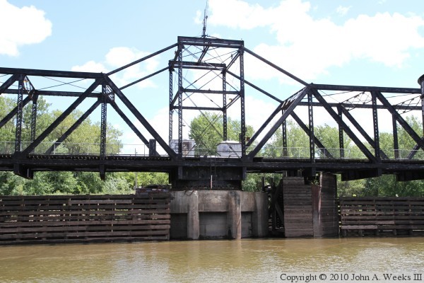
The photo above is a close view of the swing span pivot. It appears that
the bridge was recently repaired after being struck by a barge. There are
broken boards on the barrier to the left of the pier, and the boards on the
right of the pier appear to be new. In addition, the lag bolts attaching
those boards appear to be bright and shiny. The photo below is looking
north along the length of the railroad deck. There are 4 rails on the bridge.
The inner rails are called guard rails. They are in place to help keep the
wheels of a derailed locomotive or car on the bridge, preventing a train
from falling off of the bridge.

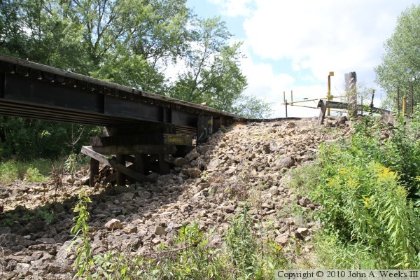
The photo above is a view of the bridge structure from the south riverbank from
a vantage point on the upriver side of the bridge abutment. The photo below
is the approach road looking south from the riverbank. The road and tracks
diverge, but both curve to the right and run parallel for about a mile
before Vernon Avenue ends at highway MN-13.
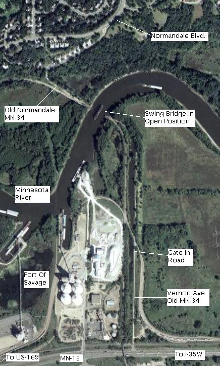
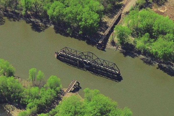
The photo above is an aerial photo of the Normandale river crossing taken from
Google Earth. The view is from an altitude of about 6000 feet. Highway 13,
the main highway through Savage, runs along the bottom of the photo. The
image below is a clip from a 1987 official Minnesota highway map. The map
shows the Normandale Crossing where CSAH-34 crosses the Minnesota River inside
the black circle. Press here to
view the complete Twin Cities area map.


The photo above is a newspaper image showing the Dan Patch Line Bridge
underwater during the flood of 1969. The roadway is to the left of the
bridge truss in this view looking south across the Minnesota River.
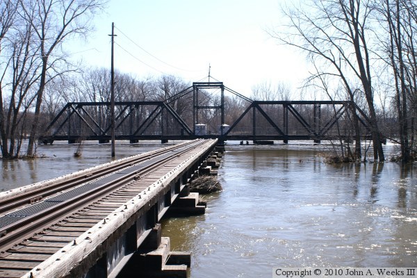
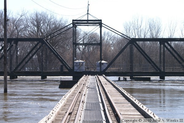
These two photos, and the four that follow, are views from the spring flood
of 2010. The water was up to the level of the bridge deck at the crest, but
it had fallen a few feet when these photos were taken. The photo above is
a view looking south along the upriver west side of the structure from the
Bloomington side of the river. The photo below is looking down the center
of the bridge deck.
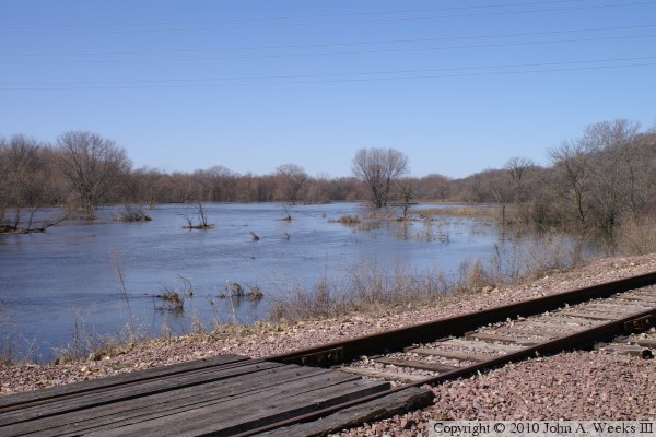
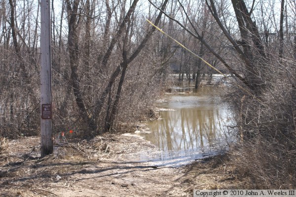
The photo above is looking south across the river flats from the road leading
to the Dan Patch Bridge on the north side of the Minnesota River. The photo
below is a view of the river flats looking west from the railroad tracks.
The photo above is a view of the river crossing looking south from the
middle of the railroad tracks. The highway once crossed the river at this
location using a traffic lane that was attached to the left side of the
bridge. The photo below is the DNR bicycle path that runs along the
Minnesota River heading east from the bridge site. The path is just a
little wet.
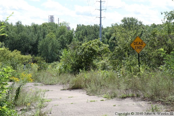
I went back to visit the Dan Patch Bridge in August, 2010, to see what it
looked like after the flood waters have receded and the land has dried out.
These two photos are the roadway leading to the swing bridge. In the photo
above, we notice that the Road Closed sign is missing from the Dead End
sign. There is a highway guard rail located behind the sign, but it is
totally hidden by the greenery. The photo below is looking downhill towards
the bridge. Trees and brush have nearly taken over the roadway.
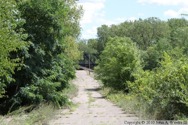
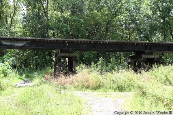
These two photos are views of the bridge from the end of the roadway. In
the photo above, we are looking along the side of the trestle. The trestle
is in a shadow due to it being a very bright and sunny day. The photo below
is looking southeast down the middle of the rails.
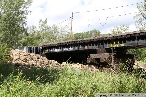
These two photos are views of the bridge abutment. The photo above is the
east side. The highway deck was located on this side of the railroad
track. The photo below is the west side of the abutment.
These two photos are views of the trail that crosses under the trestle
portion of the bridge. The photo above is looking east with the sun behind
us. The photo below is the east side, looking into the afternoon sun.
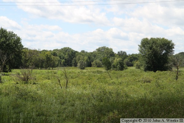
The photo above is the swampy river flats located west of the railroad
track. This was totally underwater in the spring 2010 photos above. The
photo below is the end of the railroad trestle on the north side of the
Minnesota River.

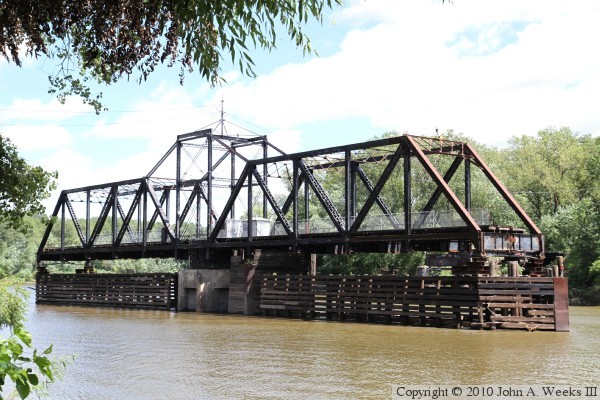
The photo above is a view of the swing span as seen from the riverbank on
the north side of the river. The photo below is a close view of the pivot
point at the middle of the structure.


The photo above is the east end of the swing span as seen from the edge of
the river. The photo below is the trestle on the south side of the river.
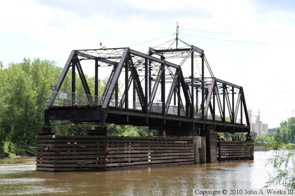
The photo above is a view of the swing span as seen from the north bank of the
river just upriver of the structure. The photo below is a similar view from
just downriver of the structure. A barge can be seen in the background. It
is tied up at one of the loaders for the complex of grain elevators located
between the river and highway MN-13.
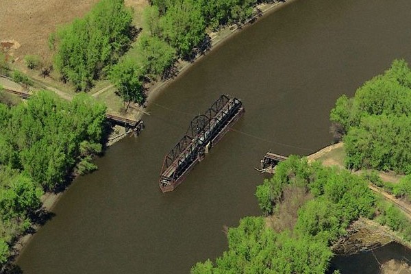
These two views are from MSN Maps. The photo above is looking north, while
the photo below is looking east.
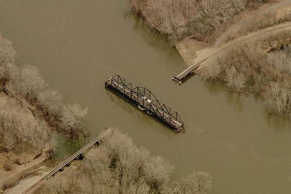
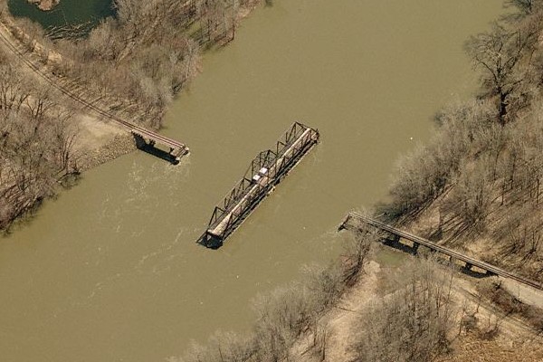
These two photos are additional views from MSN Maps. The photo above is
looking south, while the photo below is looking west. Both photos appear to
be taken during the spring given that leaves have not come out yet, and the
water level is high.
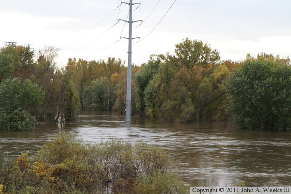
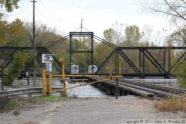
The photo above sees the river bottoms flooded for a second time in 2010
during a rare autumn flood on the Minnesota River. The photo below is
looking south towards the north end of the bridge. The yellow gate
blocks off the spot where the roadway once ran on the downstream side of
the bridge. The water over a dozen feet deep on the far side of the gate,
with the depth increasing to twenty feet above normal in the river channel.

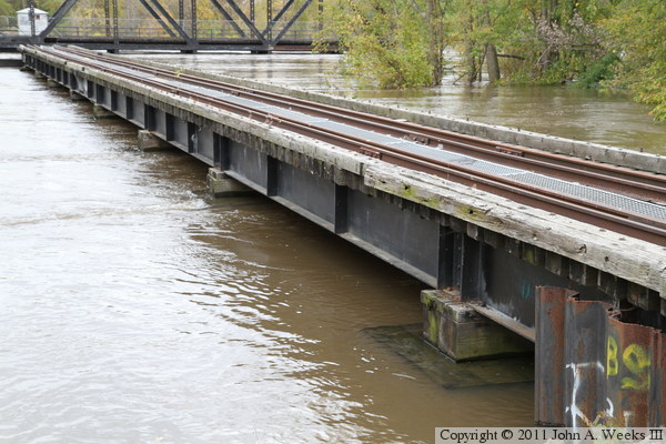
The photo above is a view of the swing span looking across the river where
the highway roadway was once attached to the railroad bridge. The photo
below is a close view along the downstream side of the steel girder
approach spans, showing that the water is only inches from the steel.
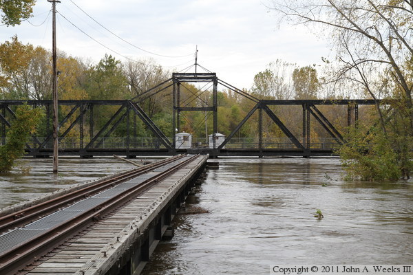
These are two more photos looking towards the swing span from the north side
of the river. The photo above is a view from the upstream side of the
approach, while the photo below is looking down the center of the railroad
tracks. The current is very swift in this area because the railroad
embankment acts like a dam blocking off the river flats, causing the mile
wide river to funnel through a gap that is less than 500 feet wide.

|
