Saint Anthony falls was once called the most important natural source
of hydropower in the United States. When it was initially developed,
hydroelectric power had not yet been invented. Rather, water was
diverted from the river and run through a series of canals, tunnels,
and gates to deliver the water to mills along the riverfront. At one
time, there was over 12 miles of active power tunnels on the Minneapolis
side of the river (the west side, the east side was part of the city
of Saint Anthony at that time). After the water was run through the
mill turbines and waterwheels, it was collected in a channel known as a
tailrace. The tailrace would carry the used water back to the river.
When hydropower was developed, much of the water power tunnel system
was abandoned. Over time, the mills would burn down, streets would
be modified, the river front was landscaped, and the lock & dam
project brought wholesale changes to the river. The result is that
these power tunnels and the tailrace were covered over and largely
forgotten.
Fast forward to 2001. The Minnesota Historical Society started to sponsor
a series of archaeological digs along the riverfront to see if they could
uncover any of the history of the milling district from the 1800s. In
the process, they uncovered a large portion of the tailrace system.
The intake was then reopened, and water was allowed to flow through the
tailrace much like it did over 100 years ago. Since that time, the park
has been developed with a parking area, trails, bridges, and information
signs. The Mill Ruins Park has been a huge addition to the riverfront in
downtown Minneapolis, and it helps connect what we see today with the
forces that helped create the Minneapolis of the 19th century. The photo
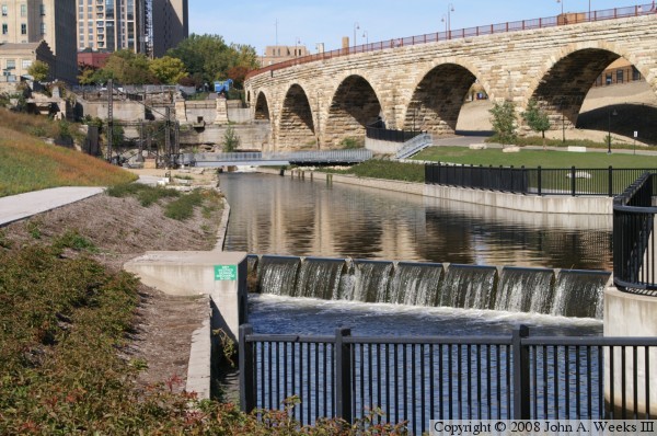
above is the tailrace canal, the centerpiece feature of the park.
The photo above is an overview of the Mill Ruins Park as seen from the
Endless Bridge at the Guthrie Theater. The photo below is bridge #1, a
concrete girder bridge over the south outlet of the tailrace canal.
There is a parking area for the park just south of this bridge.
The photo above is bridge #2, the northern of the two concrete girder
bridges over the outlet of the tailrace canal. The photo below is
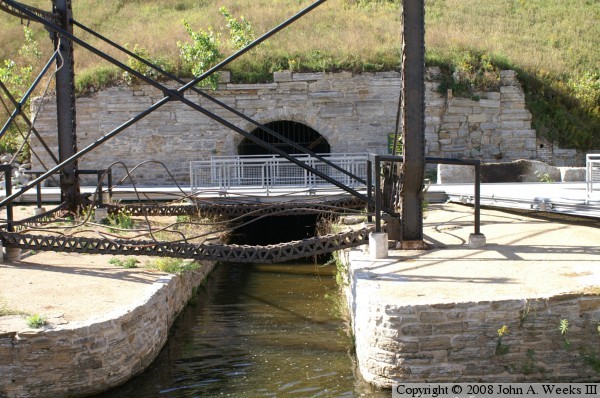
bridge #3, a steel bridge over a power tunnel outlet. This tunnel
is the outlet from one of the large flour mills. The steel structure
is the remains of a former Minneapolis Eastern Railroad trestle
that once carried passenger traffic into the downtown railroad depot.
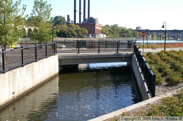
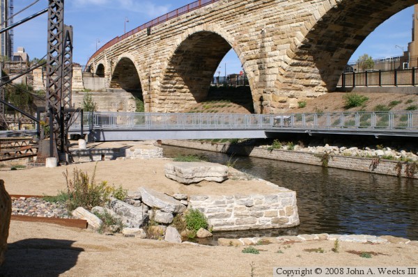
The photo above is bridge #4, another steel pedestrian bridge, this
one, over the main canal channel. Below is another view of bridge #4.
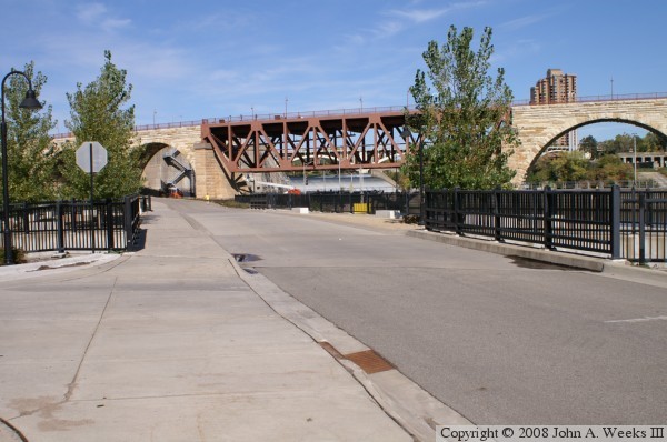
In the photo above, the tailrace canal flows under a massive rock
and concrete block that forms bridge #5, which provides access from
downtown Minneapolis to the Upper Saint Anthony Falls Lock, and to
the Mill Ruins Park. Another tunnel outlet is just to the left
of the tree in the middle of the photo. Below, we see a photo of
the roadway as it crosses bridges #1 and #2.
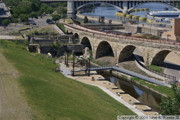
The above photo is item #6 on the map below. It is the intake for
one of the power tunnel systems. It currently provides water flow
for the Mill Ruins Park. The intake is behind the lock and dam.
From here, the water will fall 50 feet before it rejoins the great
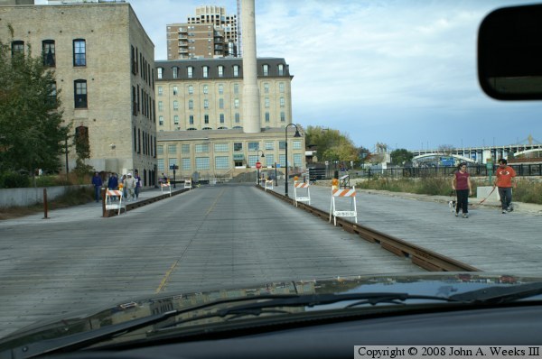
river. Below is the west river parkway behind the Mill City Museum.
The wood planking simulates the historic road surface where wood
planks formed a bridge deck to carry traffic over a power canal that
was carrying water to the two largest flour mills.
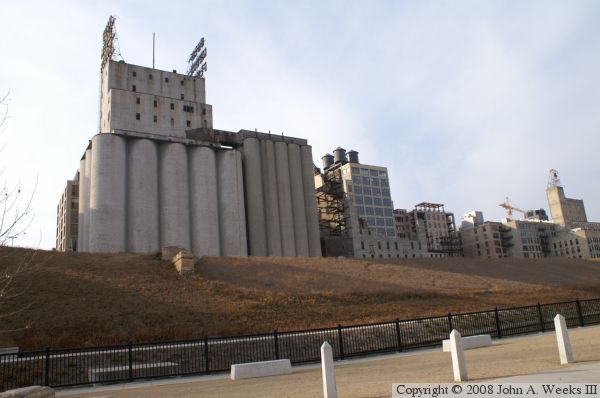
The photo above is a view of the two largest mills on the Minneapolis
side of the river. The west side of the river is referred to as the
Minneapolis side since the east side was once the city of Saint
Anthony. The city of Saint Anthony merged with Minneapolis in 1872.
The nearest mill is the Gold Medal Flour mill. Next to is the burned
out shell of the Washburn A Mill, now the Mill City Museum. Further
down is a mill converted into a top shelf hotel.
There once was a second row of mills between the location where this
photo was taken (near the river) and the remaining mills. This included
the Minneapolis Mill, Excelsior Mill, Empire Mill, and the Pillsbury B
Mill. Those were destroyed in a fire in 1881, and the foundations form
the basis of the Mill Ruins Park.
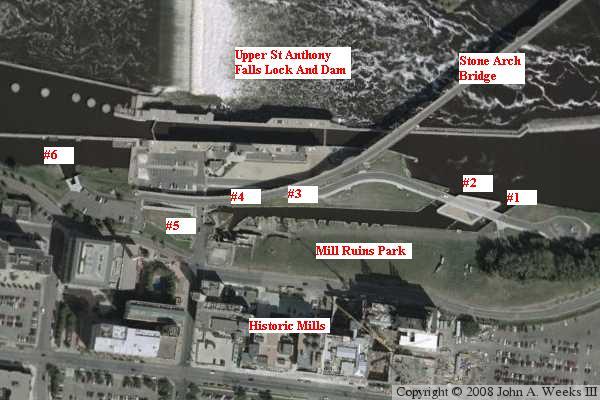
Below is an aerial photo of the Mill Ruins area. The various bridges
and structures are numbered or otherwise labeled.