| Highways, Byways, And Bridge Photography |
I-494 Bridge
I-494 Minnesota River Crossing
Bloomington, MN to Mendota Heights, MN
|
Eastbound Span |
|
• Structure ID: |
NBI: 9217E. |
|
• Length: |
4,509 Feet. |
|
|
|
Westbound Span |
|
• Structure ID: |
NBI: 9217W. |
|
• Length: |
4,393.7 Feet. |
|
|
|
Statistics Common To Both Spans |
|
• Location: |
River Mile 4.2. |
|
• River Elevation: |
686 Feet. |
|
• Highway: |
I-494. |
|
• Daily Traffic Count: |
44,000 (1996). |
|
• Bridge Type: |
Concrete Girder With Steel Girder Main Span. |
|
• Width: |
55 Feet Per Span, 3 Lanes Per Span. |
|
• Navigation Channel Width: |
230 Feet. |
|
• Height Above Water: |
55 Feet. |
|
• Date Built: |
Opened 1982. |
I-494 Bridge over the Minnesota River is located directly southeast of the
Minneapolis-Saint Paul International Airport. The Minnesota River is navigable
by riverboat traffic at this point, so the west end of the bridge was raised
high enough to allow small tow boats to clear at normal water levels.
The highway mile markers on this bridge are interesting, at least to the
road geek. I-494 and I-694 share a common set of mile markers. These
mile markers do not start where these highways meet, as expected. Rather,
the zero mile marker is on I-494 at the Minnesota River. The mile markers
go up as you head west past the MSP Airport and continue to climb as you
travel clockwise around the 494/694 loop. The last exit heading west on
I-494 before the zero marker is Exit 71, Pilot Knob Road.
Prior to this section of I-494 opening in the mid-1980's, I-494 was routed up
MN-5 past the MSP Airport, then on MN-110 across the Mendota Bridge. The
traffic was routed back onto I-494 just west of the present day US-52
interchange, where it would continue east across the Mississippi River over
the Wakota Bridge.
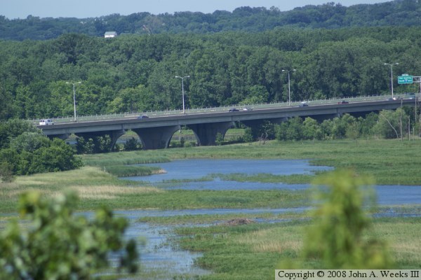
The photo above is looking east from a flyover ramp at the west end of the
I-494 Bridge. The photo below is the north face of several bridge spans
over the river flood plain as seen from an overlook within Fort Snelling
State Park located along old highway MN-13.
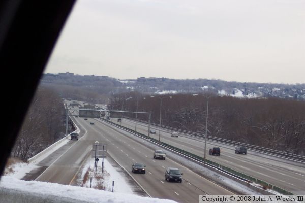
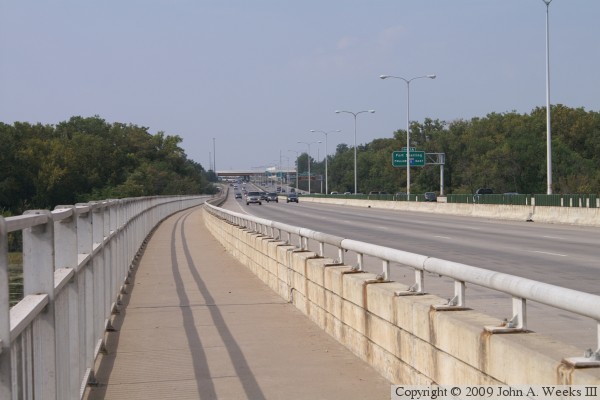
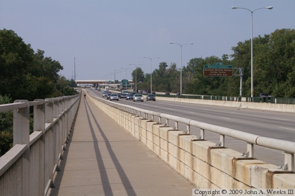
These two photos are the first of three photos showing a typical river
crossing heading westbound from Mendota Heights towards Bloomington. The
photo above is just entering the eastern end of the bridge. Notice the
mile marked on the Minnesota River guide sign. It is mile zero, which is
the base point for exit numbers on the I-494 and I-694 ring route around
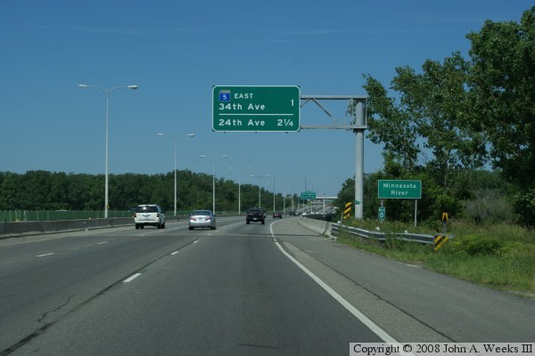
the Twin Cities. The photo below is about one-third of the way across
the bridge.


The photo above is the third of three photos showing a typical river crossing
using the I-494 Bridge. In this photo, we are nearing the west end of the
structure. The photo below is a profile view of the eastern section of the
I-494 Bridge as it crosses the river flood plain. The two river channels are
located off of the left edge of this photo.

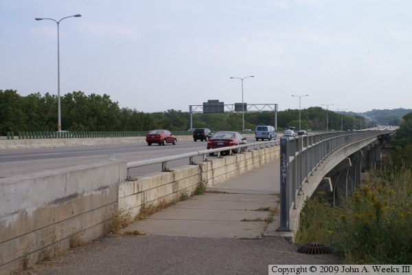
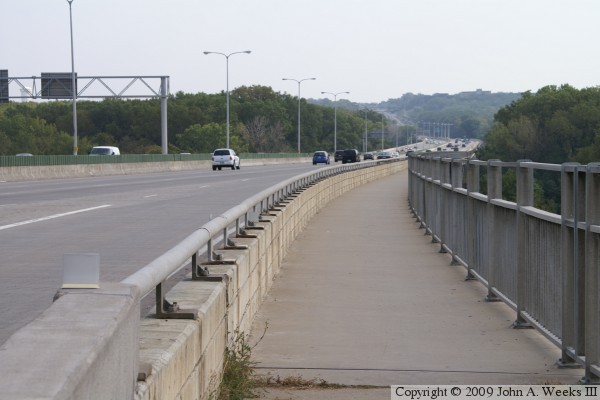
These two photos are views of the west end of the I-494 bridge from the
bicycle trail attached to the south side of the eastbound structure. In
the upper photo, we see that the landscape drops off quickly beyond the
bridge abutment. In the photo below, we can see the entire length of the
bridge. The bridge has a slight S-curve shape, which is not readily
apparent when driving over the structure at highway speeds.
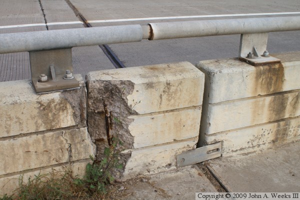
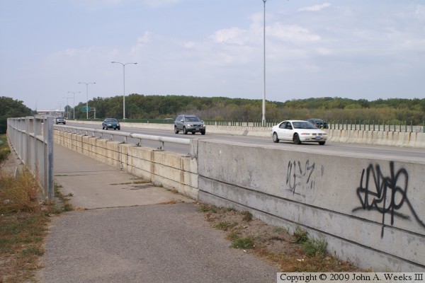
The photo above is the guard rail between the traffic lanes and the bicycle
trail at the bridge abutment. Despite the opening of this section of I-494
still being fresh in my mind, the bridge is approaching 30 years old. Some
aspects of the bridge are showing its age, such as the broken concrete at
this location. The photo below is a sign attached to the railing a bit
further to the east indicating that a fiber optic cable has been fished
through the bridge rail. This seems like an odd place to install a fiber
cable. I would expect it to be in a cableway under the bridge. Given the
length and the height of the bridge, installing a new fiber cableway likely
would have been very expensive.

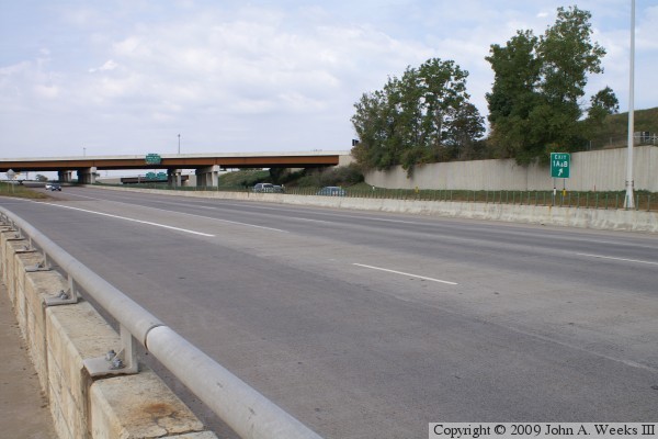
The photo above is looking back to the west from the bicycle path near the
west end of the bridge. The entrance ramp is from 34th Avenue, and the
overpasses are for Hennepin County Highway 5. The photo below is looking
north across the bridge from the center of the main river span. The MSP
Airport is located to the left of the river channel.

The photo above is looking south from the main river span. The Minnesota
River is navigable for several miles upriver from the I-494 Bridge. The
photo below is a side channel that runs a bit east of the main river
channel. This was once the main river channel, but it is now the remnant
of an oxbow curve. Since the river picked a new channel, this channel has
been filling with sentiment.


The photo above is looking east towards the east end of the bridge from the
bicycle path on the south side of the eastbound bridge span. Interstate
highway I-494 passes over Minnesota Highway MN-13 about a half mile to the
east, then climbs a grade out of the river valley towards Pilot Knob Road
and Interstate Highway I-35E. The photo below is looking west towards the
east end of the eastbound structure.
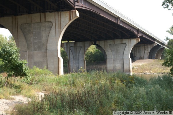
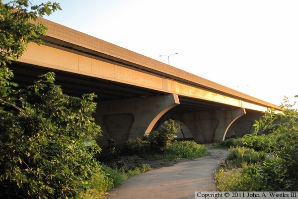
These two photos are views of the south face of the eastbound span. The
photo above is a view from just below the level of the bridge deck. The
photo below is from a vantage point located 200 feet south of the bridge
and just above the water level. There is a large shallow lake located
to the south of the east end of the I-494 bridge.

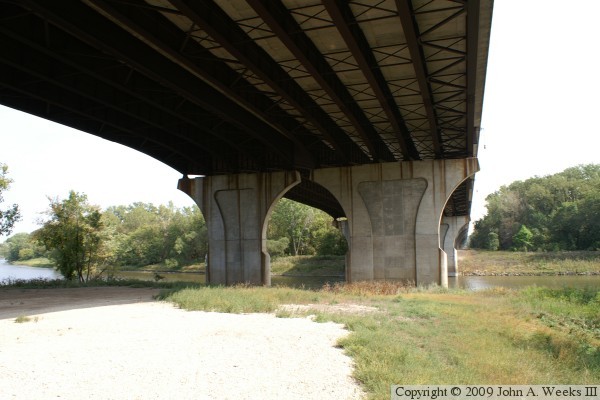
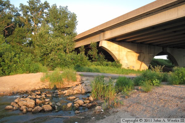
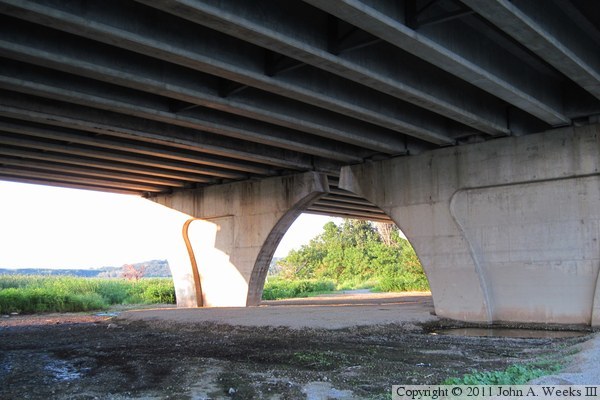
The photo below is a close view of one of the bridge piers supporting the
concrete girder spans. A small channel flows under the bridge at this
location connecting the lake to the south to the marsh located north of
the bridge. The photo below is looking west from under the center of the
bridge. The bright white line in the center of the photo is the gap between
the two parallel bridge spans.
These two photos are views looking west from the bicycle path attached to
the south side of the eastbound bridge span. The photo above is from near
the east end of the structure. The photo below is a view from the middle of
the bridge span. The green and brown overhead sign informs travelers that
the next exit leads to the National Cemetery and the Nation Wildlife Refuge
Visitors Center.
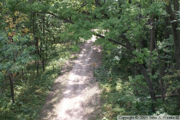
The photo above is looking down at an access road that runs along the east
side of the secondary river channel. This road is used by state park
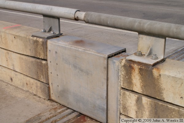
maintenance vehicles. The photo below is the joint between the river channel
span and the concrete girder spans. While the deck features an expansion
joint, the bridge railing incorporates telescoping metal sections that are
able to move as the bridge expands and contracts.
The photo above is the westernmost span of the eastbound bridge structure.
The westbound span ends where the first eastbound pier is located, accounting
for the difference in length between the two parallel structures. The photo
below is one of the westernmost of the full-height bridge piers.
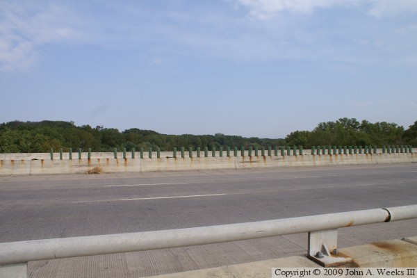
The photo above is looking east between the two bridge structures from near
the west end of the I-494 bridge. The photo below is looking back to the
west towards the west end of the I-494 bridge. The fence visible in these
two photos cordons off a small depression that holds runoff to prevent it
from draining directly into the Minnesota River. These runoff ponds have
been very successful in helping to improve the water quality in the river.


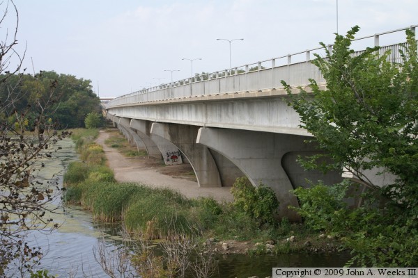
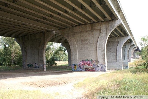
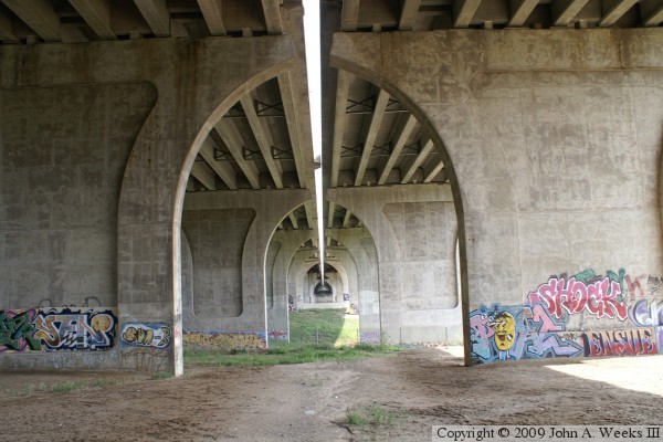
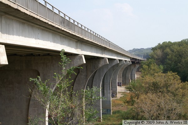
These two photos are views of the steel plate girder spans over the main
channel of the Minnesota River. The photo above is an overview shot, while
the photo below is a close view of the center span over the river. While
these bridge piers have a similar design to the piers supporting the concrete
girder spans, note that they have additional width above the waterline to
protect the bridge from barge traffic.
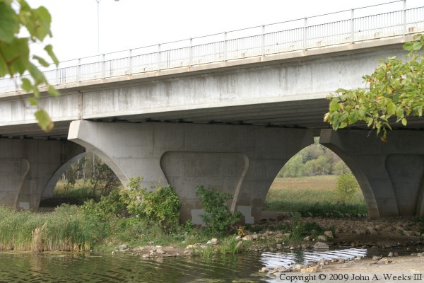
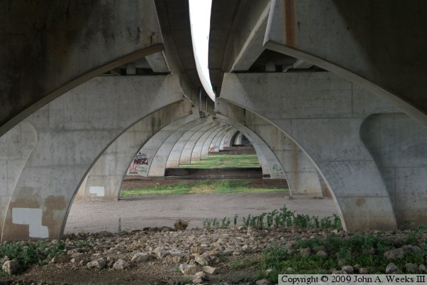
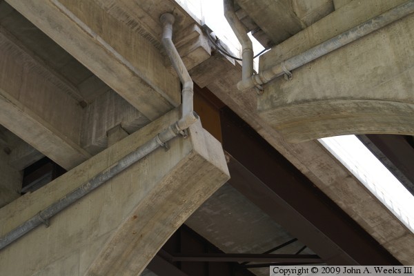
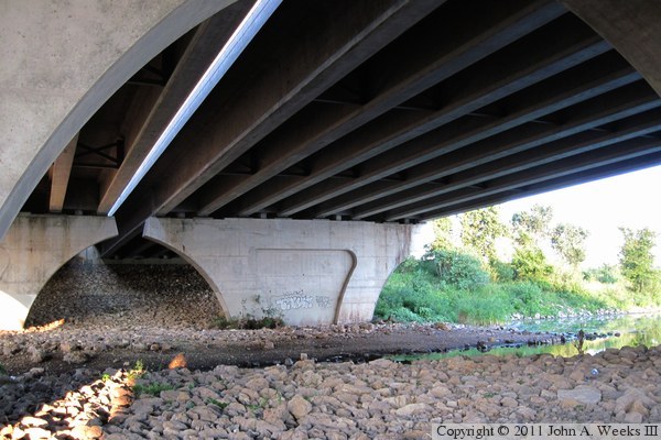
These two photos are views of the underside of the bridge. The photo above
is the underside of a plate steel girder span. The photo below is a close
view of the interface between the steel and concrete spans on the west side
of the main river channel.
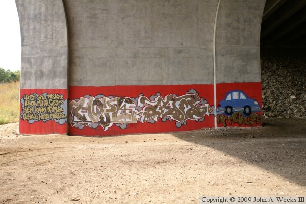
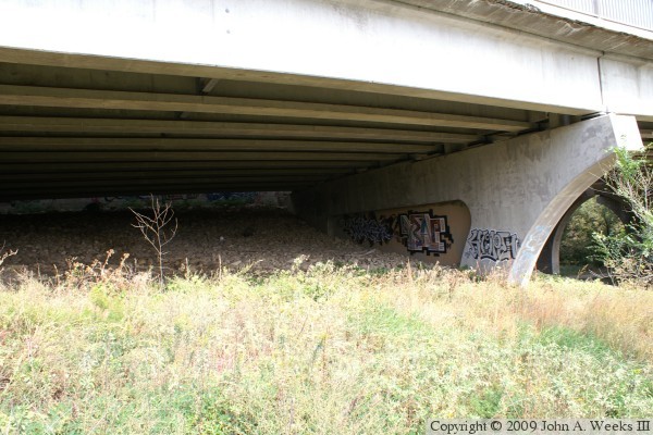
The photo above is an example of the graffiti located under the I-494
bridge. The graffiti painted on nearly every bridge pier is very intricate
in design. In fact, it might be better termed ‘large format outdoor
art’ than graffiti. The artwork is very tastefully done and shows a
high degree of skill. It is well worth the hike down to this location to
look at this artwork. The photo below is a view looking east along the east
face of the bridge as seen from just below the bridge deck level on the
west side of the I-494 bridge.
These two photos are views of a paved access road used by MN-DOT and National
Wildlife Refuge employees. It exits off of I-494, but is blocked by a
chain link fence gate. The road runs along the north side of the east bridge
abutment, then crosses under the bridge and runs along the south side of
the structure all the way to the east channel of the Minnesota River. From
there, trails go north to the Mendota Bridge and south to the Cedar Avenue
Bridge. The photo above is looking west along the north face of the bridge,
while the photo below is looking east towards the bridge abutment.


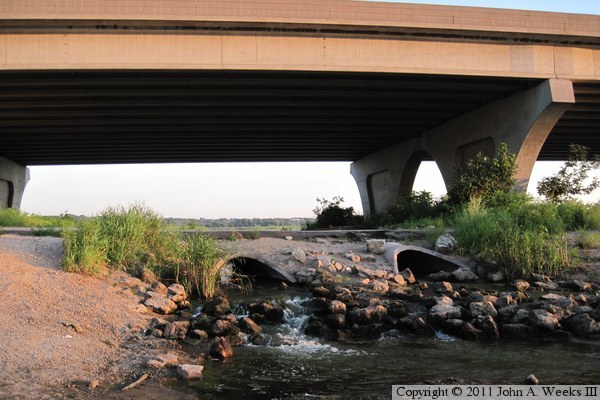
The I-494 Bridge splits Gun Club Lake into two smaller lakes, with this
channel connecting the two sections of lake. The channel is under the second
bridge span from the east end of the structure. The photo above is looking
southeast under the bridge, while the photo below is the downstream end of
the channel n the north side of the structure. Both photos includes views
of the culverts where the access road crosses the channel.

These two photos are views of the downstream side of the access road culverts
over the small channel that connects the two halves of Gun Club Lake. The
photo above is looking north into the refuge, while the photo below is looking
south towards the access road. The northern lake section is about two feet
lower than the southern lake section.
The photo above is looking towards the east bridge abutment from under the
second set of bridge piers at the east end of the structure. The small
channel under this bridge span connects the two halves of Gun Club Lake.
The photo below is looking east along the access road under the south edge
of the bridge. The access road is gravel on this side of the bridge.

The photo above is a view looking under the I-494 Bridge from the access
road that runs along the south side of the bridge on the east side of the
Minnesota River. This area was flooded upwards of ten feet deep much of the
spring and early summer of 2011. MN-DOT had recently painted over the bridge
graffiti, but it didn't take long for the outdoor artists to return after the
water retreated (photo below).

|
