| Highways, Byways, And Bridge Photography |
Senator William V. Roth Jr. Bridge
DE-1 C&D Canal Crossing At Saint Georges
Saint Georges, Delaware

| • Bridge: |
Senator William V. Roth Jr. Bridge |
| • Structure ID: |
NBI 1902082 |
| • City: |
Saint Georges |
| • State: |
Delaware |
| • Country: |
USA |
| • Carries: |
DE-1 |
| • Crosses: |
Chesapeake & Delaware Canal |
| • Date Opened: |
December 1, 1995 |
| • Total Length: |
4,649 Feet |
| • Longest Span: |
748 Feet |
| • Tower Height: |
180 Feet |
| • Deck Width: |
127 Feet |
| • Number Of Lanes: |
6 |
| • Number Of Spans: |
1 |
| • Height Above Water: |
138 Feet |
| • Traffic Count: |
58,153 (2002) |
Delaware sees a large volume of weekend traffic heading to its beaches along
the Atlantic Ocean. A large chunk of this traffic comes from the
Wilmington and Philadelphia area via the Interstate Highway system. This
traffic was funneled through northern Delaware via highway US-13. This
highway passed through several towns as well as Dover, the capital city of
Delaware. This was slow going for the beach traffic, and it snarled roads
used by local residents along the way.
Solutions to this problem were proposed as early as the late 1950s. The
route through central Delaware was rejected as part of the Interstate
Highway system. A later attempt to build a Delaware Turnpike failed, as
well as a second attempt at an Interstate Highway. Eventually, the state of
Delaware decided to abandon hopes of a federal solution and proposed a
4-lane controlled access state highway in 1985. A routing was agreed upon
in 1987, and the road was given the designation of highway DE-1 in 1989.
While the road is officially known as the Korean War Veterans Memorial
Highway, locals call it the ‘relief route’.
One obstacle faced by the construction of highway DE-1 is the Chesapeake &
Delaware Canal, a 14-mile long ship canal that cuts across northern Delaware.
Since this canal hosts ocean-going vessels, it would have to be high, at
least 100 feet over the water. The solution that was selected is a Cable
Stayed Bridge. This bridge was known as the Chesapeake & Delaware Canal
Bridge when it opened in 1995. It was officially named after Senator William
V. Roth Jr. in November, 2006. Roth is known for his bill that created the
Roth IRA.
Highway DE-1 is a tollway from the Delaware Turnpike south to Dover. However,
the exits on each side of the Roth Bridge are free. This is to allow local
traffic to use the bridge to cross the C&D Canal without paying tolls.
One reason for this is that while the US-13 Saint Georges Bridge is still open
to automobile traffic, the US Army Corps of Engineers, which manages the
US-13 bridge, would like to encourage trucks to use the Roth Bridge rather
and cheating the weight limits on the Saint Georges Bridge to avoid tolls.
There are a few unique design features of the Roth Bridge. The bridge spans
are built entirely using precast segmental box sections. They were cast
off-site and brought in on barges. The bridge is also an early example of
the use of delta frames. For example, while the approach lanes are two
separate parallel spans, the main canal span appears to be one single wide
span. However, it is actually two parallel spans that are permanently joined
by concrete trusses. These are the delta frames. They join and support the
parallel lanes, and also have the attachment to the cables. Another
interesting feature of the bridge is that the spans on the outside of the
towers, which would normally be suspended spans, are actually supported by
piers on the Roth Bridge. As a result, the only span that is suspended is
the main canal span. This design works in conjunction with another feature.
The cables are not attached to the towers. Rather, they pass through the
tower in tubes known as saddles. The net effect is that the cables hold up
the suspended canal span, pass up and through the tower, then down to a
fixed span. The weight of the fixed span counterbalances the weight of the
suspended span.
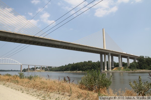
The photo above is looking west into the bright afternoon sun towards the
east side of the Roth Bridge from the north side of the C&D Canal. The
photo below is looking south towards the Roth Bridge from Kirkwood Saint
Georges Road, which has an overpass over highway DE-1 about three-fourths of
a mile north of the canal. The overpass is posted with a number of signs
prohibiting stopping, standing, or parking, and there were trees in the way.
In looking at aerial photos, there may be some better vantage points north of
the canal, which I will check out the next time I am in the area.
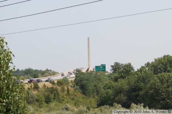
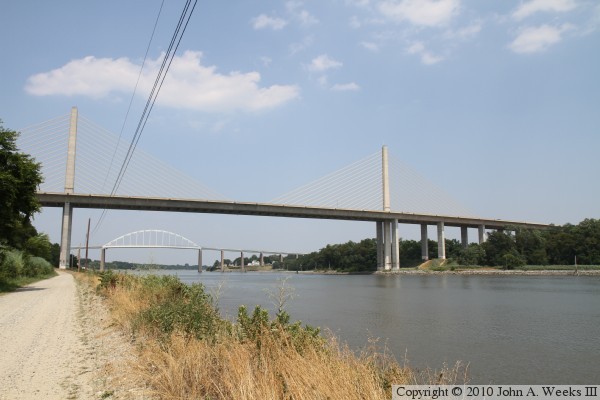
These two photos are views looking north towards the Roth Bridge from the
exit ramp from southbound highway DE-1 to Lorewood Grove Road. The photo
above is from about one-half mile from the canal. The photo below is a
bit closer, one-third of a mile from the canal, but is lower in elevation.

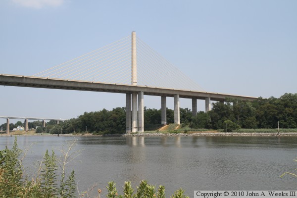
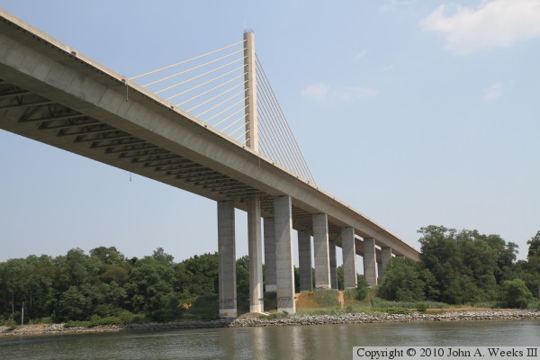
The photo above is the north main bridge tower. The photo below is the
south main bridge tower. Both photos are views looking east from the towpath
along the north side of the canal. The US-17 Saint Georges Bridge over the
C&D Canal is visible in the background.
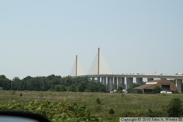
These two photos are views of the west face of the Roth Bridge. The photo
below shows the south cable stay plane, and a small part of the north
cable plane. This view is from about 750 feet west of the structure. The
photo below is from about 1,600 feet west of the Roth Bridge. Most of the
north cable plane is visible in this view.
These two photos are views looking down the west face of the main channel
span of the Roth Bridge. The photo above is from just slightly further
west, so the south cable plane is visible, while the cables are not visible
in the photo below.

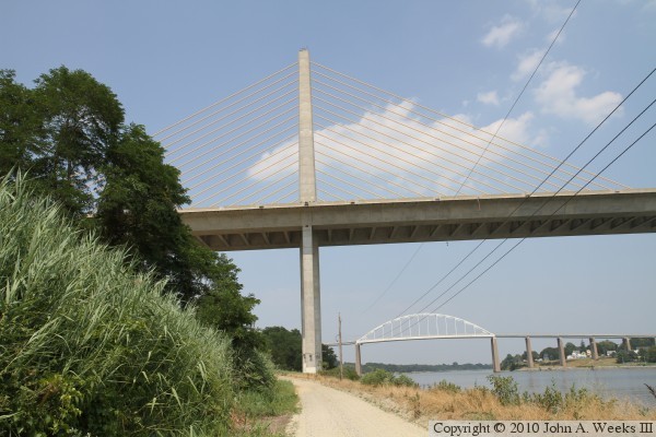
The photo above is a view looking north along the west face of the Roth
Bridge from the north side of the canal. The photo below is a similar view
looking directly down the center of the bridge. The main bridge tower is
directly behind this vantage point. Note that the the suspended deck is one
piece, while the approach spans are two parallel roadways.


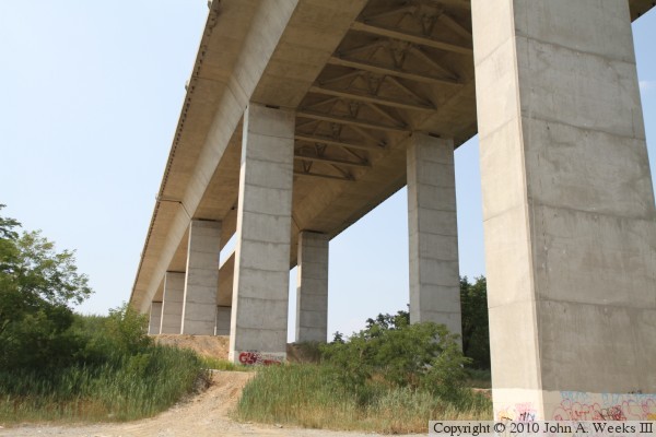
The photo above is looking up towards the bottom of the bridge span where
the north main bridge tower passes through the bridge deck. The photo below
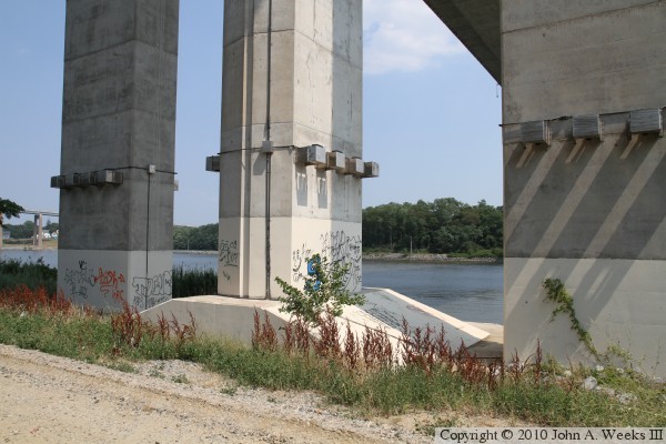
is the base of the north main bridge tower. The center pier is the main
tower, while the piers on either side support the approach spans.
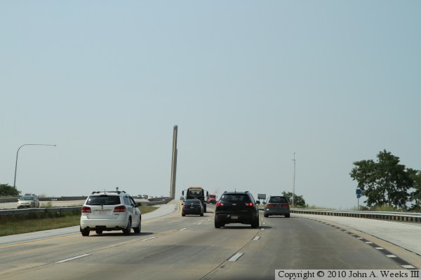
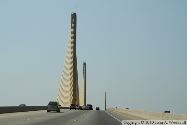
These two photos are the first of an eight photo set showing a typical
northbound bridge crossing. In the photo above, we are rounding a small
curve leading to the south end of the structure. We are just entering
the south end of the bridge in the photo below.
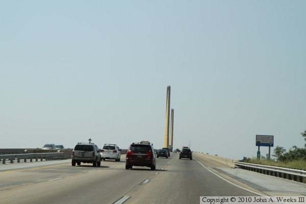
These two photos continue our northbound bridge crossing. In the photo above,
we are climbing the hill towards the main bridge span, while in the photo
below, we are nearly at the top of the incline leading to the suspended spans.
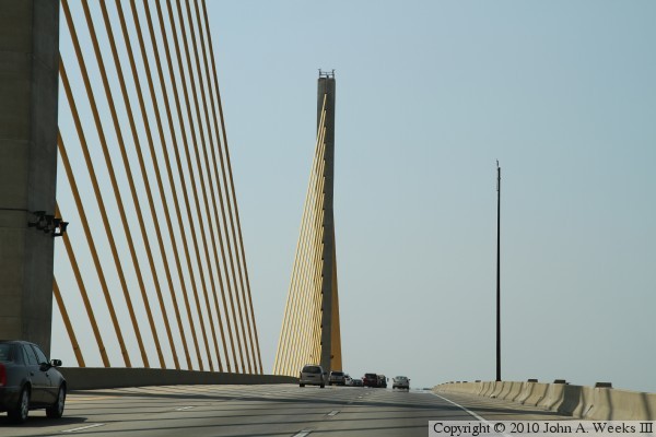
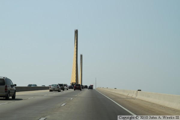
These two photos continue our northbound bridge crossing. In the photo above,
we are passing the south bridge tower, while in the photo below, we are
passing the north bridge tower.

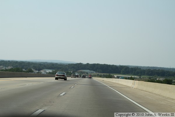
These two photos are the final two of an eight photo set showing a typical
northbound bridge crossing. In the photo above, we are just starting down
the incline leading away from the suspended spans, while in the photo below,
we are approaching the north end of the structure.
|
