Current Weather Conditions
John A. Weeks III
Friday, July 26, 2024, 11:13:20 PM CDT
Home Photo Tours Rail Fan 12 Easy Steps
Aviation Spacecraft Highways & Bridges About The Author
 
Google Search
Maps   Groups   Images   Search
 
  Home
  • 12 Easy Steps
  • Aviation
  • Spacecraft
  • Highways & Bridges
    » Bridge Photography
      - MSP River Bridges
      - C & D Canal
      - Illinois River
      - Minnehaha Creek
      - Minnesota River
      - Mississippi River
      - Missouri River
      - St. Croix River
      - St. Louis River
      - Wisconsin River
      - Best Miss River Photos
      - Cable Stayed Bridges
        › Arthur Ravenel Jr Br
        › Bill Emerson Mem Br
        › Clark Bridge
        › Cochrane-Africatown
        › Dames Point Bridge
        › Ed Hendler Bridge
        › Frank Gatski Mem Br
        › Fred Hartman Bridge
        › Glass City Skyway
        › Greenville Bridge
        › Hale Boggs Mem Br
        › John J Audubon Br
        › O'Connell Bridge
        › Penobscot Narrows Br
        › Quincy Bayview Br
        › Sen C Bond Bridge
        › Sen Wm V. Roth Jr. Br
        › Sunshine Skyway Br
        › Sidney Lanier Bridge
        › Talmadge Memorial Br
        › The Great River Bridge
        › US Grant Bridge
        › Varina-Enon Bridge
        › Veterans Memorial Br
        › Weirton-Steubenville
        › Wm H. Natcher Bridge
        › Wm H. Harsha Bridge
        › Zakim/Bunker Hill Br
          — — — — — — — —
        › Alex Fraser Bridge
        › Centennial Bridge
        › Coatzacoalcos II Bridge
        › La Plata River Bridge
        › Vancouver Skybridge
          — — — — — — — —
        › Indian River Inlet
        › Pomeroy-Mason Bridge
        › Ronald Reagan Mem
          — — — — — — — —
        › Charles W. Dean Br
        › Ironton-Russell Br
        › Ohio R Br (Downtown)
        › Ohio R Br (East End)
          — — — — — — — —
        › 6th Street Viaduct (N)
        › 6th Street Viaduct (S)
        › 21th Street Bridge
        › Arthur DiTommaso Br
        › Badger Road Bridge
        › Beach Road Bridge
        › East Fork Bridge
        › Lake Underhill Br
        › Lane Avenue Bridge
          — — — — — — — —
        › Bluff Dale Bridge
          — — — — — — — —
        › Bob Kerrey Ped Br
        › Big Rock Creek Br
        › Cross Seminole Trail
        › First Avenue Skyway
        › Gold Strike Park Br
        › Hennepin Co Med Ctr
        › Keeper Of The Plains
        › Martin Olav Sabo Br
        › Millennium Bridge
        › Mortensen Plaza
        › MSP Airport Skyway
        › Platte River Bridge
        › Reiman Bridge
        › Rhythm City Sky Br
        › Sundial Bridge
        › US-41/45 Ped Bridge
      - McGilvray Road Bridges
      - I-35W Bridge Disaster
      - Miscellaneous Bridges
      - Madison County Bridges
      - Hist Br Weekend 2013
    » Road Geek Topics
  • Photo Tours
  • Rail Fan
  • About The Author
 
Site Search By JRank
Highways, Byways, And Bridge Photography
Platte River Pedestrian Bridge
South Platte River Pedestrian/Bicycle Crossing At Denver
Denver, Colorado

Platte River Pedestrian Bridge

• Bridge: Platte River Pedestrian Bridge
• City: Denver
• State: Colorado
• Country: USA
• Carries: Pedestrians & Bicycles
• Crosses: South Platte River
• Date Opened: 2004
• Total Length: 242 Feet (Estimated)
• Longest Span: 121 Feet (Estimated)
• Tower Height: 65 Feet (Estimated)
• Deck Width: 13 Feet (Estimated)
• Number Of Spans: 1
• Height Above River: 24 Feet (Estimated)
The Platte River Pedestrian Bridge is one of three bridges that form a pedestrian and bicycle gateway between the Highland neighborhood to downtown Denver. This area had been an industrial and railroad center from Denver's earliest days. By the 1980's, it was largely disused and was a huge brownfield. The first major redevelopment in the area was the construction of Coors Field after the Colorado Rockies baseball team was established. Mayor Wellington Webb made redevelopment and public spaces a key priority during his three terms. This led to the clean up of the brownfields, extensive redevelopment with both high-end and affordable housing, and a network of parks and trails along the South Platte River.

Three main obstacles blocked access between downtown Denver and the neighborhoods to the west. This includes Interstate highway I-25, the South Platte River, and the Consolidated Main Line, a joint BNSF and Union Pacific railroad and light rail corridor. The highway was crossed with the Highland Bridge, while the railroad was crossed with the Denver Millennium Bridge. The river, sitting between these two other arteries, was crossed with this bridge, the Platte River Pedestrian Bridge. The bridge feeds into Commons Park, one of a series of parks and greenspaces built along the South Platte River where the old brownfields once sprawled. The redevelopment has been highly successful working as a catalyst for growth.

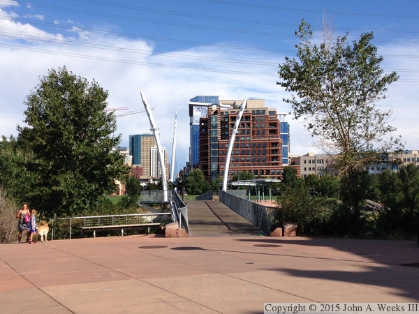
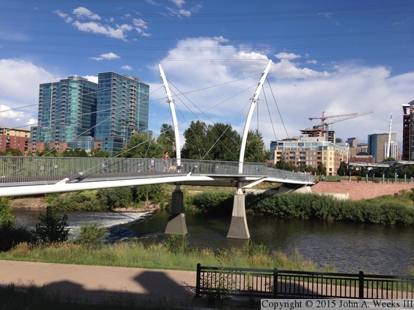
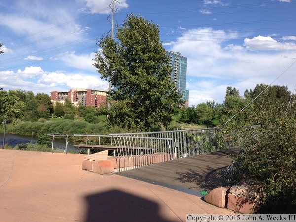
The photo above is looking southeast towards downtown Denver, with the main tower of the Millennium Bridge visible in the background. The photo below is looking east towards the upstream south face of the Platte River Bridge.

Note—these are iPhone 5 photos which imposes an upper limit on their quality.


Platte River Pedestrian Bridge
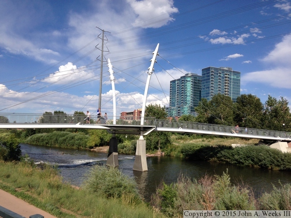
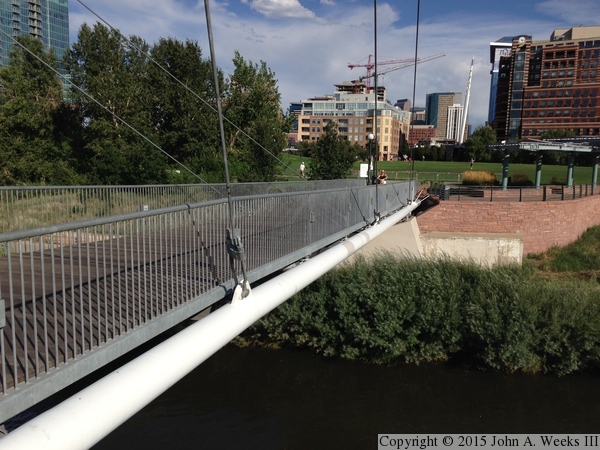
These two photos are additional views looking east towards the upstream south face of the Platte River Pedestrian Bridge. The tall buildings in the background are the Glass House Condos, a residential building featuring loft-style homes.

Platte River Pedestrian Bridge
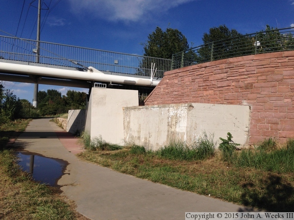
These two photos are views from under the west end of the structure from the Colorado Front Range Trail. The photo above is looking east under the length of the bridge deck. The photo below is the west bridge abutment.

Platte River Pedestrian Bridge
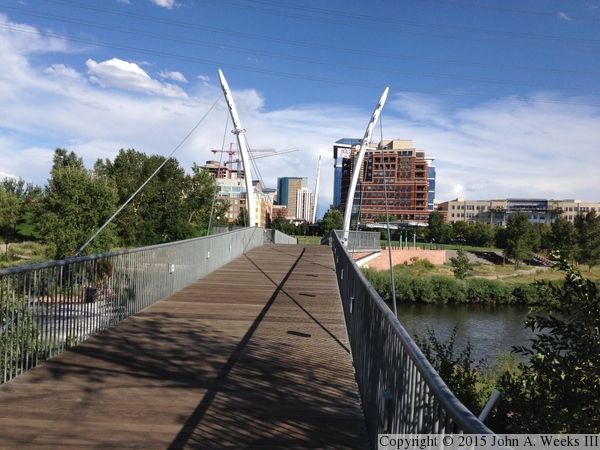
The photo above is the west end of the bridge deck as seen from the plaza on what was once 16th Street. The photo below is looking east along the length of the bridge deck towards downtown Denver.

Platte River Pedestrian Bridge
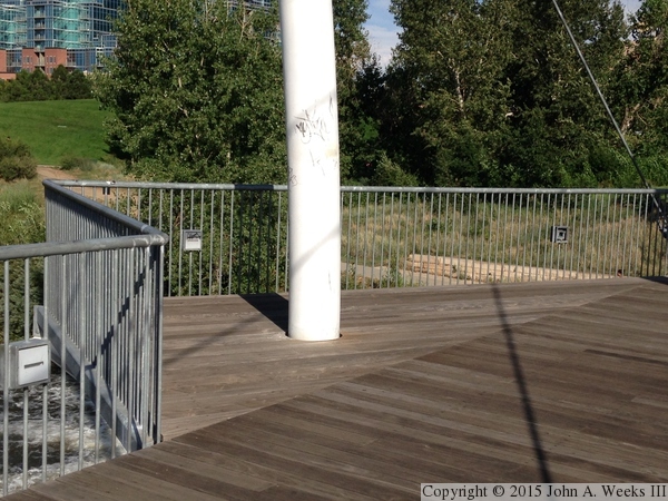
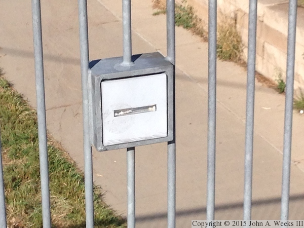
These two photos are views of the bridge deck and railing. The photo above is looking down towards the river. The two white boxes in the railings are night lighting. The photo below is an observation deck at the center of the bridge that encloses the north main bridge tower.

Platte River Pedestrian Bridge
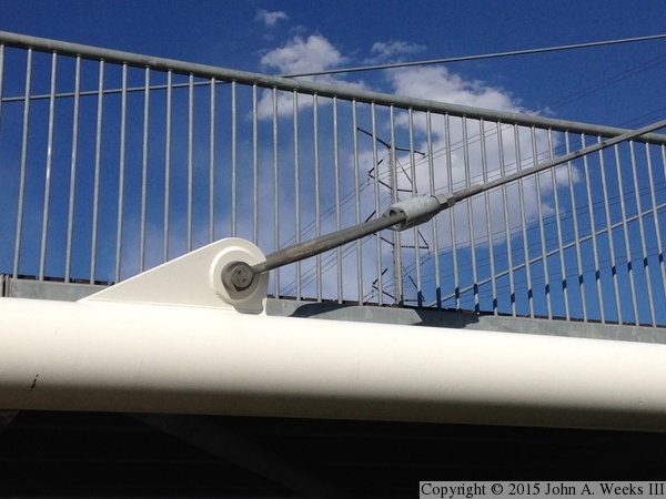
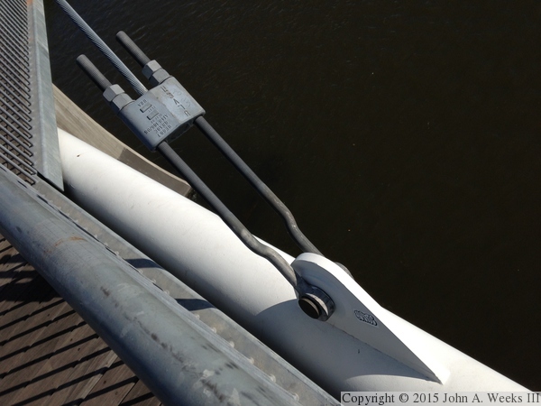
These two photos are views of two cable attachment points. The photo above is a cable attachment as seen from the trail located under the bridge. The photo below is looking at a similar attachment point looking down from the bridge deck.

Platte River Pedestrian Bridge
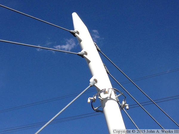
The photo above is the cable attachments at the top of one of the main bridge towers. The ring located just below the attachment points are a series of security cameras. The photo below is a close view of one of the light fixtures that illuminate the bridge deck at night.

Platte River Pedestrian Bridge
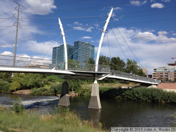
The photo above is a view of the upstream side of the eastern bridge span as seen from the observation deck at the center of the bridge. The photo below is a view of the upstream south face of the Platte River Pedestrian Bridge as seen from the Commons Park.

Platte River Pedestrian Bridge
These two photos are views from the Cherry Creek Trail, which passes under the east end of the Platte River Pedestrian Bridge. The photo above is the east bridge span. The photo below is the east bridge abutment.

Platte River Pedestrian Bridge

Made With Macintosh
Authored by John A. Weeks III, Copyright © 1996—2016, all rights reserved.
For further information, contact: john@johnweeks.com