| Highways, Byways, And Bridge Photography |
Penobscot Narrows Bridge and Observatory
US-1 Penobscot River Crossing At Prospect
Prospect, Maine
| • Bridge: |
Penobscot Narrows Bridge and Observatory |
| • Structure ID: |
NBI 6421 |
| • City: |
Prospect |
| • State: |
Maine |
| • Country: |
USA |
| • Carries: |
US-1/ME-3 |
| • Crosses: |
Penobscot River |
| • Date Opened: |
December 30, 2006 |
| • Total Length: |
2,120 Feet |
| • Longest Span: |
1,161 Feet |
| • Tower Height: |
440 Feet |
| • Deck Width: |
58 Feet |
| • Number Of Lanes: |
2 |
| • Number Of Spans: |
1 |
| • Height Above Water: |
135 Feet |
| • Traffic Count: |
9,540 (2009) |
The Waldo-Hancock Bridge was built at a comparatively low cost during the
Great Depression between 1929 and 1931. It became a major connector across
the Penobscot River providing access for local industry as well as tourism
along the Atlantic Coast. The bridge was neglected and was in need of
rehabilitation. A project got underway in 2000 to refurbish the bridge.
The project would start with the north suspension cable, then do the south
cable, and then address the steel truss work and towers.
The north bridge cable was completed in 2002. When work began on the south
cable, a serious corrosion problem was found in the cable after its outer
wrapping was removed. The state was forced to impose a 12-ton weight limit
on the bridge. After further research, the rehabilitation project was
abandoned in 2003 and a new bridge cable stayed bridge project was undertaken
on an emergency basis. However, the old bridge would have to stay in operation
until the new bridge was ready. The state decided to install an additional
set of cables on the bridge to ensure that the structure would be safe for
traffic and to allow the bridge weight limit to be increased to 40 tons.
The new cables were added above the existing suspension cables. New anchor
blocks were installed near each bridge abutment. Saddles were fabricated and
installed at the top of the two main bridge towers, and the towers at each
end of the approach spans. The new cables were winched across the bridge one
at a time, one per day. Once the cables were in place, rods were placed
between the existing vertical cables and the new cables. Once these rods
were tightened, the new cables began to carry their share of the bridge
weight.
The state of Maine partnered with construction company FIGG in a unique
process where the state actively participated in the design and
construction of the project. As a design/build project, construction work
began before the final design was completed. This can add risk to a project,
but it does help compress the timeline, which was critical for an emergency
bridge replacement.
The design that was selected is a two-lane cable stayed bridge. This is an
ideal structure where a long bridge span is required, but lower traffic
volumes dictate a less expensive structure. There are two main bridge
towers, each of which supports a single plane cable fan. A unique feature
of the cable system is that they are not attached to the towers. Rather,
the cables loop through the tower, and each end is attached to the bridge.
This method caused problems on the Clark Superbridge in Alton, Illinois,
and hadn't been attempted for nearly a decade. A new process for passing
cables through the tower had been developed, and both this bridge and the
Glass City Bridge in Toledo were built using this design. It has proven
to be simpler to build and appears to be working well.
Many cable stayed bridges have had issues with their cabling systems, with
some needing retrofits after they opened. The state of Maine worked hard
to learn from these past issues and avoid future problems, with a design that
is hoped will last 100 years or more. The cables have sealed outer shells
to keep moisture out. A nitrogen system keeps pressure inside of the cable
shells to prevent any leakage of salt air into the shells. A more recent
project is an experiment where several stay cables were replaced with
carbon fiber cables. While carbon fiber is much more expensive, it is much
lighter and it is immune to corrosion. If this test is successful, we might
see carbon fiber used on new bridges, and we might see existing bridges
retrofit at some point during their lifetime.
The most spectacular feature of the new Penobscot Narrows Bridge is the
observatory at the top of the west tower. Tourists are able to enter an
elevator at the bottom of the tower, rise to the 400 foot level, then
take two flights of stairs to the 437 foot level. The observatory is
operated in conjunction with the Fort Knox Historic Site, and there is a
small fee to ride the elevator. It is fully handicap accessible. This
is the only bridge observatory in the United States, and only three other
bridge observatories exist. The Penobscot Narrows Bridge and Observatory
is the tallest of the four. The observatory opened on May 19, 2007, and it
is open from May through October each year.
The Penobscot Narrows Bridge has been closed twice since it opened due to
bomb threats. In 2009, a note was left in the observatory indicating that
a device would be set off. In 2010, a threat was found on a Post-It Note
in a restroom. In each case, the bridge was closed for several hours while
authorities searched the site. No such devices were found.
The fate of the Waldo-Hancock Bridge has not yet been decided when this was
written in 2011. The state of Maine recently passed a bonding bill that
included funding to demolish this old bridge, but no date has been set. The
bonding is good for four years. The US Department of Homeland Security did
conduct strength tests on the bridge using a gas compression device in order
to collect data on how other bridges might stand up to explosions. When the
bridge is demolished, the Department of Homeland Security plans to run
additional tests on parts of the structure using explosives.
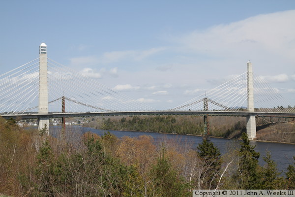
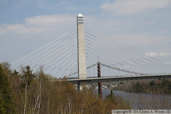
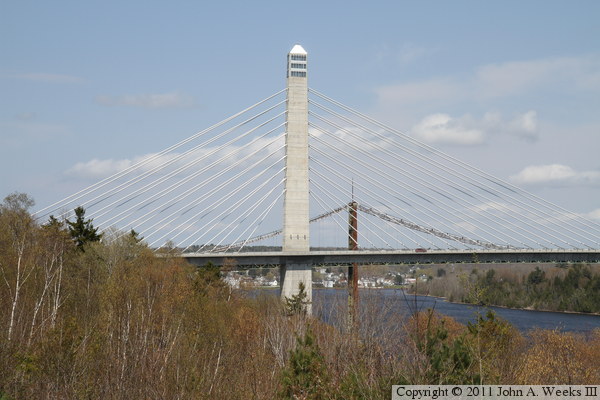
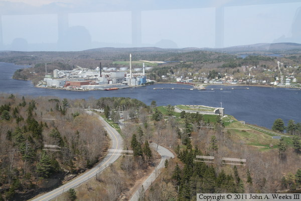
The photo above is a view looking northeast towards the Penobscot Narrows
Bridge as seen from a scenic overview located just south of the bridge on
highway US-1. A bank of clouds was located along the ocean, and was just
moving out to sea towards the east on the afternoon that I visited the site.
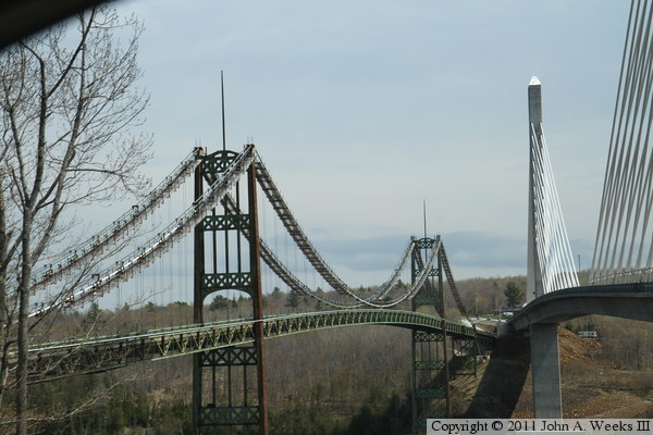
The old Waldo-Hancock Bridge is located just north of the new cable stayed
structure.
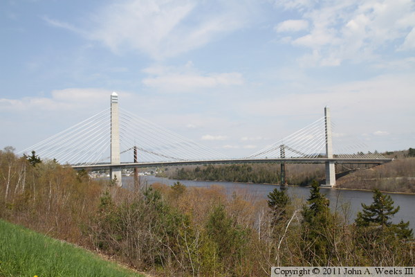
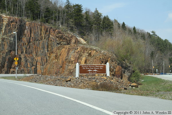
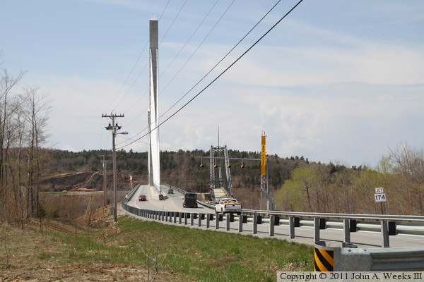
The photo above is a wider view of the bridge as seen from the scenic
overlook on highway US-1. The photo below is the highway sign for the
observatory and Fort Knox Historic Site leading to the west end of the
structure. The mountain was blasted out to realign US-1 to avoid a
sharp turn at the west end of the bridge.
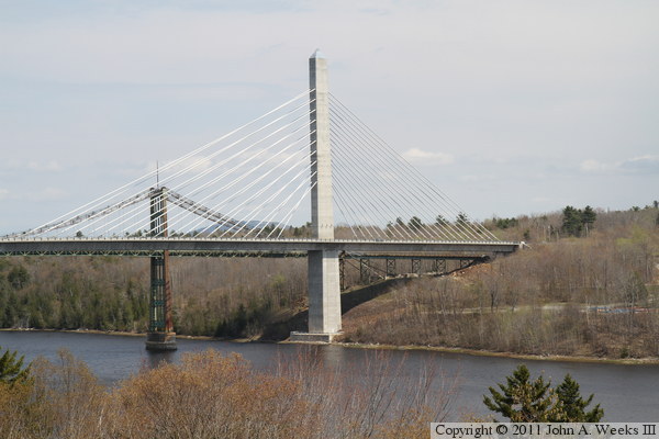
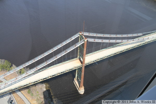
The photo above is the east bridge tower and cable fan, as seen from the
scenic overlook on highway US-1. The photo below is the west bridge tower,
which contains the observatory. Note the windows near the top of the tower.
The photo above is a view looking west down the center of the bridge deck.
The highway has two traffic lanes, one on either side of the cable fans.
The old Waldo-Hancock Bridge is located just to the north of the new
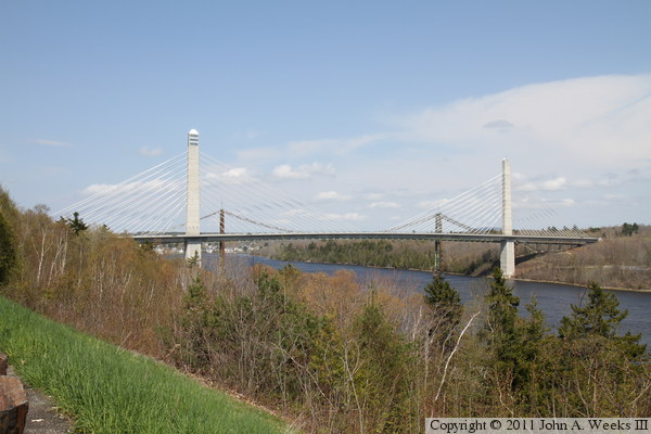
Penobscot Narrows Bridge. The photo below is another view looking northeast
from the scenic overview on highway US-1. This photo, taken about two hours
after the photos above, show that the clouds have moved, but not far enough
for a blue sky view of the bridge.
These two photos are additional views of the bridge towers and cable fans
taken later in the afternoon. The photo above is the east bridge tower,
while the photo below is the west bridge tower and observatory.
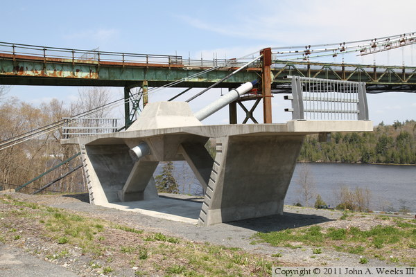
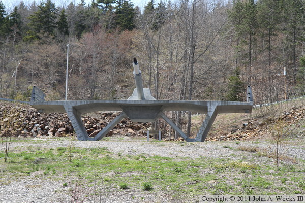
The bridge deck was constructed from a series of concrete box segments.
Traditional segmented design has the segments built in a casting yard,
transported to the site, then hoisted into place. On this bridge, however,
the segments were cast in place on the bridge using machines called form
travelers. Four different crews worked on the bridge deck, one going in
each direction from each of the main bridge towers. Four crews working
in parallel sped up the project, allowing the bridge to open in little more
than three years. These two photos are examples of a segment that is on
display. The bridge deck is hallow, which allows it to be both lightweight
and strong.
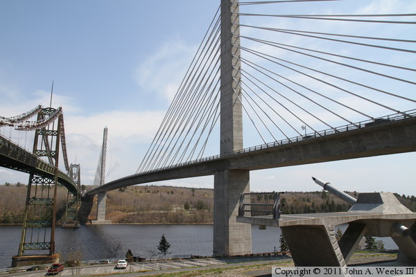
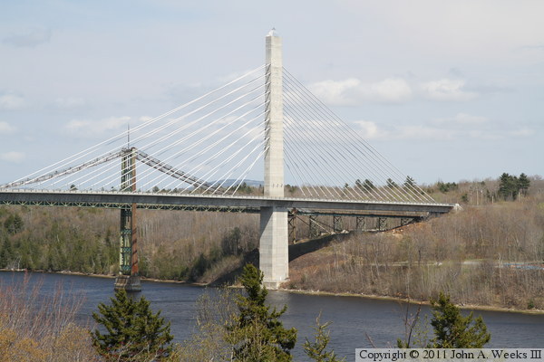
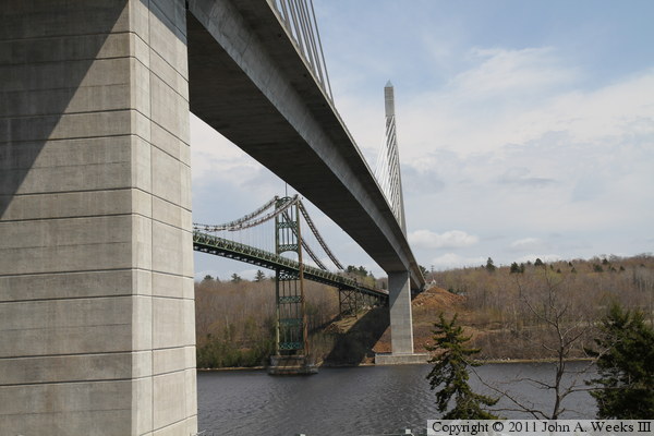
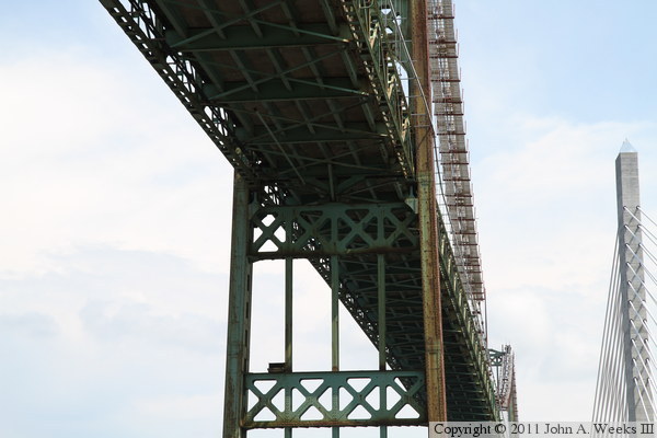
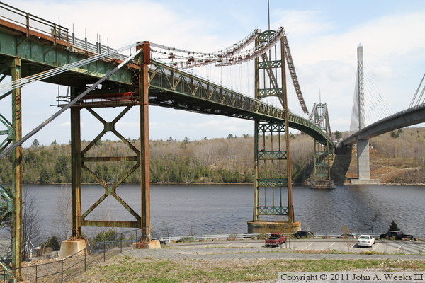
These two photos are looking east across the Penobscot River between the
two bridges. The photo above is from the hill on the west riverbank, while
the photo below is from the parking lot near the edge of the river.

The photo above is looking east down the south face of the Penobscot Narrows
Bridge from near the west bridge tower. The photo below is the west bridge
abutment as seen from the same location.

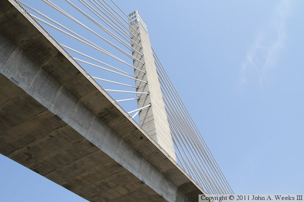
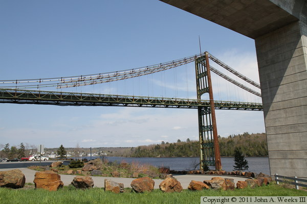
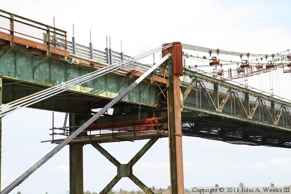
The photo below is looking up towards the west bridge tower from very near
the tower foundation. Note that the bridge cables are located near the edge
of the bridge towers. Since they connect to the middle of the roadway, the
most logical place to run the cables is through the middle of the tower.
However, that wasn't possible due to the elevator, which runs up the middle
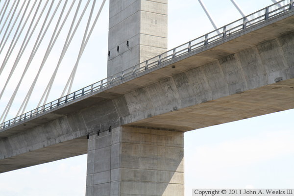
of the bridge tower. The photo below is the connection point where the
bridge deck connects to the west bridge tower.
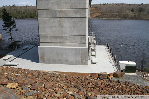
The photo above is the base of the west bridge tower. The photo below
is the south side of the west bridge tower, which includes the doorway
leading to the elevator to the observatory. This photo is slightly
overexposed to bring out the detail in the concrete and inside the
entry.

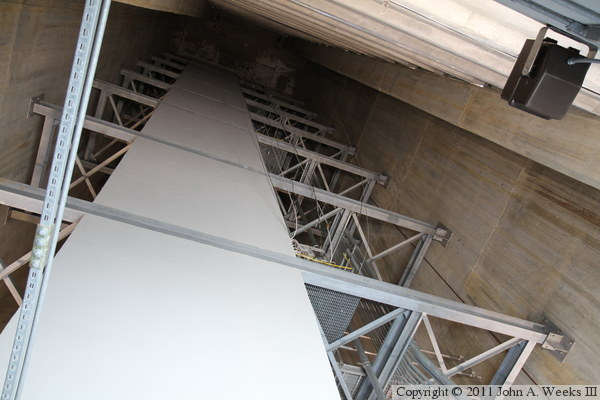
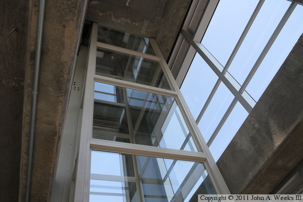
The photo above is looking up into the west bridge tower along the side of
the elevator shaft. The photo below is the elevator lobby in the lower of
the three levels of the observatory. The elevator door is close to the
glass at the edge of the tower, which is more than just a little unnerving
when the elevator door opens up. This elevator is the fastest elevator
in the state of Maine, and makes the trip in about one minute.
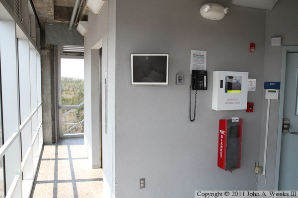
The photo above is an access elevator for physically challenged people to
go to the top floor of the observatory. The photo below is looking east
across the top level of the observatory. The top of the access elevator
is visible on the far side of the room. The second level of the observatory
is the equipment room for the main elevator.


The photo above is the compass rose that is inscribed in the floor of the
observatory. According to the state of Maine web site, the stone was cut from
a quarry in Deer Isle, Maine. Deer Isle is located on the coast of Maine
where the Penobscot River empties into the Atlantic Ocean. The photo below is
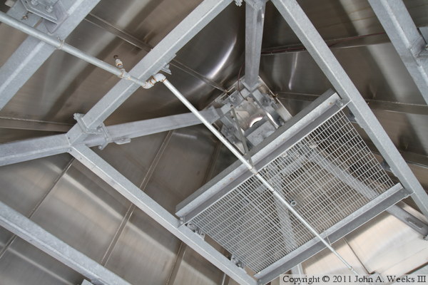
the roof of the tower. Note that it is not insulated. The observatory is not
heated, and it can be cold inside on cool days or when the wind is high.
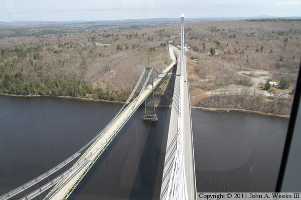
These two photos are views looking east from the bridge observatory. The
photo above is looking across the Penobscot River at the two bridge spans,
while the photo below is a closer view of the east bridge tower.
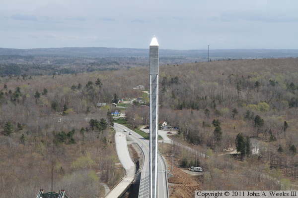
The photo above is looking west from the bridge observatory towards the
west end of the Penobscot Narrows Bridge. The area to the left of the
bridge abutment was once a popular local restaurant called the Sail Inn.
It was demolished as part of the bridge project. The photo below is looking
down at the west tower of the Waldo-Hancock Bridge.

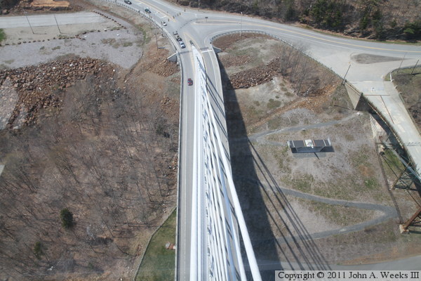
The photo above is looking south down the Penobscot River. The highway on
the right side of the river is US-1. The photo below is looking north from
the bridge observatory. Historic Fort Knox is on the near side of the river,
while the city of Bucksport and the Verso Paper Corporation Bucksport Mill
are located on the far side of the river. Bucksport is a city of 5,000
people. The mill runs four paper machines and employs 800 people.
The photo above is looking east across the Penobscot River between the
two bridge spans, featuring a nice view of the Waldo-Hancock suspension
bridge. The photo below is looking up towards the bottom of the bridge
deck and the west bridge tower.
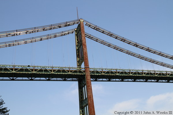
These two photos are views of the west tower of the Waldo-Hancock Bridge.
The photo above is from the observatory parking area looking under the new
Penobscot Narrows Bridge, while the photo below is from near the edge of
the river.
The photo below is looking east across the Penobscot River along the south
face of the Waldo-Hancock Bridge. The photo below is a close view of
the top of the last trestle tower before the start of the first suspended
bridge span. Note the extra bridge cables that were added above the main
suspension cables, the steel work that holds the added cables above the
top of the short tower, and where the bridge deck was removed to make room
for the cables to pass the deck.
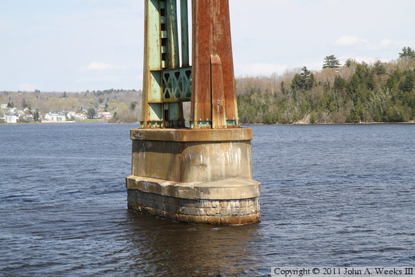
The photo above is the base of the west tower of the Waldo-Hancock Bridge.
The photo below is the west abutment of the suspension bridge. Note the
new anchor blocks that were built to support the additional cables that
were added in the first decade of the 2000s.


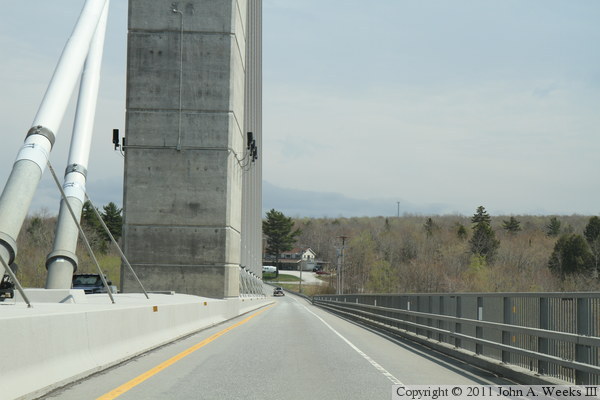
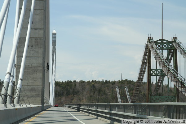
These two photos, plus the four that follow, show a typical bridge crossing
heading eastbound across the Penobscot Narrows. In the photo above, we are
passing through the stop light at the west end of the bridge. In the photo
below, we have entered the west end of the bridge and have started passing
the west cable fan.
These two photos continue our eastbound bridge crossing. In the photo above,
we are passing the west bridge tower and have entered the main bridge span.
In the photo below, we are passing the mid-point of the main suspended span.

These two photos conclude our eastbound bridge crossing. In the photo above,
we are nearing the east bridge tower. In the photo below, we have passed
off of the main bridge span and are nearing the east end of the structure.


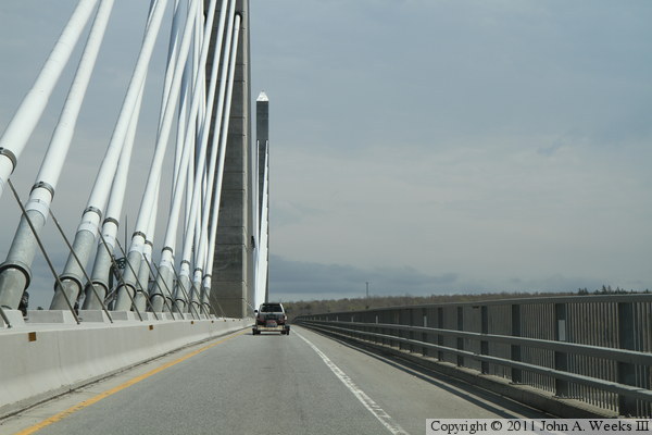
These two photos, and the six that follow, show a typical westbound bridge
crossing. In the photo above, we are approaching the east end of the
structure. Note the gate arm to the right of the highway. We are just
entering the east end of the bridge in the photo below.

These two photos continue our westbound crossing of the Penobscot Narrows
Bridge. In the photo above, we are approaching the east bridge tower. We
are just passed the east bridge tower in the photo below and have entered
the main suspended span.
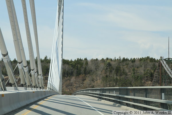
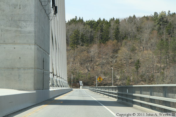
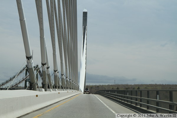
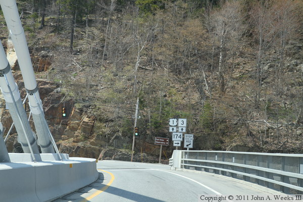
These two photos conclude our westbound crossing of the Penobscot Narrows
Bridge. In the photo above, we are approaching the west bridge tower. In
the photo below, we have reached the west end of the bridge and are
approaching the stoplights where US-1 and ME-3 meet Maine state highway 174.
|
