| Highways, Byways, And Bridge Photography |
Keeper Of The Plains Bridge
Arkansas/Little Arkansas R. Pedestrian Crossing At Wichita
Wichita, Kansas
| • Bridge: |
Keeper Of The Plains Bridge |
| • City: |
Wichita |
| • State: |
Kansas |
| • Country: |
USA |
| • Carries: |
Pedestrians |
| • Date Opened: |
Finished Jan 2007, Dedicated May 18, 2007 |
| • Tower Height: |
117 Feet |
| • Deck Width: |
12 Feet-4 Inches, 10 Foot Wide Path |
| • Number Of Spans: |
2 (Sequential) |
|
|
|
South Bridge Structure |
| • Crosses: |
Arkansas River |
| • Total Length: |
331 Feet |
| • Longest Span: |
225 Feet (Estimated) |
| • Height Above Water: |
18 Feet (Estimated) |
|
|
|
North Bridge Structure |
| • Crosses: |
Little Arkansas River |
| • Total Length: |
251 Feet |
| • Longest Span: |
175 Feet (Estimated) |
| • Height Above Water: |
14 Feet (Estimated) |
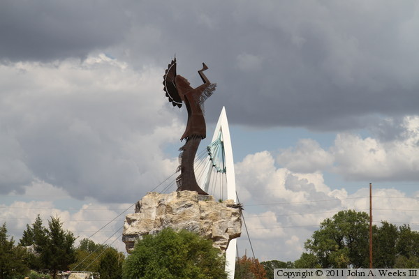
In the early 1970s, cities across the nation built signature projects to
celebrate the United States bicentennial. In Wichita, the city commissioners
voted to fund the Mid-America All-Indian Center. The project was built at
the confluence of the Arkansas River and the Little Arkansas River, a location
that is considered to be a sacred site by Native Americans. Artist Blackbear
Bosin, who happened to be of Native American heritage, designed a sculpture for
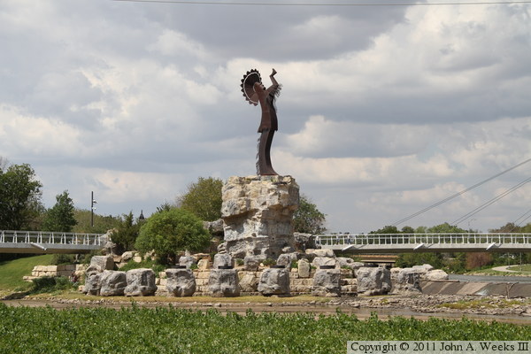
the project and donated it to the city of Wichita. The 44 foot tall Keeper
Of The Plains was made from COR-TEN steel and weighs 10,000 pounds. The
sculpture was place at the confluence of the rivers facing east. The project
was dedicated on May 18, 1974.
The city worked on a riverfront redevelopment plan during the 1980s. A master
plan was adopted in 1989. In 1999, the Wichita River Corridor Improvement
Plan was approved for a section of river known as the core area, and formal
design work began. The city council approved a concept to raise the Keeper Of
The Plains sculpture by 30 feet and install a pair of cable stayed bridges.
Funding was approved in 2003, with construction of the bridges occurring in
2006. The two bridges were completed in January of 2007. An elaborate
dedication celebration was held on the evening of May 18, 2007, 33 years to
the day after the Keeper Of The Plains was originally dedicated. The
celebration included a fireworks and light show that was set to music.
The project started by building a cofferdam around the site of the statue
base. Sand was dredged from the river to build a causeway across 80% of
each river channel. Next, the tower bases were built. The tower structure
was fabricated off-site and brought in three sections, two legs and the top
section was the cable anchor assembly. Installing the tower sections turned
out to be a challenge since the tower is slanted 9 degrees off of vertical.
The deck was precast off-site as a series of 32-foot long segments. The
south bridge has 11 segments while the north span has 9 segments. Steel
falsework was built to assist in assembling the deck. Segments were set on
top of the falsework and then slid into position. The segments were bonded
together using cables that run the length of the bridge. The cables were
tightened slightly as each segment was installed, then the cables were
stretched very tight in a process called post-tensioning after all the segments
were in place. Once the deck was complete, the stay cables were installed.
The cables are attached at the top of the tower using a round wedge that
slides into a socket. The cables are attached to each side of the deck using
adjustable anchors. As each cable was installed, a tool called a strand jack
was used to pull the cable through the anchor, tightening it just enough to
remove any slack. Once all the cables were installed, each cable was again
jacked more tightly, lifting the bridge span off of the falsework. Once the
deck was lifted, the falsework and sand causeway was removed.
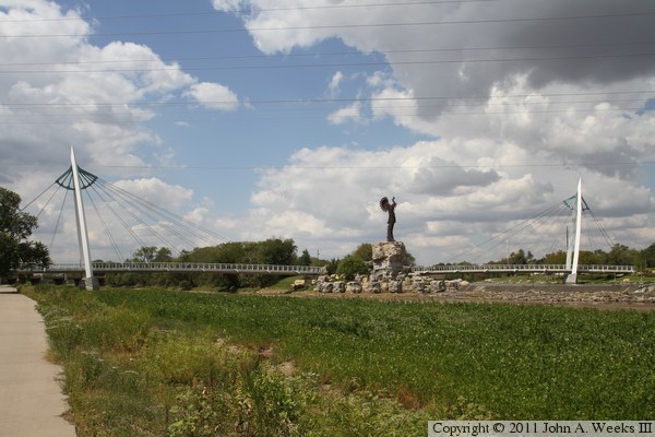
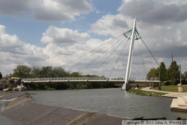
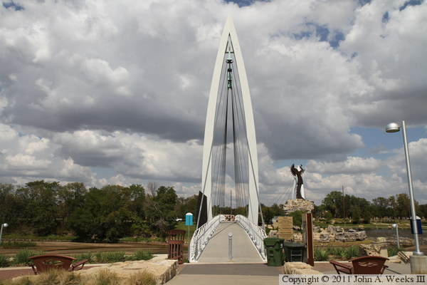
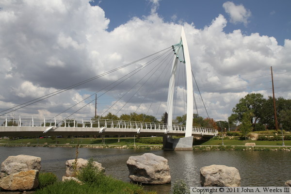
The photo above is looking west from the south bank of the Arkansas River
towards the two spans of the Keeper Of The Plains Bridge. The main
channel of the Arkansas River is choked with grass, while the Little
Arkansas River is backed up behind a low head dam just to the right of
the statue. The river levels were especially low in 2011 due to a prolonged
drought over the past 10 years that became especially severe over the summer.
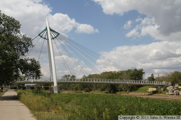
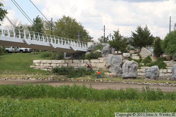
These two photos are views from along the south bank of the Arkansas River
just east of the river crossing. The photo above is the south bridge span
over the Arkansas River, while the photo below is the north bridge span
over the Little Arkansas River. Kansas had pure blue sky for a week, but
storm clouds moved into Wichita just as I arrived in town. The rain started
falling within an hour after these photos were taken, and the rain fell
for three days. This storm likely saved the winter wheat crop that had
just been planted.
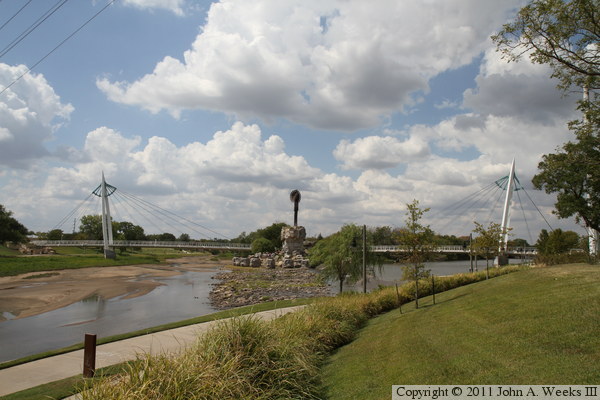
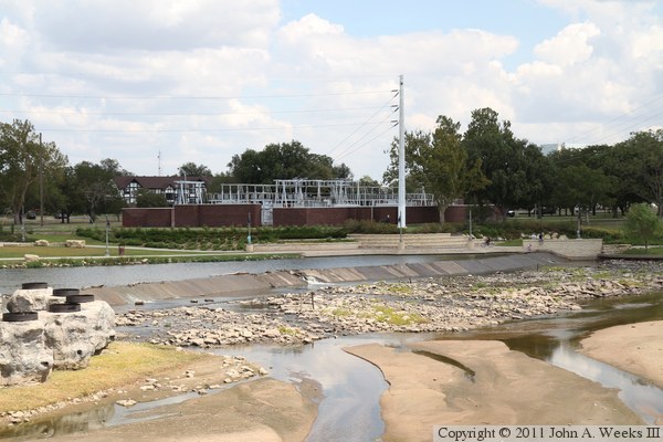
These two photos are views from the north bank of the Arkansas River at
the east end of the dam at the confluence of the Little Arkansas River.
The photo above is looking southwest towards the south bridge span over
the Arkansas River, while the photo below is looking west towards the north
span over the Little Arkansas River.
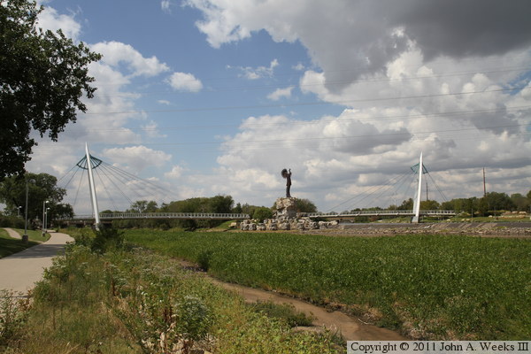
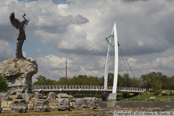
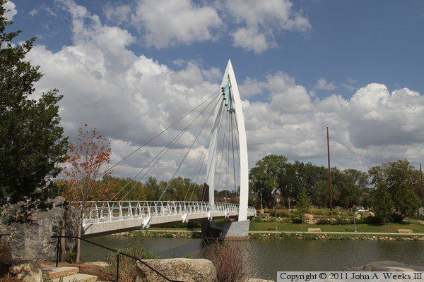
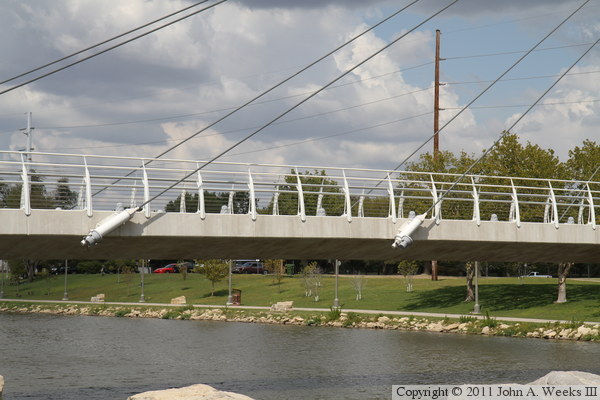
The photo above is a wider view showing both bridge spans as seen from the
south bank of the Arkansas River. The photo below is a similar view looking
west from the north bank of the river. While the Arkansas River is nearly
dry at this location, the Little Arkansas River has a few feet of water
backed up behind the low head dam. The Little Arkansas has two bypass canals
to divert water into the Arkansas River upstream of the confluence, and the
larger Arkansas River has a flood control diversion channel that passes
southwest of the city.

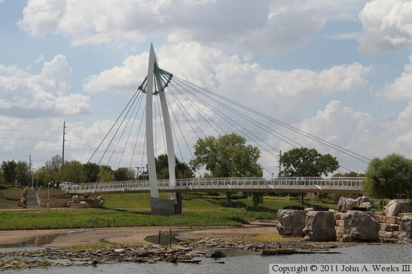
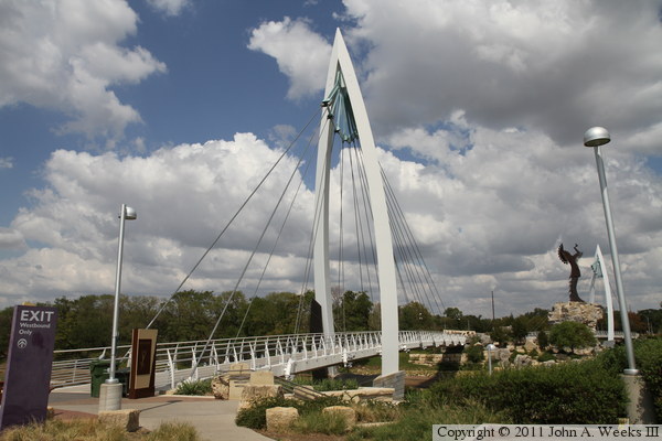
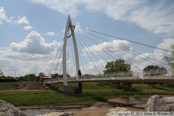
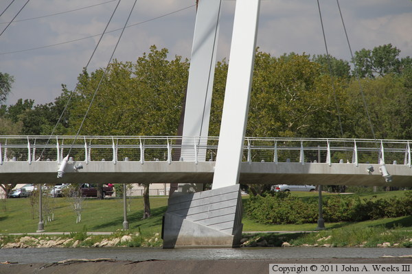
These two photos, and the 24 that follow, focus on the south bridge span
over the Arkansas River. The photo above is looking west towards the main
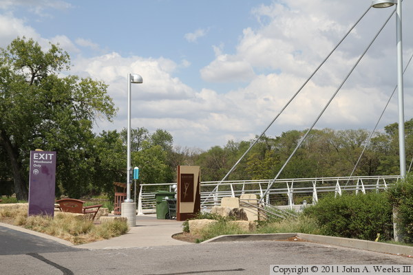
tower of the south bridge span. The vantage point is the parking lot at
Exploration Place, the science museum operated by Sedgwick County. The
photo below is looking northwest down the east face of the structure.
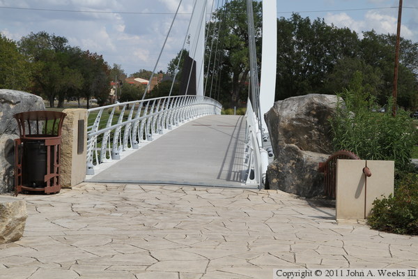
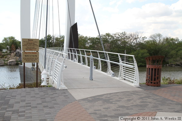
These two photos are views of the south end of the south bridge span. The
photo above is looking northwest towards the bridge entrance, while the
photo below is looking north-northwest.

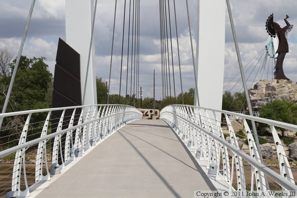
The photo above is looking north down the length of the bridge deck from
the Exploration Place parking lot. The photo below is from the south
bridge abutment as we begin our journey crossing the bridge northbound.

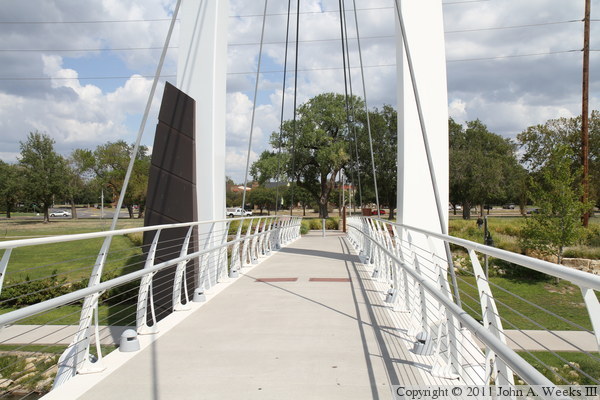
The photo above is looking north down the length of the bridge deck from
just south of the main bridge tower. The photo below is looking northwest
across the Arkansas River, showing the dark accent piece on the upstream
side of the bridge tower.


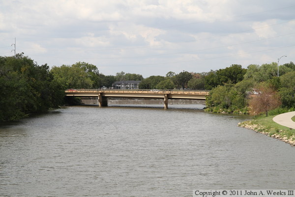
The photo above is looking upstream on the Arkansas River from the deck of
the south bridge span. The highway bridge carries North Seneca Street over
the Arkansas River. From this vantage point, we can see that the river is
almost dry. The photo below is looking east from south bridge span towards
the low head dam at the confluence of the Arkansas River and the Little
Arkansas River.
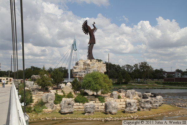
The photo above is the view of the Keeper Of The Plains as seen from the
south bridge structure, with the north bridge visible in the background.
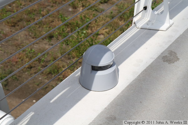
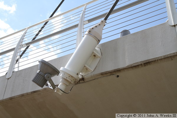
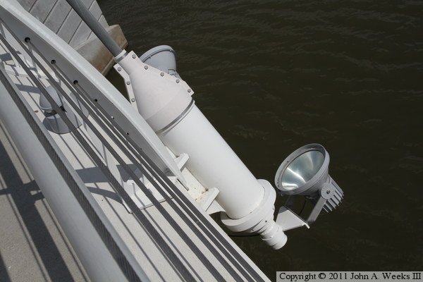
The photo below is a detail view of a light fixture on the bridge deck.
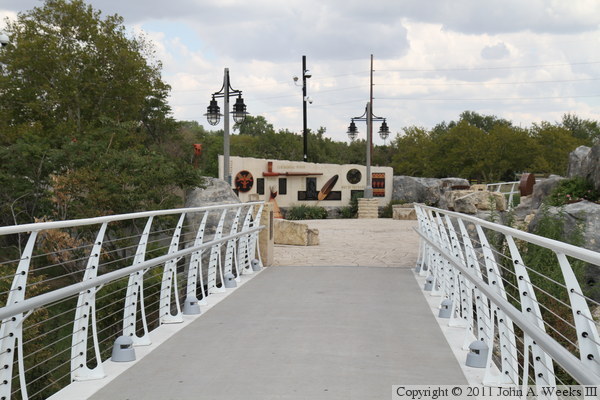
The photo above is the north end of the bridge deck of the south bridge span
as it exists to the plaza area. The photo below is looking south down the
length of the south bridge span from the plaza.

The photo above is looking southwest towards the south bridge structure from
the rocks at the base of the statue. This is a difficult photo angle due
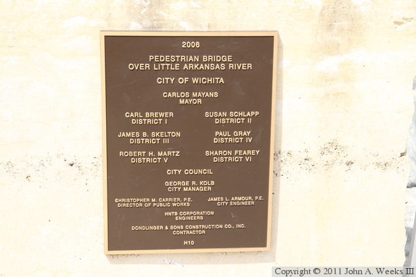
to the bright midday sun in the south sky. The photo below is the bridge
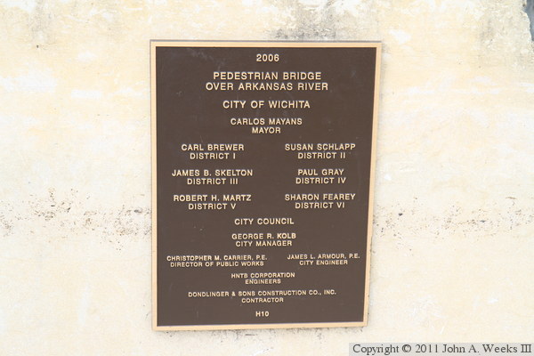
plate for the south bridge span.

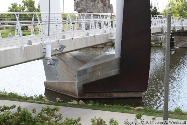
The photo above is the south bridge abutment of the south bridge span. The
stairway allows access to the trail running along the river from the parking
area above. The photo below is the rock garden located under the bridge
deck at the south bridge abutment.

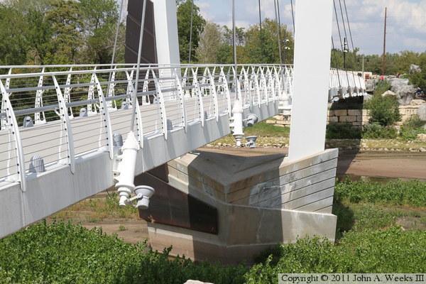
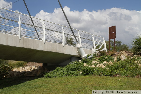
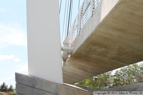
These two photos are views of the base of the south bridge tower. The photo
above is from the same level as the bridge deck. The photo below is from the
trail that passes under the bridge deck. While it is hard to see in these
photos, there is a small pipe that keeps the deck from swinging between the
two legs of the tower.
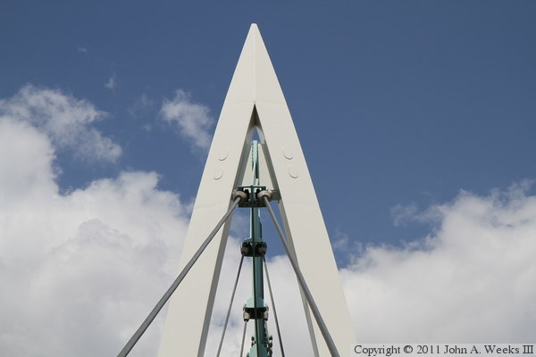
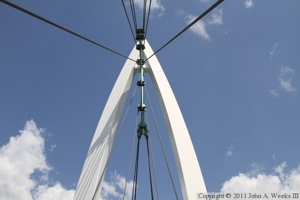
These two photos are detail views of the top of the south bridge tower. The
photo above is looking north from the bridge deck, while the photo below
is looking towards the east face of the structure. It is apparent in this
second photo how the asymmetry in the bridge results in the cable spacing
to be different on each side of the tower.

These two photos are views of a cable attachment to the deck of the south
bridge span. The photo below shows one with a single light attached, while
the photo below shows an attachment with two light fixtures.


The photo above is another view of a cable attachment as seen from the
same level as the bridge deck. The photo below is the north abutment of
the south bridge span. Workers are clearing weeds from under the bridge
abutment on the day of my visit.
These two photos, and the 20 that follow, focus on the north bridge span
over the Little Arkansas River. These two views are looking to the northeast
towards the north bridge span from the rocks at the base of the statue. The
photo above is from near the bridge abutment, while the photo below is from
the east end of the statue base.

The photo above is looking north towards the north bridge structure from the
plaza as we approach the bridge crossing northbound. The photo below is a
closer view of the south end of the north bridge span.
The photo above is looking north down the length of the north bridge span
from the center of the Little Arkansas River channel. The photo below is
looking upstream to the northwest along the river. The bridge carries
West Central Avenue over the river. A dam located just upstream of the
bridge is visible under the bridge deck.

The photo above is looking northwest towards the bridge railing near the
north end of the north bridge structure. The photo below is approaching
the north end of the north bridge span. There is a small plaza area at
the north end of the bridge, with a parking area located just upstream of
the bridge.

The photo above is the bridge plate for the north bridge structure. The
photo below is the north entrance to the north bridge span.
The photo above is the north abutment of the north bridge span. The photo
below is looking southwest across the Little Arkansas River towards the
south abutment of the north bridge span.

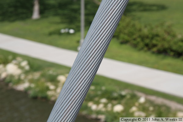
The photo above is looking towards the east face of bridge deck over the main
channel of the Little Arkansas River. The photo below is a close view of
one of the stay cables.
The photo above is looking down from the bridge deck towards a cable
attachment on the north bridge span. The photo below is looking up towards
a cable attachment from the trail the passes under the north bridge span.

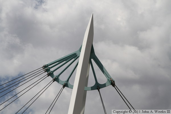
These two photos are views of the top of the north bridge tower. The photo
below is looking up from the bridge deck towards the cable anchor assembly.
The photo below is looking towards the east side of the cable anchor.
This is two views of the base of the north bridge tower. The photo above is
looking northwest from near the low head dam at the confluence of the two
rivers. The photo below is looking to the southwest from near the north
bridge abutment.

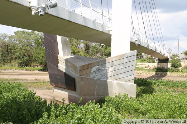
The photo above is a closer view of the base of the north bridge tower from
just upstream of the north bridge abutment. The photo below is a close view
of the spacer between the bridge tower and bridge deck.
These two photos, and the 16 that follow, focus on the plaza between the two
bridge spans and views from the local trails. The photo above is looking
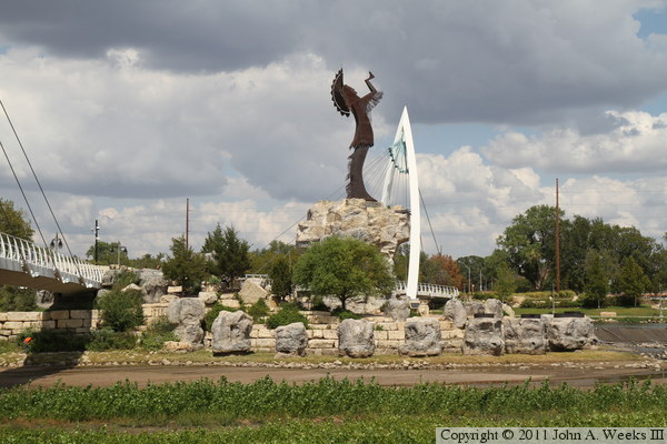
north across the Arkansas River towards the Keeper Of The Plains sculpture.
The south bridge span is to the left while the north bridge span is located
behind the sculpture base. The photo below is looking west towards the
statue from the riverfront near the Exploration Place building. There is
normally water falling down the terrace of rocks at the base of the statue,
but the river was too low to accommodate the water diversion.
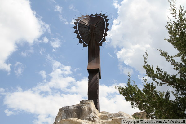
The photo above is a close view of the back of the sculpture as seen from the
deck of the south bridge structure. The photo below is a similar close view,
but of south side of the statue. It is interesting to note how different the
sky looks after only 30 minutes between these two photos.

The photo below is looking east down the length of the low head dam at
the confluence of the two rivers as seen from the rocks at the base of the
statue. One of the gas burners for the light display is visible on the
right side of the photo. The photo below is a closer view of one of these
gas burners.
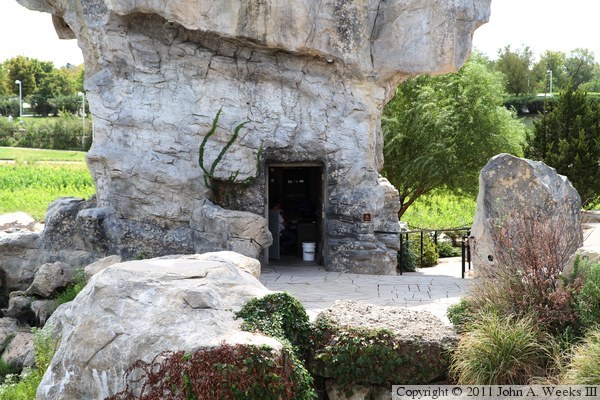
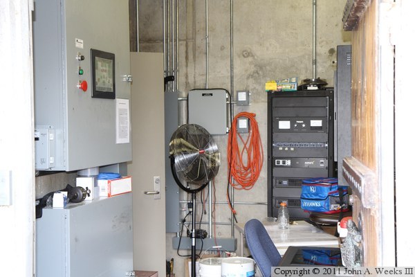
The photo above is the entrance to the control center located in the base
of the statue. The photo below is a look inside of the control center.
The equipment in this room operates the bridge lights, the gas flame display,
and the elevator that leads from the plaza to the trail that runs through the
rocks at the base of the statue.

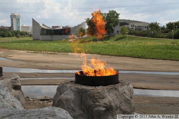
The gas flame display normally runs for about 15 minutes starting around
9:00 PM in the summer. However, the technician that was on duty was kind
enough to light up the flames during my visit. The photo above shows three
flames burning as we look south across the Little Arkansas River towards the
base of the statue. The photo below is a close view of one of the flame
burners with the Exploration Place science museum located in the background.
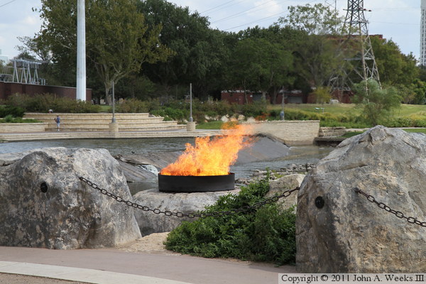
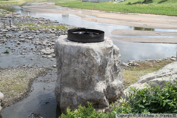
Here are two views of the fire pot located closest to the low head dam where
the two rivers meet. The dam is in the background in the photo above, while
downtown Wichita in the background of the photo below. Each fire pot puts out
1.4-million BTU per hour, about ten times that of a typical residential
furnace. The city of Wichita has had a long string of problems with the fire
pots and their electronic controls. They often have to light them manually
with a flare. The company that designed the fire pots went out of business,
so the city brought in a local boiler company in 2011 to help sort out the bugs.

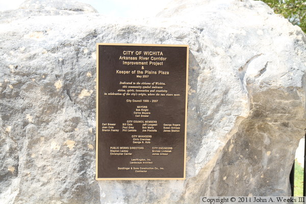
The photo above is the marker from the dedication of the plaza in May, 2007.
The photo below is the circle of life display on the plaza. The circle
includes the four fundamental elements of air, water, fire, and earth. It
also symbolizes the four seasons and the four compass points. A turtle
shell is featured in the center to represent the Native American belief that
we were all riding through the galactic sea on the back of a giant sea turtle.


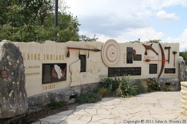
These two photos are two more displays that are featured on the plaza
between the two bridge structures. The Mid-America All-Indian Center is
located just west of the plaza. The location for the museum and statue were
chosen due to the importance of this location to native tribes.

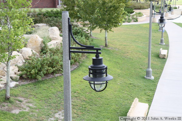
The photo above is a marker for the trail that runs along the north bank of
the Little Arkansas River. Wichita has an extensive network of public trails
with one running on each side of the rivers at this location. The photo below
is a view of a decorative lighting fixture that is located along the
Exploration Trail.
|
