| Highways, Byways, And Bridge Photography |
Gold Strike Park Pedestrian Bridge
Clear Creek Crossing At Arvada
Arvada, Colorado
| • Bridge: |
Gold Strike Park Pedestrian Bridge |
| • City: |
Arvada |
| • State: |
Colorado |
| • Country: |
USA |
| • Carries: |
Pedestrians & Bicycles |
| • Crosses: |
Clear Creek |
| • Date Opened: |
October, 2001 |
| • Total Length: |
400 Feet (Estimated) |
| • Longest Span: |
175 Feet (Estimated) |
| • Tower Height: |
100 Feet (Estimated) |
| • Deck Width: |
14 Feet (Estimated) |
| • Number Of Spans: |
1 |
| • Height Above Creek: |
21 Feet (Estimated) |
The first gold was discovered in Colorado when a wagon train heading to
California stopped along Clear Creek, and Lewis Ralston dipped his pan
into a small stream and found 1/4 ounce of gold. The creek was named
after Ralston, who continued west and only returned 8 years later. In
reality, local Native Americans discovered this gold years before, and
actually had named the area with a word that meant gold mine. The gold
soon played out, with the real riches in Arvada being very productive
farm land.
In the modern era, the City of Arvada purchased the land at the confluence
of Ralston Creek and Clear Creek (near Interstate highway I-76 and
Sheridan Boulevard for a park to commemorate the mining history in the
region as well as the original reason that Arvada was founded. The
centerpiece of this park is a 400 foot long curved cable stay bridge
that connects the Clear Creek Trail to the Ralston Creek Trail. These
trails are well used and connect to other major trails in the Denver
Area, such as the Front Range Trail and South Platte Trail.
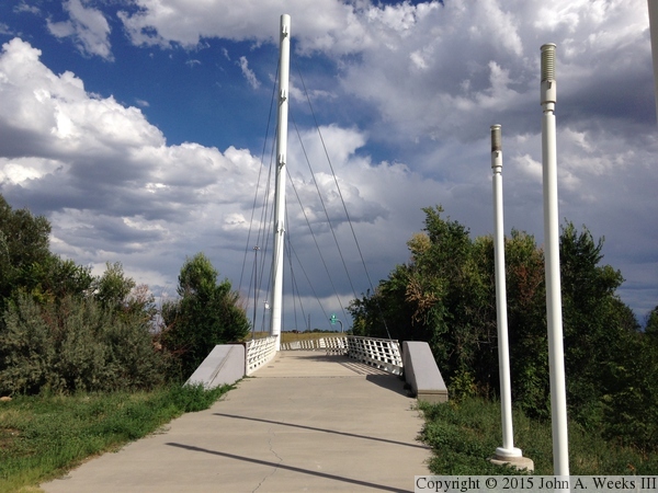
The photo above is a view of the Gold Strike Park Pedestrian Bridge as
seen from the Ralston Creek Trail as it approaches the west end of the
structure. The photo below is the first of five showing a typical
crossing of the bridge walking west to east. This first view is from
the parking area at the trailhead on West 56th Avenue just off of Ralston
Road.
Note—these are iPhone 5 photos which imposes an upper limit on their
quality.


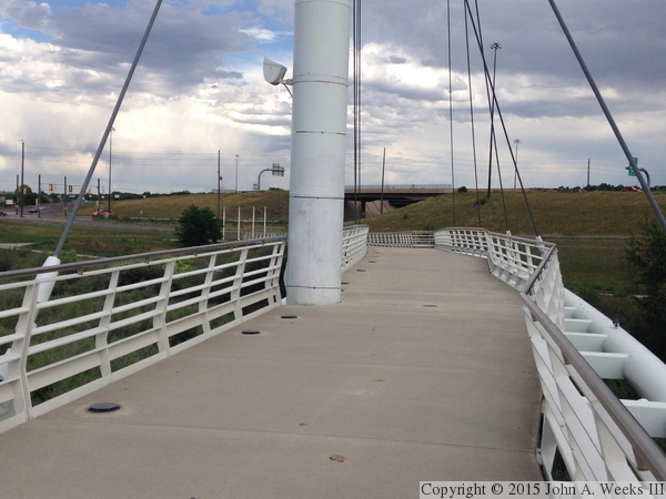
The photo above is the west approach to the bridge on Ralston Creek Trail.
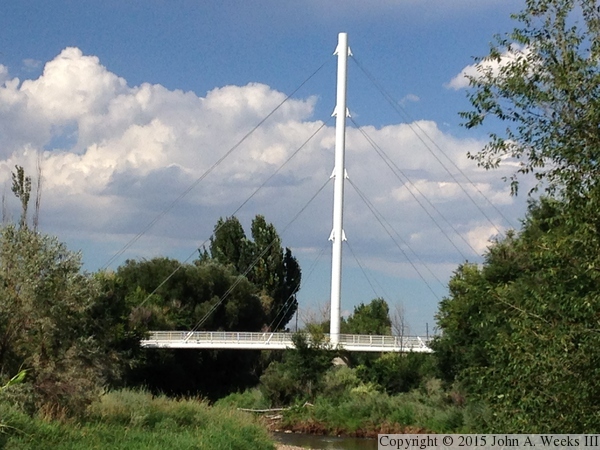
The photo below is a view of the midpoint of the suspended spans of the
bridge, with the main bridge tower located in the center of the photo.
The interchange of Interstate highway I-76 and Sheridan Boulevard is located
in the background.

The photo above is the transition from the east end of the suspended spans
and the concrete slab approach spans. The photo below is the east approach
to the bridge.
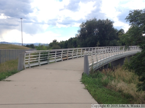

The photo above is another view of the transition between the suspended
spans and the approach spans on the east end of the bridge. The photo
below are the approach spans as the descend to the east bridge abutment.
The vantage point for these two photos is the Clear Creek Trail, which
passes under the east end of the Gold Strike Park Pedestrian Bridge.
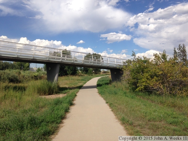
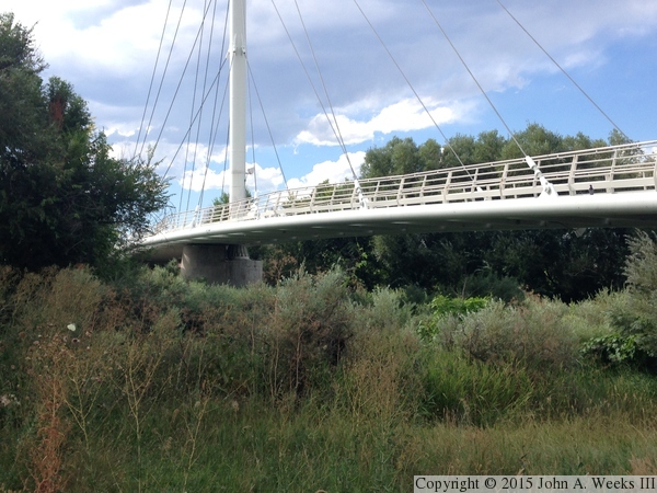
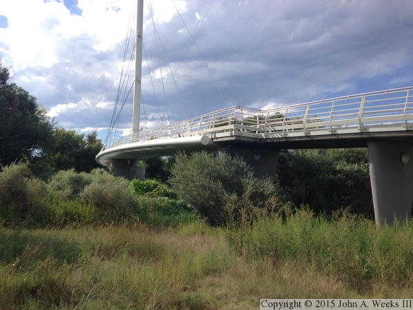
The photo above is a ground-level view of the suspended spans looking to
the northwest from the Clear Creek Trail. The photo below is looking
northeast from the south bank of Clear Creek. Given the trees and the
length of time since the structure was built, there are no unobstructed
views of either side of the bridge.
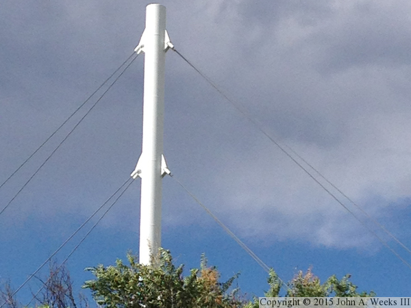
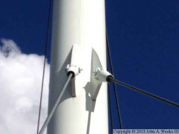
The photo above is the top of the main bridge tower showing two sets of
cable attachment points. The photo below is a closer view of one of the
cable attachment points, showing that there are actually two cables on
each side of the tower.
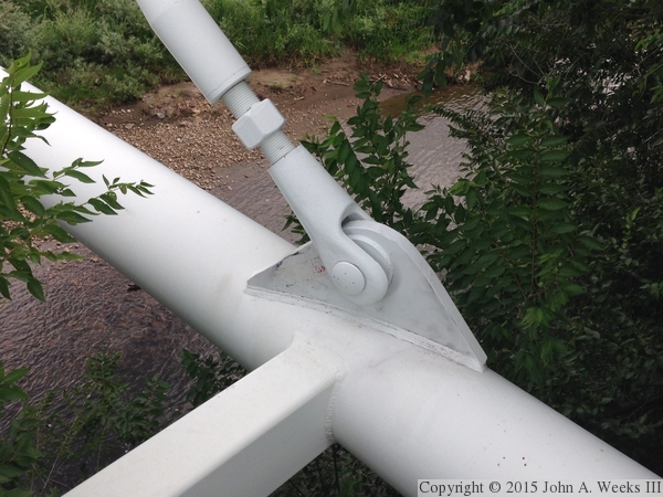
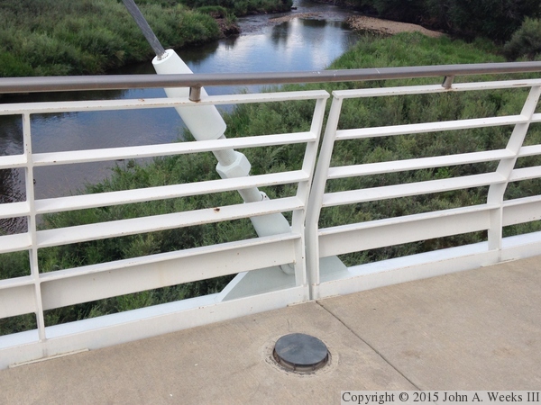
The photo above is a detail view of a cable attachment point on the bridge
deck structure. The photo below is a view of the bridge railing on the
suspended bridge deck, showing both a cable attachment as well as a
light built into the bridge deck.

The photo above is a close view of the connection between a suspension
cable and the hardware that attaches it to the bridge structure. The
photo below is another view of the transition from the approach spans
to the suspended spans. The large diameter pipe on the side of the
suspended span is a main beam for the bridge deck, which is supported
by the stay cables. The deck is built between two parallel pipes. A
gradual bend in the pipe creates the curve in the bridge deck, something
that would have been hard to do with more traditional I-beams.
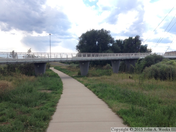
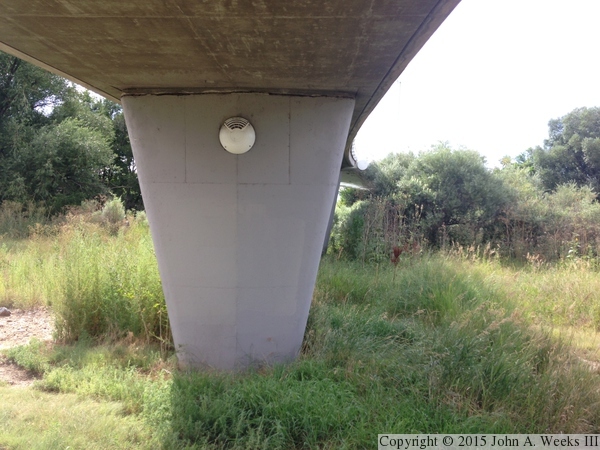
The photo above is a view looking to the southwest towards the concrete
slab approach spans. The photo below is a view from under the approach
spans of one of the bridge piers. The white object on the pier is a
light fixture.
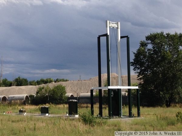
These two photos are pieces of gold mining equipment that is on display
at the trailhead. There are other displays and interpretive signs that
explain the discovery of gold and history of mining at this site.

|
