| Highways, Byways, And Bridge Photography |
Dames Point Bridge
FL-9A Saint John's River Crossing At Jacksonville
Jacksonville, Florida

| • Bridge: |
Dames Point Bridge |
| • Structure ID: |
NBI 720518 |
| • City: |
Jacksonville |
| • State: |
Florida |
| • Country: |
USA |
| • Carries: |
FL-9A (Future I-295) |
| • Crosses: |
Saint John's River |
| • Date Opened: |
March, 1989 |
| • Total Length: |
10,646 Feet |
| • Longest Span: |
1,300 Feet |
| • Tower Height: |
471 Feet |
| • Deck Width: |
106 Feet |
| • Number Of Lanes: |
6 |
| • Number Of Spans: |
1 |
| • Height Above Water: |
175 Feet |
| • Traffic Count: |
52,860 (2002) |
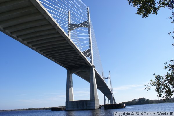
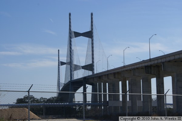
The Dames Point Bridge, also known as the Napoleon Bonaparte Broward
Bridge, is part of the future I-295 ring route Interstate highway
that will eventually circle Jacksonville. This bridge is one of
the larger cable stay bridges in the US, and it features a harp-style
cable arrangement for strength. The harp style has two sets of cables
in parallel. These cables total a length of over 21 miles.
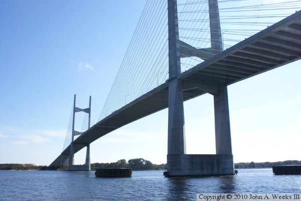
This bridge had been proposed for more than 30 years. It nearly
was started in the 1970s, but an economic recession caused it to
be shelved. The bridge design was modified late in the design process
to increase the height above the water from 160 feet to 175 feet. It
is fortunate that this was done since modern container ships need this
clearance. Some critics suggest that this was still too low, and it
should have been built with 190 feet of clearance to allow the larger
cruise ships to pass under the bridge. Even that would be too low given
that the newest cruise ships require 200 feet of clearance.
The first major maintenance was performed on the bridge in 2007 and 2008
when the stay cables were painted. This involved erecting large stacks of
scaffolding on each side of the bridge to provide access to the cables.
The bridge is officially named after Napoleon Bonaparte Broward,
a former governor of Florida and all-around character. Besides his
political career, Broward was a daring sea captain, and was known to
run guns to the Cuban revolutionaries.
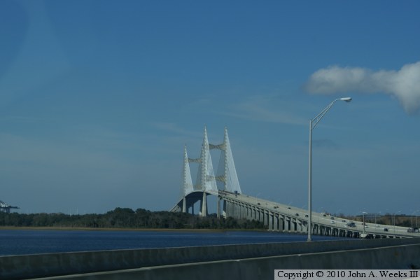
The photo above is a view of the upriver west face of the bridge as seen
from the south shore of the river. The vantage point was between two
houses in a residential area located southwest of the river crossing.

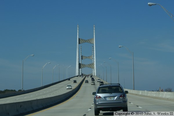
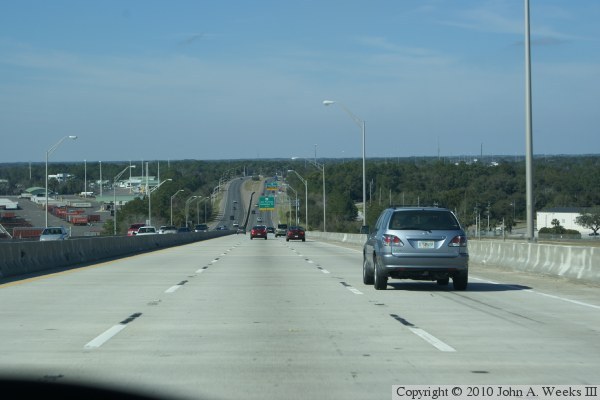
These two photos are the first of a seven photo set showing a typical
crossing of the Dames Point Bridge heading northbound. The photo above
is entering the south end of the bridge. The photo below is a view of
the main channel spans as seen from the northbound traffic lanes. The
sweeping curve in the highway allows for a view of the cable stayed span
from a mile south of the structure.
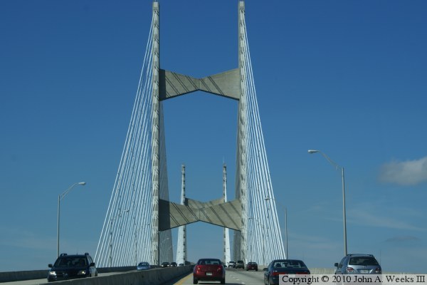
These two photos are views heading northbound on FL-9A towards the cable
stayed spans of the Dames Point Bridge. The photo above is the transition
from the low causeway spans to the ramp that leads to the main river channel
span. The photo above is nearing the start of the cable stayed span.
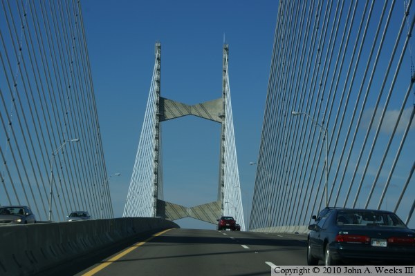
These two photos continue our northbound crossing of the Dames Point Bridge.
The photo above is passing the south bridge tower while the photo below is
passing the north bridge tower. Note that the cables are arranged in
side-by-side pairs.

The photo above is a view from the ramp leading downhill from the cable
stayed span at the north end of the main river channel. The photo below is
a view of the transition from the cable stayed span to the concrete girder
spans at the north end of the bridge.
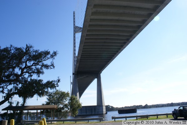
These two photos are views from the riverbank on the north shore of the
Saint John's River. The photo above is the upriver west face of the
bridge, while the photo below is the downriver east face of the structure.
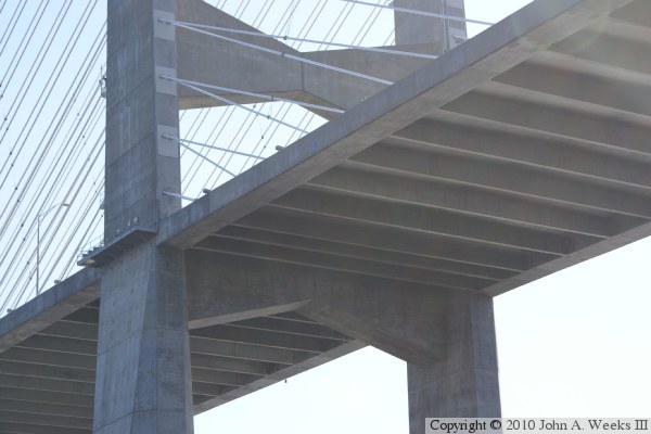
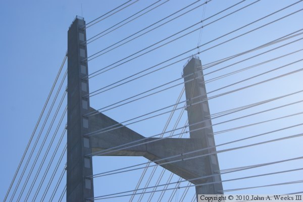
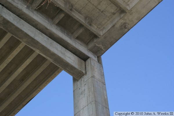
These two photos are detail views of the north bridge tower. The photo
above is a view where the bridge deck is joined to the tower. The photo
below is a view of the cable attachment points near the top of the tower.
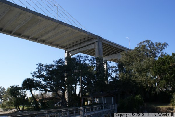
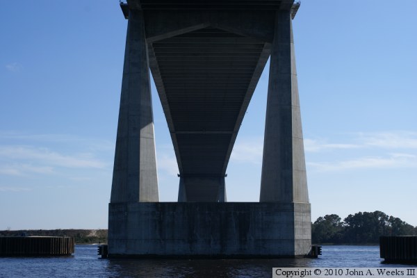
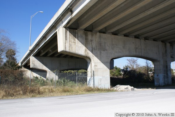
These two photos are views from under the bridge at the north end of the
cable stayed span. The photo above is looking south from under the east
side of the bridge, while the photo below is from under the center of the
bridge deck.
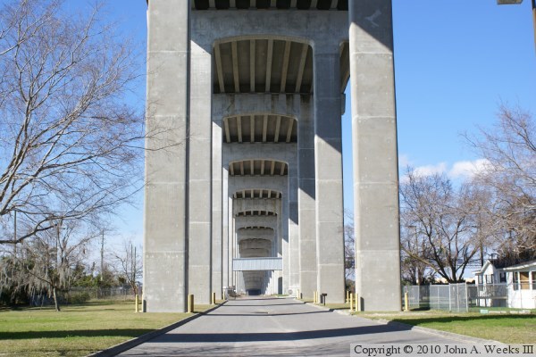
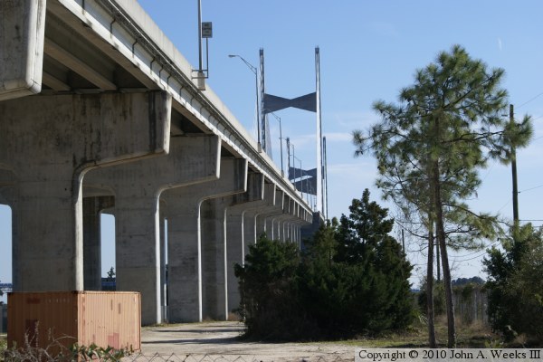
These two photos are looking north from the same location. The photo above
is looking through the piers supporting the concrete girder spans. The
entrance to a local park runs between the piers. The photo below is a
view of the west face of the concrete girder spans at the north end of
the structure.
The photo above is a detail view of the transition between the suspended
span and the first concrete girder span at the north end of the cable
stayed span. The photo below is the north bridge abutment.
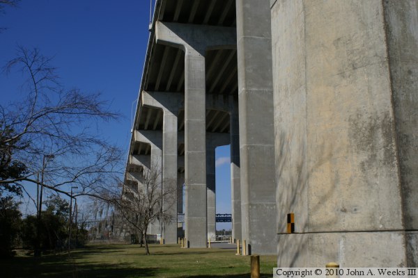
These two photos are views looking south from near the north bridge
abutment. The photo above is the west face of the structure, while
the photo below is looking south along the east face of the bridge.
|
