| Highways, Byways, And Bridge Photography |
Greenville Bridge
US-82/US-278 Mississippi River Crossing At Greenville
Greenville, Mississippi
| • Bridge: |
Greenville Bridge |
| • Structure ID: |
Not Listed In 2010 NBI Data |
| • City: |
Greenville |
| • State: |
Mississippi |
| • Country: |
USA |
| • Carries: |
US-82, US-278 |
| • Crosses: |
Mississippi River |
| • Date Opened: |
August 4, 2010 |
| • Total Length: |
13,560 Feet |
| • Longest Span: |
1,378 Feet |
| • Tower Height: |
425 Feet |
| • Deck Width: |
101 Feet |
| • Number Of Lanes: |
4 |
| • Number Of Spans: |
1 |
| • Height Above Water: |
121 Feet |
| • Traffic Count: |
7,200 (2002, Old Bridge) |
The Benjamin G. Humphreys Bridge, which carried US-82 and US-278 across the
Mississippi River for 70 years, was a navigation hazard from the day it was
built just prior to World War II. The bridge was located on a tight curve in
the river with a strong cross-current flowing across the navigation channel
near the bridge piers. Navigation through the bridge was much like threading
the eye of a needle. Despite the Humphreys Bridge still being structurally
sound, it was decided to replace that structure, with the new Greenville
Bridge project being kicked off in 2001.
The replacement structure, a giant cable stayed bridge, is situated about
about 2,800 feet downriver. It is located on a straight section of the river
with a 1,300 foot span between the two 425 foot tall bridge towers. Like the
old Humphreys Bridge, the Greenville Bridge is located almost entirely in
Arkansas, including most of the eastern approach road. This is due to the
river channel having moved west, but the state line remaining at the location
of the old river channel.
Various web sites, including the official project web site, claimed that
this would be the largest cable stay bridge in North America when completed.
That claim appears to be incorrect given that the Cooper River Bridge in
Charleston, South Carolina, has a span of over 1,500 feet and towers that
are 575 feet tall. When the Greenville Bridge opened, it was the second
largest cable stayed bridge in the US based on the 1,378 foot main channel
span. It held the number two spot only nine months until the John James
Audubon Bridge opened in May of 2011, which pushed the Greenville Bridge
back to third place.
Despite not being the largest bridge over the Mississippi River, the
Greenville Bridge is still an impressive structure. The bridge has 2-1/2
miles of elevated roadway. The main structure of the bridge is 2,560 feet
long with a 1,378 foot main span and two 591 foot long side spans.
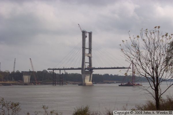
As of November, 2006, the cable stayed bridge was complete. However,
construction on the approach roads was only just getting underway. It would
take almost 4 more years to complete the approach roads, so the new river
crossing became the ultimate bridge to nowhere, one huge and elegant structure
with both ends suspended 120 feet in the air. An official Mississippi DOT
photo of the completed bridge is included below showing the structure
spanning the river, but not being connected to the highway system.
The opening of the new Greenville Bridge was eventually scheduled for July 28,
2010, with a ribbon cutting ceremony being held two days prior to the
opening. The opening was delayed a few days when, at the last minute, it was
decided to complete some additional paving work on one of the approach roads
and bad weather set back that paving. The long awaited opening finally
occurred at around 6 PM on August 4, 2010. The old bridge was closed at that
time, and was largely dismantled during 2011.
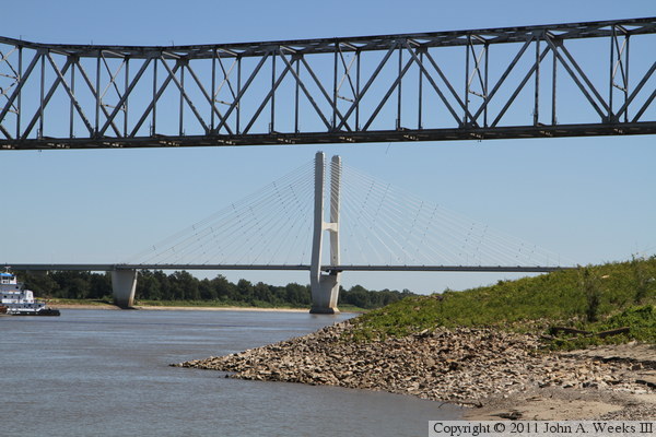
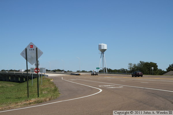
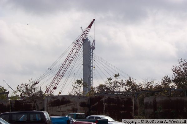
The photo above is looking downstream to the southeast from the construction
staging area on the west bank of the Mississippi River. The old bridge,
known as the Benjamin G. Humphreys Bridge, is visible in the foreground.
From this vantage point, only the east main bridge tower is visible. The
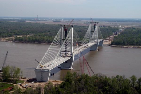
photo below is an aerial photo of the bridge site in the summer of 2006
looking northeast with the city of Greenville in the distance. This image
was provided to me by the the bridge project manager.
There are publicly available locations to see the main span of the
Greenville Bridge, at least not without hiking through a snake infested
swamp or from a boat on the river. These two photos are about as close as
one can get with an automobile. The photo above is looking east along the
south face of the bridge from the parking lot of the Cow Pen restaurant.
The Cow Pen is located adjacent to the west bridge abutment. Coincidentally,
the Cow Pen caught fire and burned in 2007 while the Greenville Bridge was
under construction, but it has since been rebuilt. The photo below is looking
southeast from the former US-82 alignment leading to the old bridge.
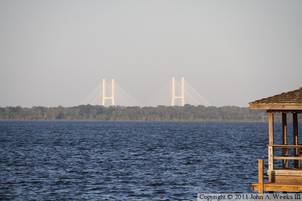
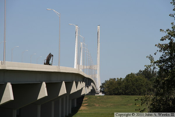
The photo above is looking east from the boat ram at the Lakeshore Cafe in
nearby Lake Village, Arkansas. The Greenville Bridge is slightly over 4 miles
away, most of which is over Lake Chicot, an oxbow lake that was once the main
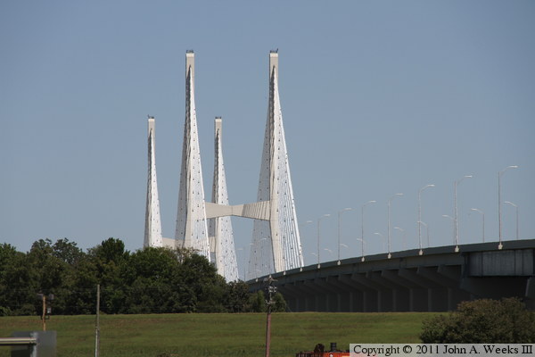
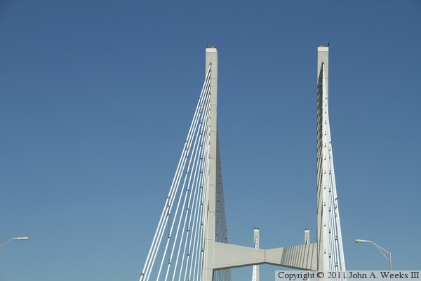
channel of the Mississippi River. The photo below is a view of the upper
portion of the west main bridge tower where the stay cables are connected
to the tower. The bridge features two towers, each of which has two parallel
cable fans.
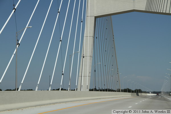
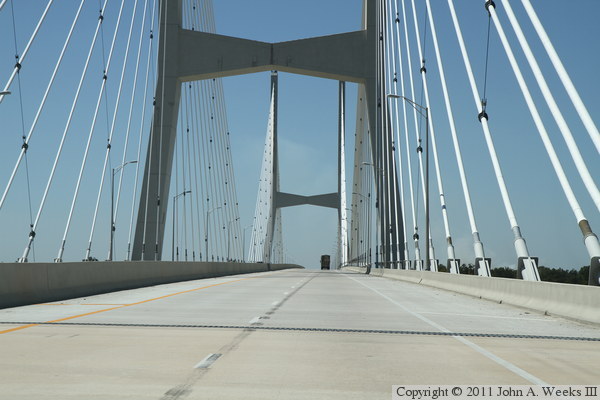
These two photos are views of the cables as they attach to the bridge
deck near the east tower. These views were taken from a moving vehicle
heading eastbound. The photo above is looking diagonally across the
bridge deck, while in the photo below, we are in the traffic lane next to
the south edge of the structure.
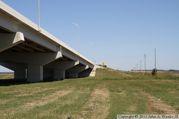
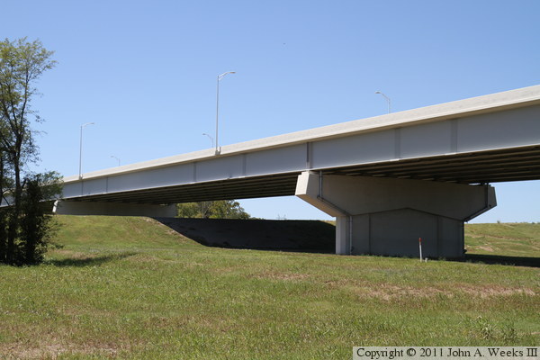
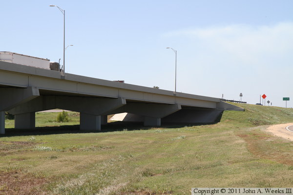
These two photos are views of the east bridge abutment in Refuge, Mississippi.
The approach spans are prestressed concrete girders supported by a long
series of large concrete T-piers.
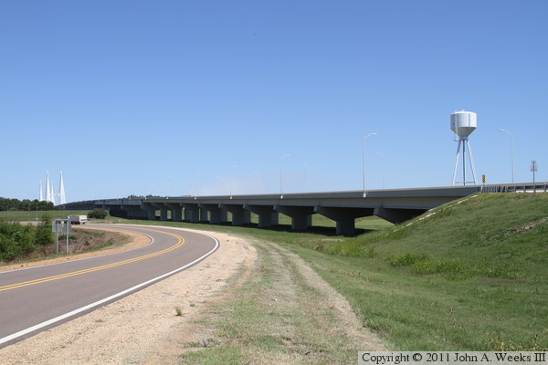
The photo above is the approach spans on the east end of the bridge as they
pass over Refuge Road. Harlow's Casino Resort & Hotel is located on
the far side of the approach spans on the north side of the structure. The
photo below is a transition point from prestressed concrete girders to a
steel deck plate girder span.
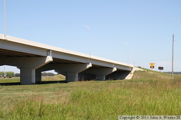
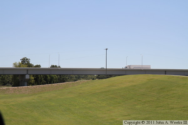
These two photos show that the steel deck plate girder spans are used to
cross the levee. The photo below is looking northwest from Refuge Road,
while the photo below is looking south from the parking lot at Harlow's
Casino.
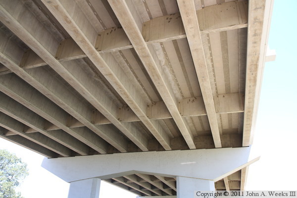
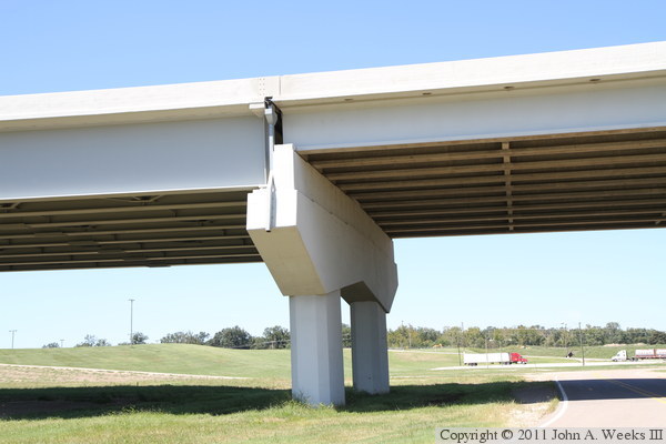
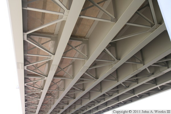
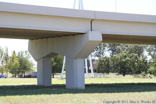
The photo above is the underside of a concrete girder span. The girders are
large concrete I-beams that are held upright by concrete blocks set between
the girders. The photo below is the underside of a steel deck plate girder
span. The steel girders are nearly twice as tall as the concrete girders,
but they also span longer distances between piers.
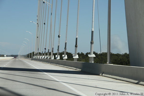
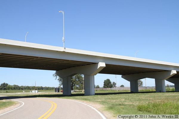
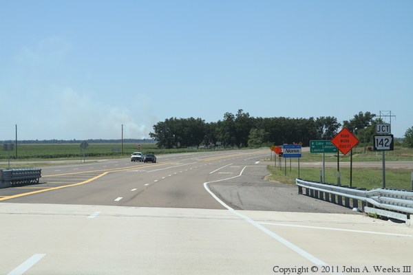
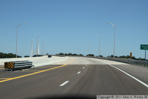
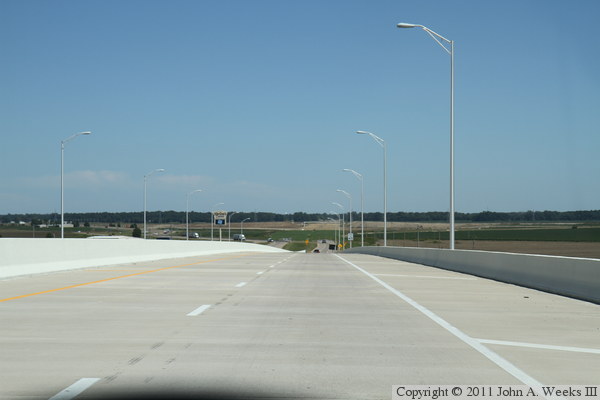
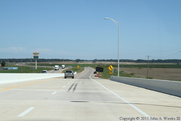
These two photos, and the 14 that follow, show a typical bridge crossing
heading westbound from Mississippi to Arkansas. The photo above is the
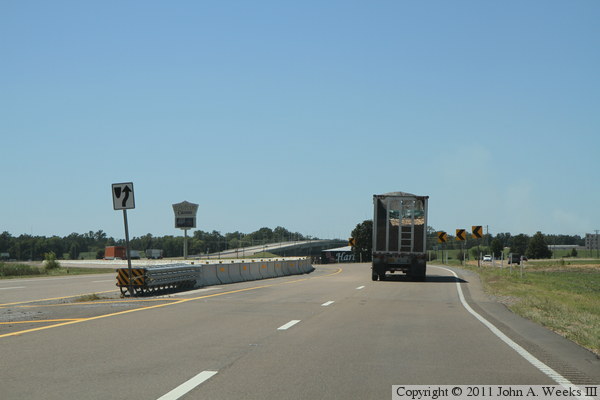
temporary connection from the old alignment of US-82 to the new Greenville
Bridge. Eventually, there will be a freeway bypassing the south side of
Greenville, and the current routing of US-82 will connect to this freeway
at an interchange located about a mile east of the bridge site. The photo
below is the 4-lane approach to the bridge.
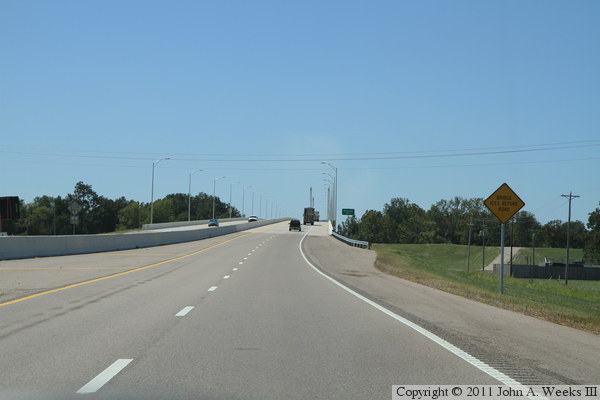
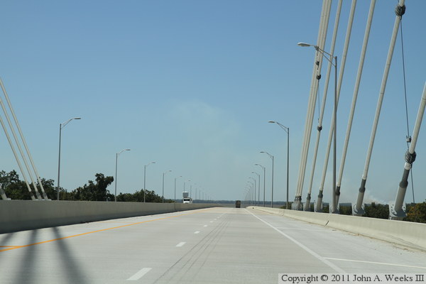
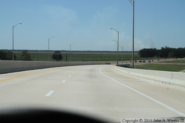
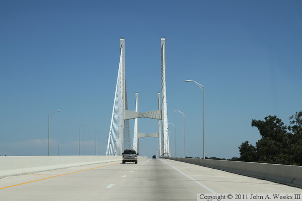
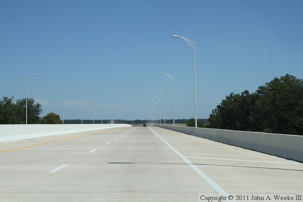
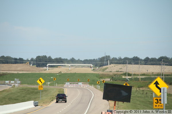
Continuing our westbound crossing, the photo above is the final approach
to the east end of the Greenville Bridge. The photo below is our first
view after having entered the bridge. From here, we have to climb a
small grade to get up and over the levee, which passes under a longer
steel deck plate girder span.
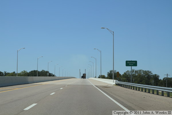
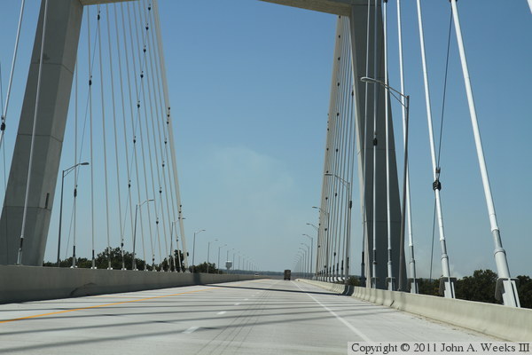
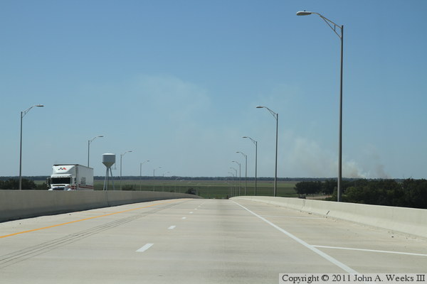
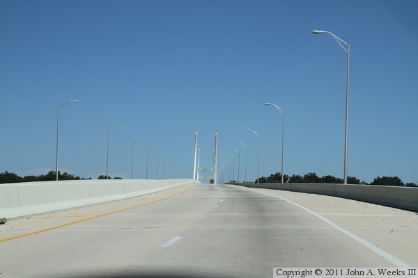
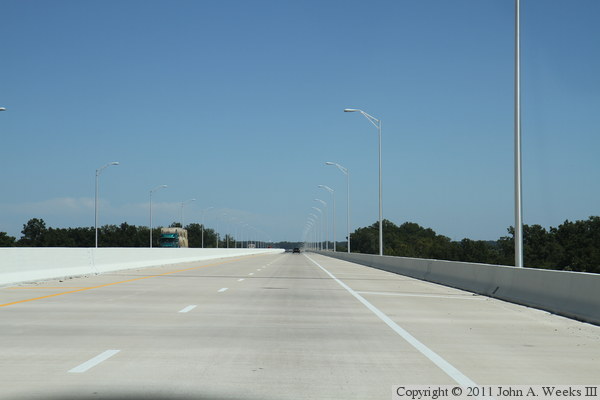
Continuing our westbound crossing, the photo above is from about a mile from
the first cable suspended span. While the bridge deck appears to have leveled
out, we are still climbing at a steady rate to reach a level of about 120
feet above the river. In the photo below, we are about one-third of a mile
from the first cable suspended span.
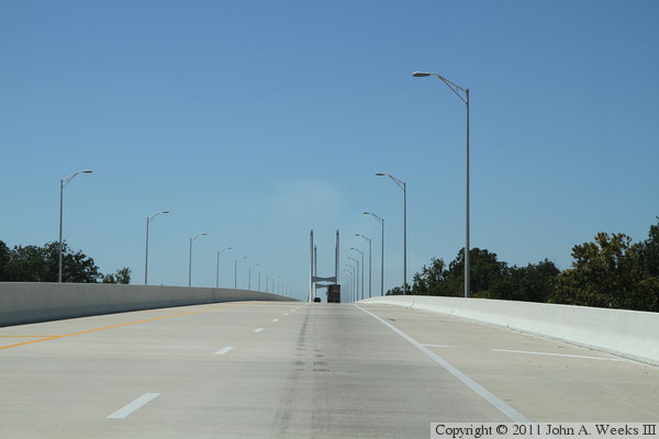
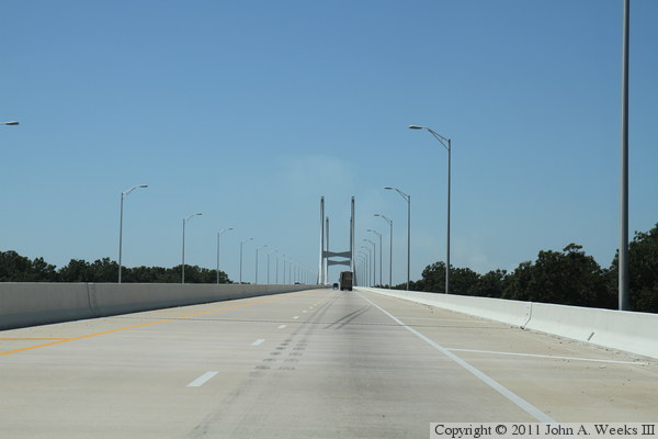
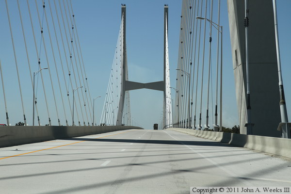
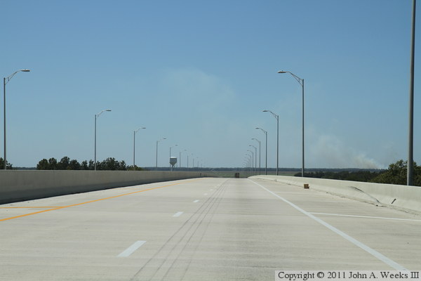
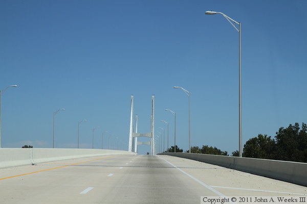
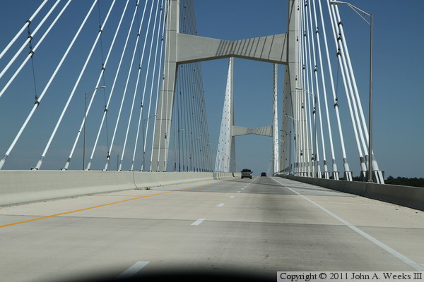
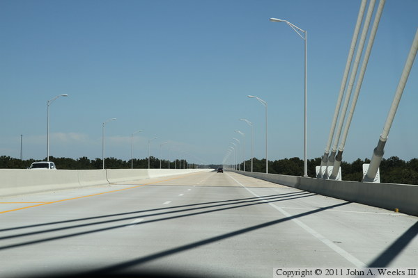
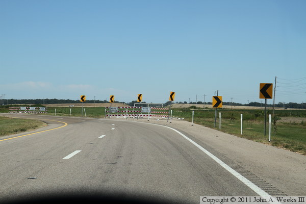
Continuing our westbound crossing, in the photo above, we are approaching the
east end of the first cable suspended bridge span, while in the photo below,
we have entered the first cable suspended span and are traveling between the
two parallel cable fans on the east side of the main bridge span.
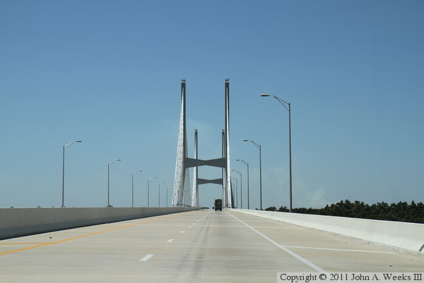
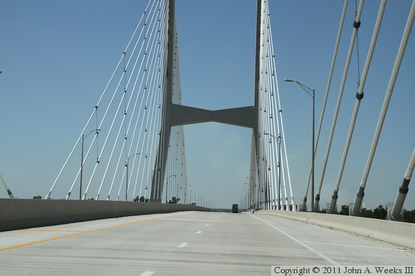
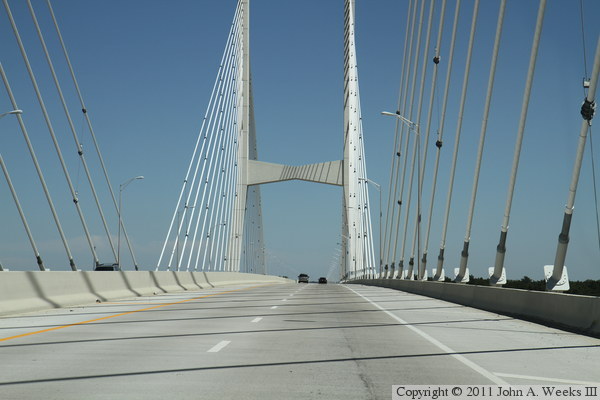
Continuing our westbound crossing, the photo above shows us passing the
east main bridge tower. In the photo below, we are nearing the midpoint of
the main bridge span and we are approaching the cable fans on the west end
of the main bridge span.
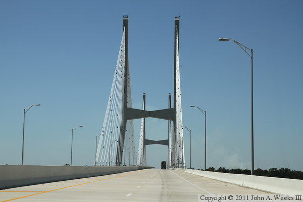
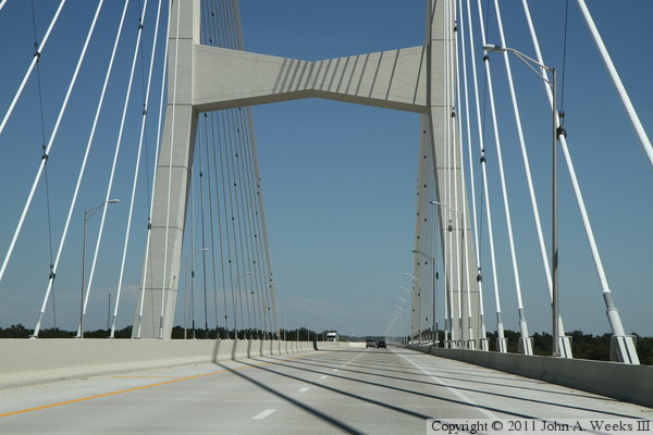
Continuing our westbound crossing, in the photo above, we are approaching the
west main bridge tower. The photo below is the west end of the suspended
span.
Continuing our westbound crossing, the photo above is the concrete girder
trestle at the west end of the structure. The photo below is at the crest
of the grade leading down to the west bridge abutment.
Continuing our westbound crossing, the photo above is descending the grade
at the west end of the structure. The photo below is exiting the bridge
and back on dry land. While the Arkansas state line sign is located
just west of the bridge abutment, the bridge itself is located almost
entirely in the state of Arkansas, with the state line being near the east
abutment well east of the Mississippi River.
The photo above is looking southeast along the upstream north face of the
bridge. Our vantage point is standing on the shoulder of the old alignment
of highway US-82. The photo below is looking southwest towards the west
bridge abutment.
The photo above is a close view of a pair of T-piers that support a
prestressed concrete girder span. The photo below is the deck plate girder
span on the west end of the structure that carries the highway over the levee.
These two photos, and the 13 that follow, show a typical bridge crossing
heading eastbound. The photo above is the intersection at the west end of the
bridge with the roadway leading to the old Benjamin G. Humphreys Bridge. The
photo below is approaching the west end of the Greenville Bridge.
Continuing our eastbound bridge crossing, the photo above is taken just after
entered the west end of the bridge. The photo below is climbing the grade
at the west end of the structure to get up and over the levee.
Continuing our eastbound bridge crossing, the photo above shows us about
a quarter mile from the main suspended spans. In the photo below, we are
approaching the west end of the main suspended span.
Continuing our eastbound bridge crossing, these two photos show us crossing
the main span over the river navigation channel. In the photo above, we
have just passed the west main bridge tower, while in the photo below,
we are passing between the two parallel cable fans on the east end of the
main channel span.
Continuing our eastbound bridge crossing, the photo above shows the east end
of the main suspended spans, while the photo below shows the prestressed
concrete girder spans on the east end of the bridge.
Continuing our eastbound bridge crossing, in the photo above, we are about
half way across the concrete girder spans on the east end of the structure.
In the photo below, we are at the crest of the grade leading back down to
ground level as we pass over the levee on the east side of the river.
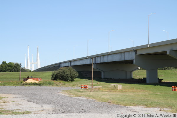
Continuing our eastbound bridge crossing, the photo above shows the east
end of the Greenville Bridge. The photo below is a telephoto view showing
the freeway construction east of the Greenville Bridge, including an
interchange where the freeway will connect to the old alignment of US-82.
The photo above is the end of the 4-lane segment at the east end of the
Greenville Bridge, where a temporary connection connects to the old alignment
of US-82. The photo below is the east tower of the Greenville during
construction in the summer of 2005. The deck is being installed. As each
section of the deck is added to the bridge, it is supported with a stay cable.
The vantage point is under the west end of the Humphreys Bridge located
just upstream.
The photo above is the west bridge tower as seen from the bridge project
staging area under the Humphreys Bridge. I visited the bridge site on three
occasions while the bridge was under construction, but it was raining each
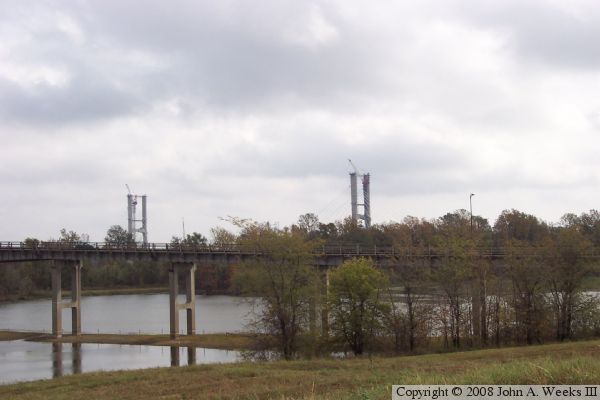
time, which explains the foggy photos and the ugly sky. The photo below is
looking northeast towards the bridge project from near the levee on the west
side of the river.
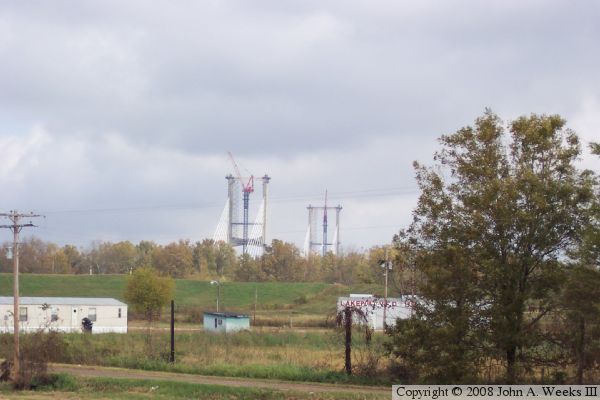
The photo above is looking south at the bridge project from near the US-82
bridge on the west side of the river. The only part of the bridge that is
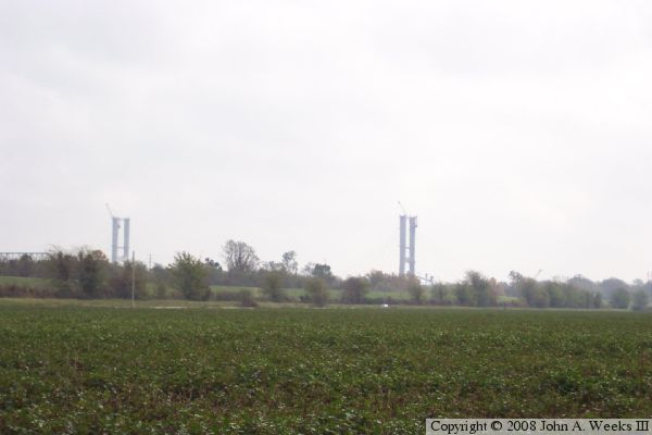
visible from these locations is the tops of the towers. The photo below is
a view of the bridge project from a farm field located outside of the levee
system on the west side of the river.
|
