| Highways, Byways, And Bridge Photography |
Arthur J. DiTommaso Memorial Bridge
5th Street Nashua River Crossing At Fitchburg
Fitchburg, Massachusetts
| • Bridge: |
Arthur J. DiTommaso Memorial Bridge |
| • Structure ID: |
NBI F04019ANLMHD634 |
| • City: |
Fitchburg |
| • State: |
Massachusetts |
| • Country: |
USA |
| • Carries: |
5th Street |
| • Crosses: |
Nashua River, Boston & Maine Railroad |
| • Date Opened: |
September 30, 2003 |
| • Total Length: |
657 Feet |
| • Longest Span: |
357 Feet |
| • Tower Height: |
275 Feet |
| • Deck Width: |
45 Feet |
| • Number Of Lanes: |
2 |
| • Number Of Spans: |
1 |
| • Height Above Water: |
80 Feet (Estimated) |
| • Traffic Count: |
4,030 (2004) |
The original 5th Street Bridge was a 6-span concrete arch structure built
in 1912. It was neglected and deteriorated to such a bad state that it had
to be closed in the 1990s. The engineering firm STV Inc. was engaged to
rehabilitate the structure. However, after extensive testing, it was
determined that the concrete arch bridge was in such bad shape that it was
not practical to fix it. STV recommended a cable stayed bridge as a
replacement in order to minimize the amount of highly contaminated soil
that would need to be disturbed at the bridge site.
The 1912 bridge was demolished in 1997, and the new cable stayed bridge
was built between 2001 and 2003. The new bridge features a pair of
concrete H-towers that are 275 feet tall. They support 52 stay cables,
26 on each side of the bridge. What is unusual is that the bridge is
not symmetrical from end to end, or even on each side of each tower.
For example, heading east to west, there are 10 stay cables on the
east side of the east tower, 12 cables on the west side of the east tower,
16 cables on the east side of the west tower, and 14 cables on the west
side of the west tower. The west approach span crosses the Boston &
Maine Railroad, the main span crosses an abandoned industrial site and
the Nashua River, and the east approach span, which is much shorter than
the west approach span, crosses a steep embankment leading down to the river.
The new 5th Street cable stayed bridge is named after Arthur J. DiTommaso,
a long time Fitchburg police officer. The state of Massachusetts approved
this designation on July 24, 1996, prior to the bridge being constructed.
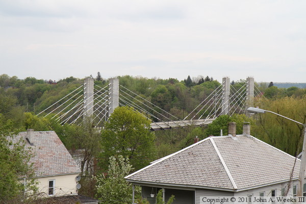
The photo above is looking northeast towards the DiTommaso Bridge from
a nearby bluff on Canton Street. The bridge is surrounded by trees, making
it difficult to see the entire structure in one view. The photo above is
the south face of the west bridge abutment.
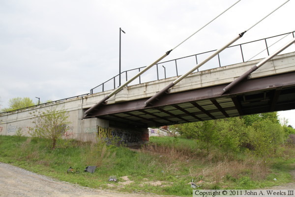
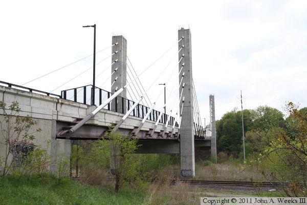
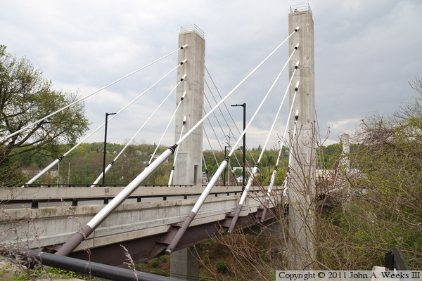
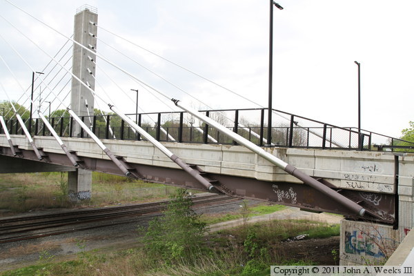
These two photos are views of the bridge as seen from an access road leading
down to the B&M railroad tracks. The photo above is looking east
towards the west main bridge tower, while the photo below is the south
face of the main bridge span. The bridge cables supporting the main span
can be counted in this view. There are 8 cables from each leg of the west
tower, but only 6 cables from each leg of the east tower. The approach
spans have one fewer cable from each tower.
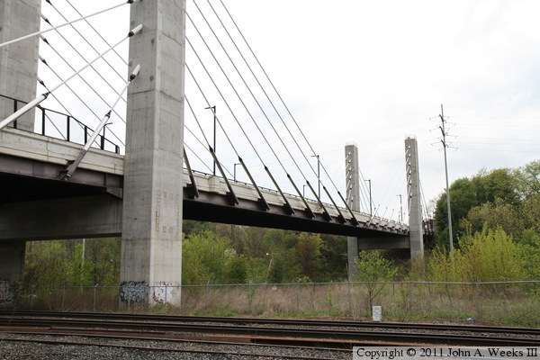
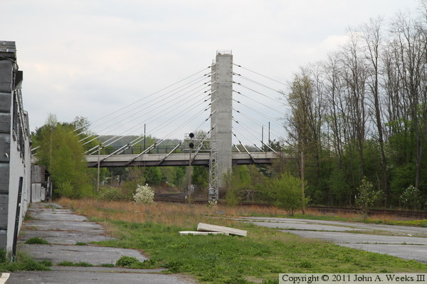
The photo below is looking north towards the west main bridge tower.
A railroad signal tower is located near the bridge tower. The photo
below is the north face of the east approach span. The Nashua River
is visible from this location.


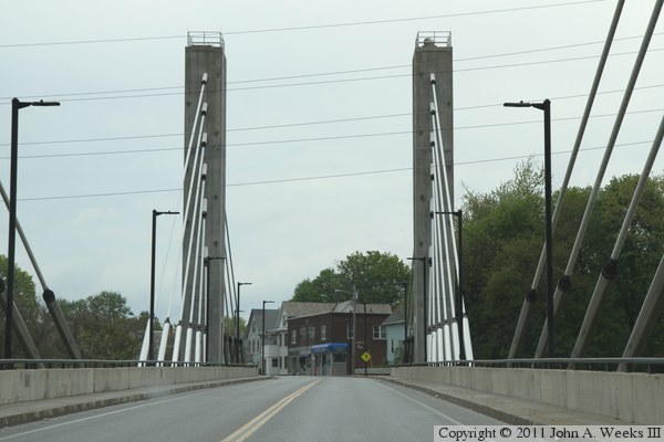
These two photos are views looking west down the length of the bridge deck
from the east end of the structure. The photo above is from the south side
of Harvard Street, while the photo below is from the north side of the street.
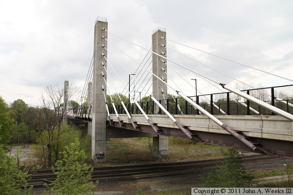
These two photos are views from the northeast corner of the DiTommaso Bridge.
The photo above is a closer view of the approach span and east bridge tower,
while the photo below is a wider overview shot.

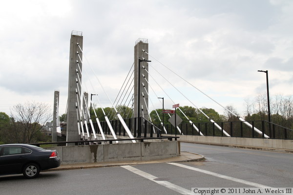
These two photos are views from the northwest corner of the DiTommaso Bridge.
The photo above is an overview shot showing the west bridge tower, while the
photo below is a closer view of the west approach span.
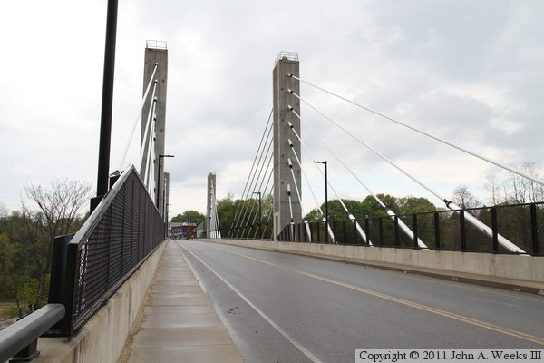
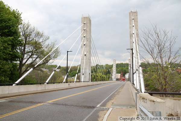
These two photos are views looking east down the length of the bridge deck
from the west end of the structure. The photo above is from the south side
of 5th Street, while the photo below is from the north side of the street.
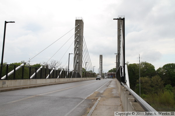
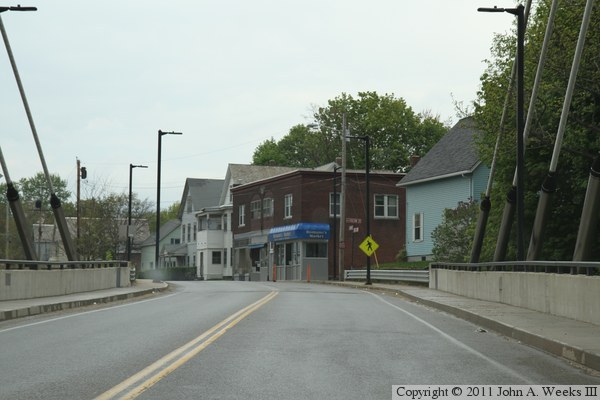
The photo above is an overview of the scene at the northwest corner of
the bridge. The photo below is the first of three photos showing a typical
bridge crossing heading eastbound. In this photo, we are approaching the
west end of the bridge.

These two photos continue our eastbound bridge crossing. In the photo
above, we have just passed the west tower and we are crossing the main
bridge span. In the photo below, we are passing the east bridge tower
and are crossing the east approach span.

The photo above is the bridge name sign posted just east of the structure
on Harvard Street. The photo below shows the construction date that is
engraved in the guardrail at the northeast corner of the bridge.

|
