| Highways, Byways, And Bridge Photography |
Bob Kerrey Pedestrian Bridge
Missouri River Trail Crossing
Omaha, NE

|
• Bridge: |
Bob Kerrey Pedestrian Bridge |
|
• Structure ID: |
Not Listed In NBI |
|
• City: |
Council Bluffs, Omaha |
|
• State: |
Iowa, Nebraska |
|
• Country: |
USA |
|
• Carries: |
Regional Trail |
|
• Crosses: |
Missouri River |
|
• Date Opened: |
September 28, 2008 |
|
• Total Length: |
2,224 Feet |
|
• Longest Span: |
506 Feet |
|
• Tower Height: |
210 Feet |
|
• Deck Width: |
15 Feet |
|
• Number Of Lanes: |
N/A |
|
• Number Of Spans: |
1 |
|
• Height Above Water: |
53 Feet |
|
• Daily Traffic Count: |
0, Not Open To Traffic |
Both of the twin cities of Omaha, Nebraska, and Council Bluffs, Iowa, have
well developed and growing regional trail systems. Both cities are working
hard to take back the riverfront and make it accessible by the public for
recreation. The only problem is that there was no connection across the
Missouri River. The railroad and interstate highway bridges were built
without pedestrian or bicycle access. As trail systems became much more
popular in the 1990's, both cities decided to set a goal to fix this
problem.
The first major step in building a pedestrian crossing over the Missouri
River occurred when Senator Bob Kerrey secured a $19-million federal earmark
before leaving office in 2000. The second link between the trail systems
started to pick up speed when it was decided to replace the South Omaha
Veterans Memorial Bridge, and the new bridge would be built with a 10 foot
walkway for pedestrians and bicycles.
The northern river crossing was put out to bid a few years after the federal
money was secured. However, the bids for the project came in at $44-million,
far more than what was available. The project was redesigned, and a second
round of bidding resulted in HNTB corporation being awarded the project
in May, 2006, for a price of $22-million. Local governments picked up
the rest, with some corporate donations such as Gallup, which funded the
lighting system.
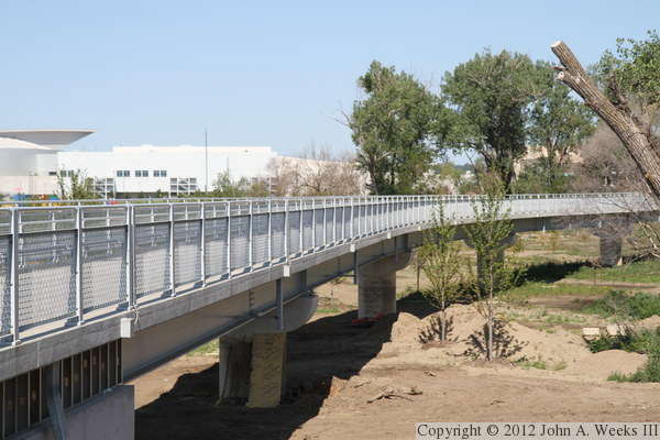
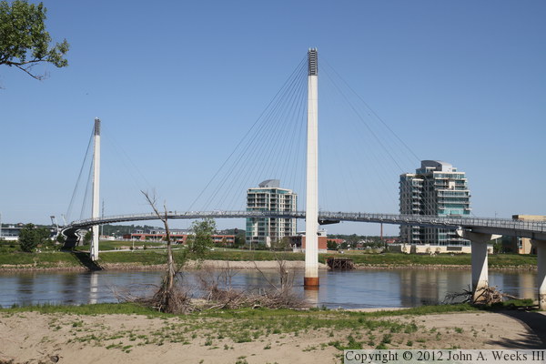
The resulting bridge was one of the longest pedestrian bridges in the nation
when it opened in 2008. Several longer bridges have opened since that time,
leaving the Bob Kerrey Pedestrian Bridge with the distinction of being the
longest pedestrian bridge to link two different states. The structure
consists of two towers that are each 210 feet tall (above the water), with an
additional 25 feet below water, and 80 feet below the riverbed. There are
three suspended spans, including a main navigation channel span of 506 feet.
The Iowa side features a number of fixed steel girder spans, while the
Nebraska side features a sweeping spiral walkway that connects to the
riverfront trail system. The long curves of the bridge deck and the
stunning views make the bridge as much a destination as it is a link
between trail systems.
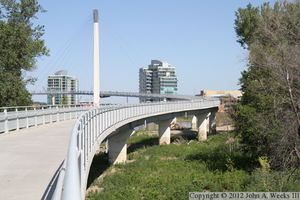
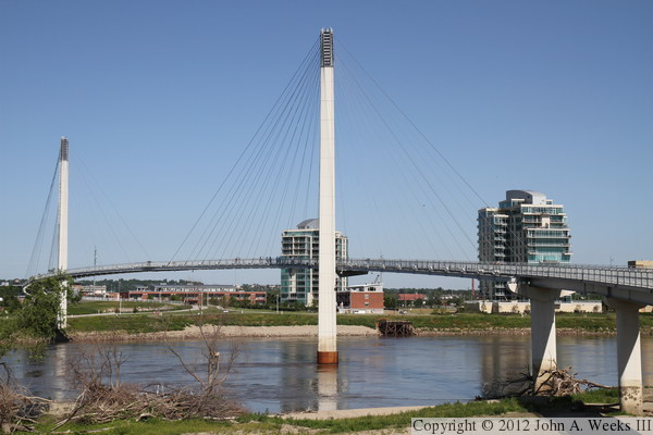
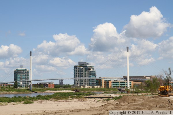
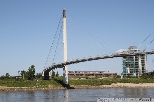
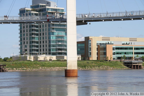
The photo above is the view looking east across the Missouri River from the
plaza located in front of the Riverfront Place apartment towers, located
just upstream from the Lewis & Clark Landing. The site was formerly
occupied by the ASARCO lead refinery, which closed in 1997, and required
extensive environmental cleanup efforts.
The remainder of this page is divided into three sections. The first is 45
photos showing a typical bridge crossing walking west from Iowa across the
Missouri River into Nebraska. The second section is eight night photos.
Finally, the third section is a ground level tour of the Iowa side of the
structure as the park was recovering from the massive floods in 2011.

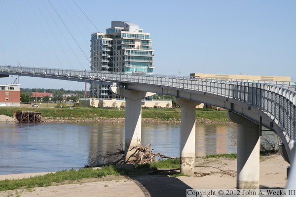
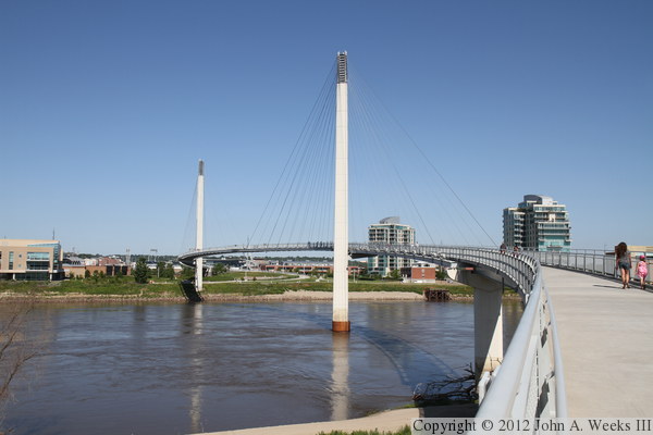
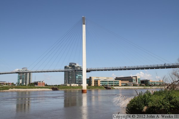
The photo above is looking downstream on the Missouri River from a dock
located in front of the Gallup company headquarters building on the Nebraska
side of the river. Iowa is on the left side of the photo, and the highway
I-480 Grenville Dodge bridge is visible in the background. The photo below
is the Iowa side of the river as seen looking east from the riverfront in
Omaha.

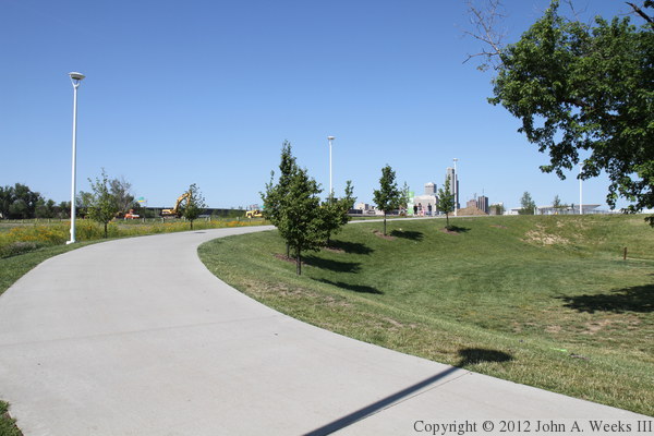
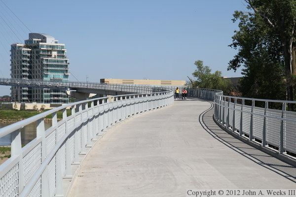
The photo above is the Iowa Riverfront Trail that leads to the east end
of the Bob Kerrey Pedestrian Bridge. Council Bluffs has an extensive
network of bicycle and recreational trails, including one that runs nearly
the entire length of the riverfront through the city. The trails are generally
ten feet wide and paved with asphalt. The photo below is a route marker
embedded into the trail surface.

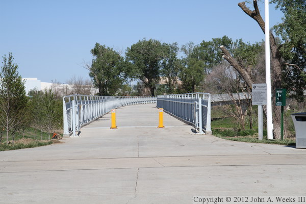
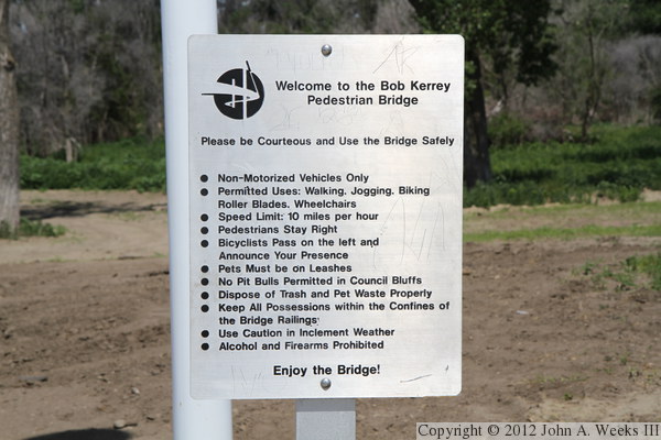
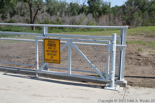
The photo above is the east entrance to the Bob Kerrey bridge. The photo
below is a close view of the sign at the entrance to the bridge.
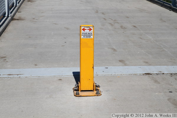
The photo above is a closer view of the device used to block traffic from
using the Bob Kerrey Bridge. If there is a need to bring an emergency or
maintenance vehicle onto the bridge, a lock can be removed allowing a pin
to be pulled at the base of the post. The post then folds down against
the bridge deck. The photo below is the gate at the east end of the bridge.
As the sign suggests, the bridge is closed at times of high winds or ice.
The photo above is the view looking along the north face of the Bob Kerrey
Bridge from alongside the east bridge abutment. The photo below is the
bridge deck as we are approaching the first sweeping curve to the northwest.
These two photos are views looking northwest alongside the upstream face
of the Bob Kerrey Bridge on the Iowa side of the Missouri River.
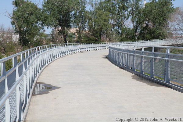
The photo above is the bridge deck as we are about halfway through the
sweeping curves on the Iowa side of the river. The photo below is the
view from the bridge deck looking west across the Missouri River towards
the main suspended bridge spans. The buildings in the background are
the Riverfront Place townhouse complex.
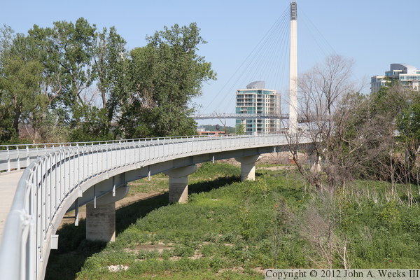
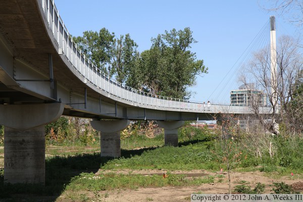
The photo above is looking along the downstream face of the Bob Kerrey Bridge
from the last of the sweeping turns on the Iowa side of the river. Note the
high water stains on the bridge piers left from the monumental floods in 2011.
The photo below is a view of the overwater bridge spans as seen from this
same vantage point.
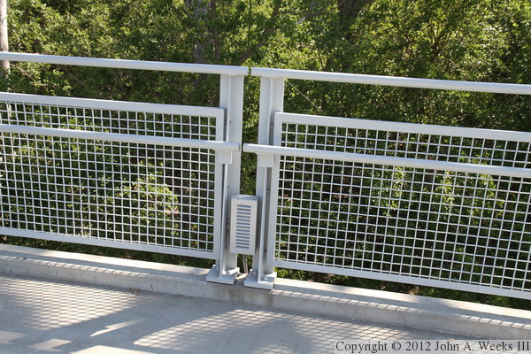
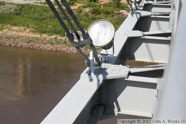
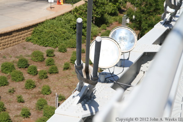
The photo above is the bridge railing, which features a light fixture that
illuminates the bridge deck at night. The photo below is the main suspended
bridge span as seen when we are approaching the end of the deck girder
spans on the Iowa side of the river.

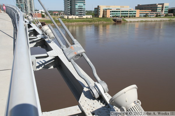
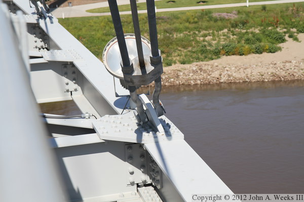
The photo above is the structure on the side of the bridge deck at the
transition point between the deck girder spans and the suspended spans.
The suspended spans are built on a steel frame, and that frame rests on
a bearing that allows the steel to slide to accommodate expansion and
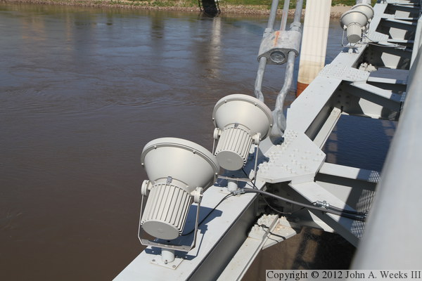
movement of the suspended span. The photo below is a close view of a pair
of light fixtures located near a cable attachment point.
The photo above is a cable attachment point on the upstream side of the
bridge on the east end of the suspended spans. The low-rise building in
the background is the Gallup company headquarters building. The photo
below is the bridge deck at the transition from the fixed spans to the
suspended spans.
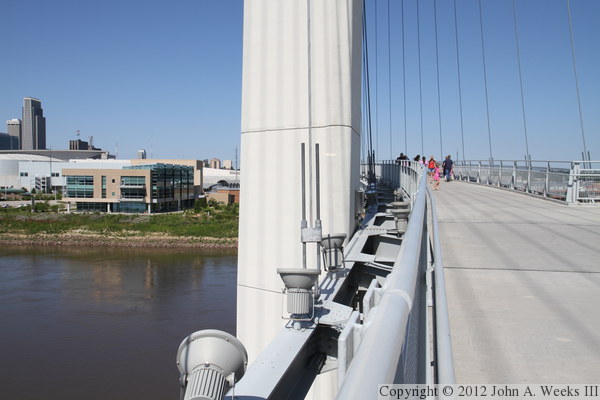
The photo above is approaching the east main bridge tower. The suspended
deck passes to the north of the tower on the Iowa side of the river, but to
the south of the tower on the Nebraska side of the river. The photo below
is the bump-out located on the upstream side of the bridge deck across
from the east main bridge tower.
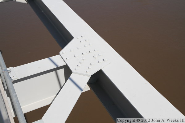
The photo above is the bridge deck structure as it passes the east main
bridge tower. The photo below is a close view of a section of the bridge
deck support structure. The deck is supported by a steel truss that is
laying on its side, and suspended by cables that attach along its edge.
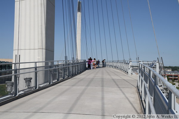
The photo above is a view looking across the width of the bridge deck
towards the east main bridge tower. Nebraska is in the background. The
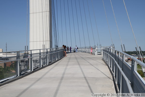
photo below is the bridge deck halfway between the two tall bridge towers.
These two photos are views of two cable attachment points. The photo above
is on the upstream side of the bridge, while the photo below is on the
downstream side of the structure. The cable tensions is adjustable
by turning the nuts on the eye-bolts. However, they are adjusted nearly
all the way tight and have little room for additional adjustment. I
suspect that this adjustment was needed when the cables were first
installed, but now that the bridge is complete, it is unlikely that the
cables will stretch. In fact, individual cables would only need to be
adjusted if they stretch in a nonuniform manner.

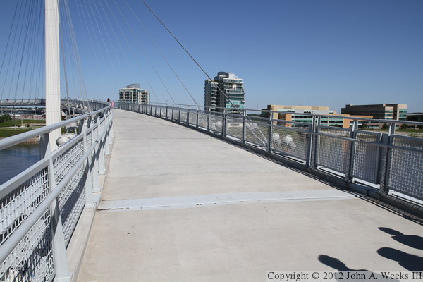
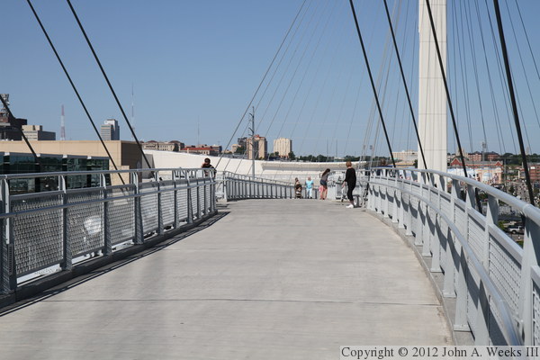
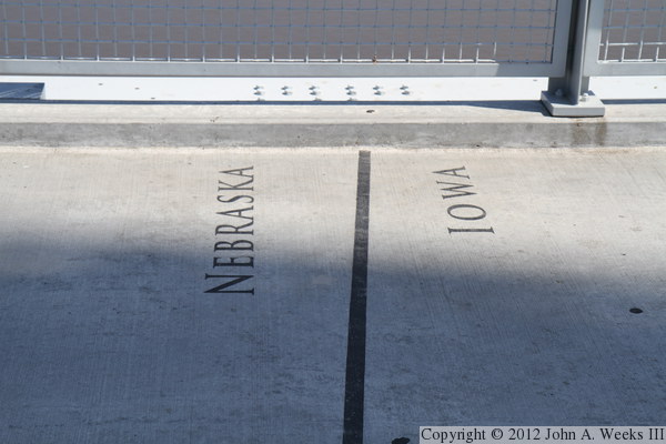
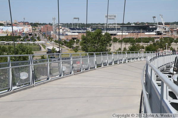
The photo above is the bridge deck at the midpoint of the river crossing.
There are a pair of bump-outs across from each other at this location. The
photo below is the Iowa-Nebraska state line, which is painted on the bridge
deck.
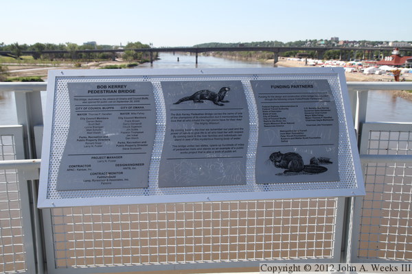
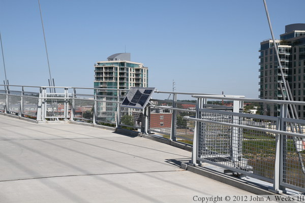
The photo above is a guide sign located at the mid-river observation bump-out.
The photo below is an emergency call-box located next to the guide signs.

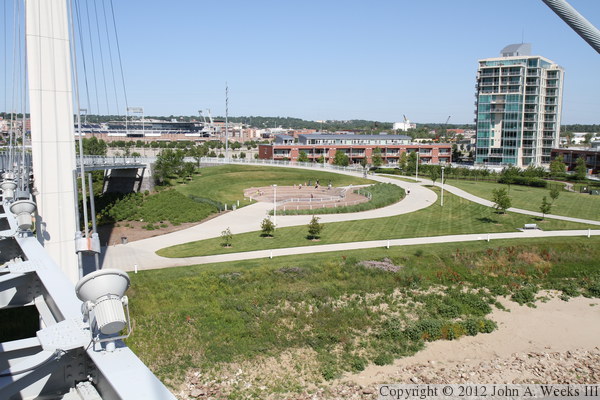
The photo above is a view of the plaza and fountain located on the Omaha
side of the Bob Kerrey Bridge. The approach to the bridge curves down and
meets the riverfront trails on the Nebraska side of the Missouri. The
photo below is the west bridge abutment as seen from the bridge deck.
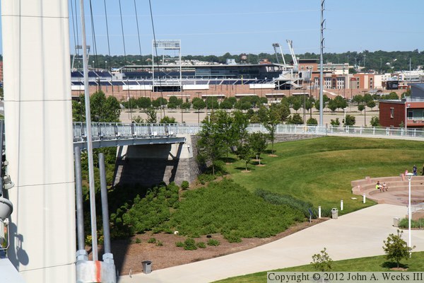

The photo above is the bridge deck approaching the west main bridge tower as
we start descending down to the Nebraska side of the river. The baseball
park in the background is TD Ameritrade Park, home of the NCAA college
world series. The photo below is the observation bump-out located across
the bridge deck from the west main bridge tower. The building in the
background is the CenturyLink Center, a convention center and 19,000 seat
arena that hosts concerts and college sporting events.


The photo above is the bridge structure as it passes to the south side
of the west main bridge tower on the Nebraska side of the river. The photo
below is the bridge deck near the west end of the final suspended span on
the Nebraska side of the river.
The photo above is a cable attachment point on the Omaha end of the bridge.
In this view, we see the lenses of the lights, whereas the photos above
showed the back end of the light fixtures. The photo below are the
barricades on the west end of the bridge to keep unauthorized vehicles off
of the structure.

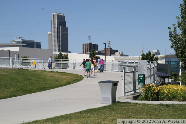
The photo above is the west approach to the bridge. The tall building in
the background is the First National Bank Tower. At 45 stories, it is the
tallest building in Nebraska. The photo below shows the bridge approach
as it spirals down to meet the trail that runs along the Omaha riverfront.

These two photos show the west bridge abutment. Note that the westernmost
suspended bridge span lands right on the abutment, whereas on the Iowa side
of the river, there was a long series of fixed bridge spans between the
abutment and the suspended spans.

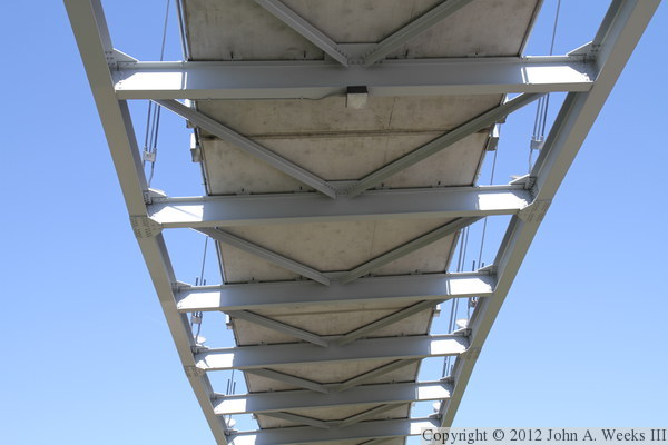
The photo above is the underside of the suspended span on the west end
of the bridge. The steel truss structure that supports the bridge deck can
be seen in this view. The stay cables attach to the beams on the outside
edges of this structure. The photo below is a marker that welcomes
pedestrians and bicyclists on the bridge to the city of Omaha.
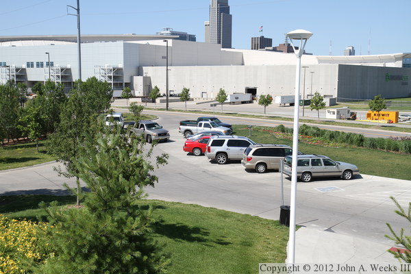
The photo above is the parking lot for the bridge along Riverfront Drive.
The lot is pretty small and is often full. There is normally plenty of
parking in the various parks along the riverfront, except on the day of
my visit, there was an event in progress, making parking hard to find.
Fortunately, the Gallup company opened their employee parking lot to
visitors. The photo below is a view looking northwest from the bridge deck.
The taller building is one of the towers that is part of Riverfront Place,
a large townhome complex, with the building to the right being the Gallup
company, whose operations are based in Omaha.


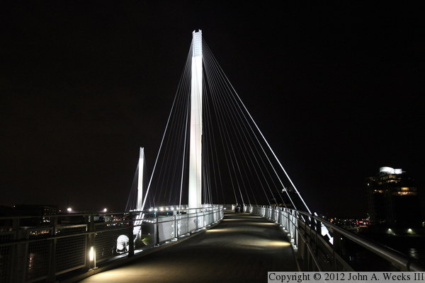
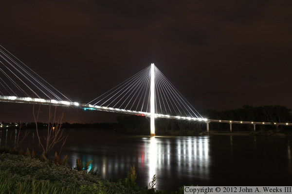
These two photos are first of eight night views. The photo above is
looking east across the river from the Omaha side of the bridge, with the
vantage point being just north of the structure. The photo below is on
the bridge deck on the Iowa side of the river looking towards Omaha.
These night photos are hard to take since the cables are very thin, and
the exposure required to see them causes most everything else to be
overexposed. In addition, the compression used to shrink these photos
down to a reasonable size causes a loss of detail on the cables.
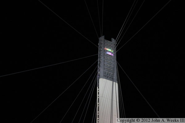
The photo above is looking towards downtown Omaha from the bridge deck,
with the bridge railing in the foreground. The blue and green lights
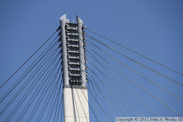
are on the CenturyLink Center. The photo below is the top of the west
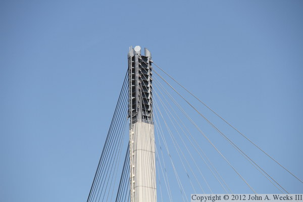
main bridge tower. Note the two segments of colored light in the metal
structure at the top of the tower. All of these slots are supposed to
be illuminated, but the lighting controller failed shortly after it was
first turned on in 2008. Engineers were not sure why it failed, but
both lightning and water intrusion were suspected. A new system was
installed in 2012 that can be adjusted to any color in the spectrum.
It was unveiled on November 21, 2012, the weekend of the Iowa-Nebraska
football game, with the Iowa tower lit up in in Hawkeye gold, and the
Nebraska tower lit up in Huskers red.

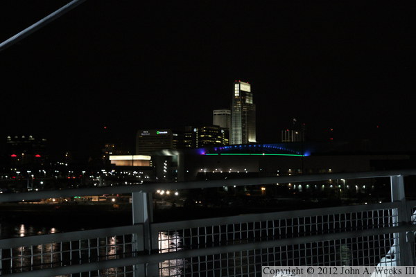
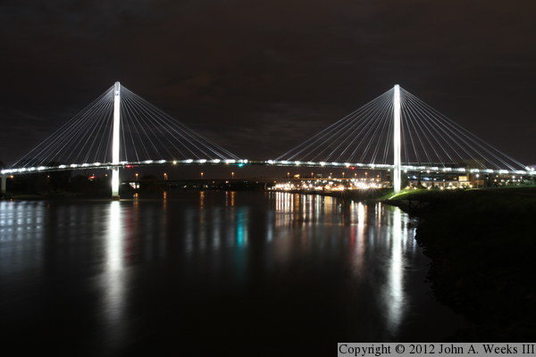
These two photos are views looking northeast from along the riverfront
trail in Omaha. The photo above shows both bridge towers and cable fans,
while the photo below is centered on the Iowa bridge tower. Note the red
and green lights under the bridge deck. They mark the main river
navigation channel, with the green light being the center of the channel.
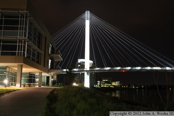
The photo above is the Nebraska main bridge tower and cable fan. The
vantage point is the riverfront trail as it passes in front of the National
Park Service office, which serves as the headquarters and visitor center
for the Lewis & Clark National Historic Trail. The photo below is
looking downriver from a boat dock located in front of the Gallup
company building. Iowa is on the left, Nebraska is on the right.

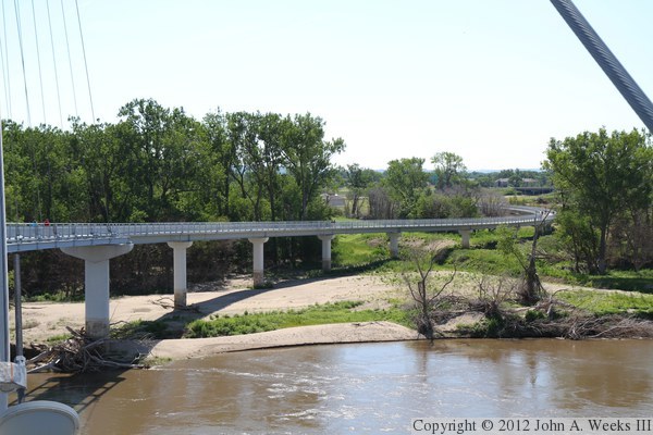
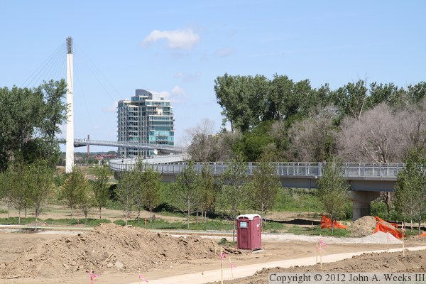
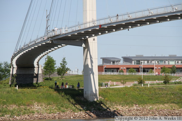
These two photos show the Iowa end of the Bob Kerrey Bridge as seen from
the west side of the river. The photo above is a view from near the water
level, showing the underside of the easternmost suspended span as well as
the fixed spans in Council Bluffs. The photo below is a similar view
from the bridge deck looking down on those same spans. I thought it would
be interesting to take a closer look at this area, so the remaining
photos are a ground-level tour from the Iowa side of the river.
The photo above is a view looking northwest towards the main suspended
bridge span from the park located on the Council Bluffs side of the
river. The park was flooded in 2011, and was still being cleaned up
when I visited in June, 2012. The sun was so bright that the bridge
cables are only barely visible. The photo below is a view of the fixed
bridge spans running across the river flats.

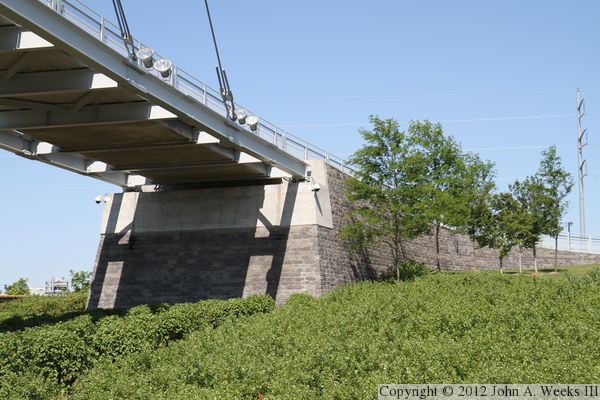
The photo above is the east bridge abutment. Note that while the west
bridge abutment is dressed up with brick, this abutment is raw concrete.
The photo below is looking west along the upstream side of the fixed bridge
spans. The fixed spans are supported by two parallel steel beams, which
in turn support a concrete deck that was poured on top of corrugated steel
sheeting.
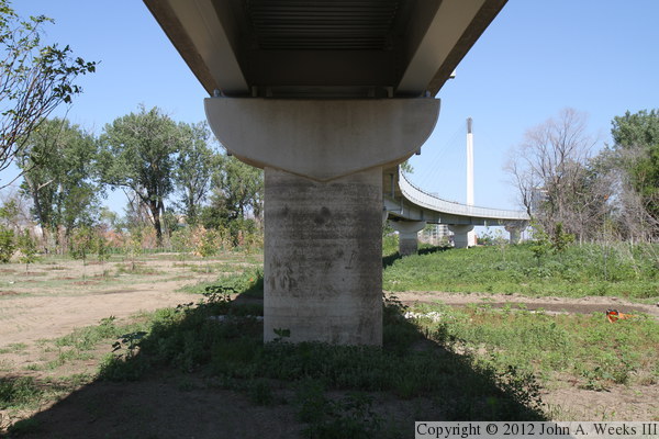
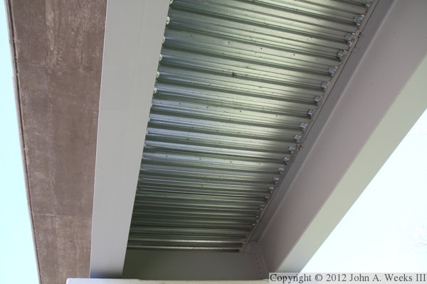
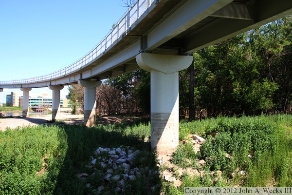
The photo above is the first bridge pier heading west from the east bridge
abutment. The photo above is the underside of the fixed span bridge deck.
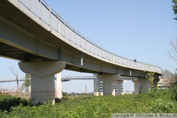
The photo above is the upstream side of the fixed spans as they go through
the first sweeping turn to the northwest. Note that the bridge piers are
shaped like fat letter T's. The photo below is the base of one of the
bridge piers. This one appears to be round, but that is because we are
looking at the thin edge of the pier. This particular pier suffered a
bit of erosion during the flood, but is undamaged.

The photo above is the downstream side of the fixed spans as they make
their second sweeping turn back to the west. A deep gully was carved in
the silt at this location, so I had to pick my path carefully to get
closer to the riverbank. The photo below is the final fixed span, and
the wider pier (on the left) where the bridge transitions to suspended spans.
These two photos are views of the individual bridge towers as seen from
the riverbank on the Iowa side of the river. The photo above is the
west bridge tower on the Nebraska side of the Missouri River, while the
photo below is the east bridge tower.

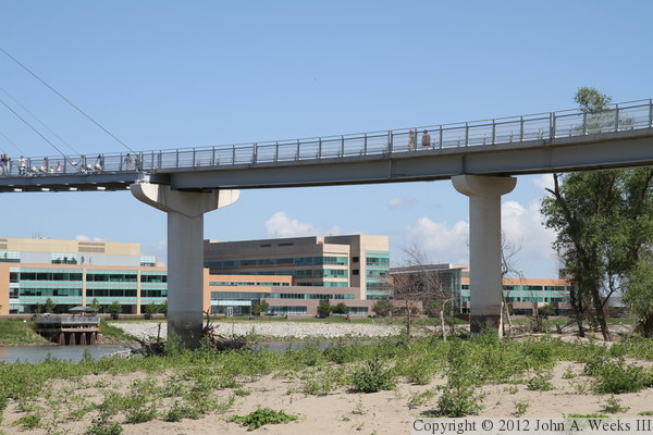
The photo above is the main bridge suspended spans as seen from the riverbank
on the Iowa side of the river just downstream from the structure. The
photo below is the top of the east main bridge tower showing the cable
attachment points.
These photos are two views of the bridge deck as it passes on the upstream
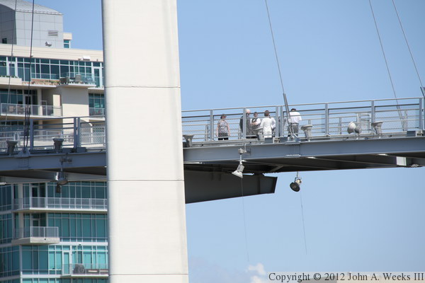
side of the east bridge tower. The photo above is a closer photo, while
the photo below is a wider view. Both photos show a number of visitors on
the bridge deck. In fact, the bridge was very busy on the weekend that
I visited despite many of the trails in Council Bluffs still being closed
from the 2011 flood.

These two photos, taken from the same vantage point on the Iowa side of
the river, show the bridge deck passing on the downstream side of the
west bridge tower. Note that the west bridge tower is built on firm
ground, while the east bridge tower was in the river channel.
The photo above is the cable attachment structure at the top of the
west bridge tower. The photo below shows cables as they attach to the
suspended span at the east end of the structure. Again, both photos
were taken from the same vantage point on the riverbank on the Iowa
side of the Missouri River.

|
