Current Weather Conditions
John A. Weeks III
Wednesday, May 8, 2024, 1:05:58 PM CDT
Home Photo Tours Rail Fan 12 Easy Steps
Aviation Spacecraft Highways & Bridges About The Author
 
Google Search
Maps   Groups   Images   Search
 
  Home
  • 12 Easy Steps
  • Aviation
  • Spacecraft
  • Highways & Bridges
    » Bridge Photography
      - MSP River Bridges
        › 10th Avenue Bridge
        › Arcola High Bridge
        › Betty Adkins Bridge
        › Bloomington Ferry
        › Bloomington Fry Tr
        › BNSF RR Bridge
        › Boom Island Foot Br
        › Broadway Avenue Br
        › C&NW Bridge (1)
        › C&NW Bridge (2)
        › Camden Bridge
        › Cedar Avenue Bridge
        › Cedar Ave Br (Old)
        › Cedar Ave Bicycle Br
        › Cedar Bend RR Br
        › Chaska Bridge (Old)
        › Chaska Swing Bridge
        › Chaska Trestle
        › Coon Rapids Dam
        › CP RR Bridge
        › Dan Patch Line Br
        › Dartmouth Bridge
        › East Channel Bridge
        › East Channel RR Br
        › East River Flats Br
        › Endless Bridge
        › F. W. Cappelen Mem
        › Father Henn Bluffs
        › Father Louis Henn Br
        › Ferry Street Bridge
        › First Avenue Bridge
        › Fort Road Bridge
        › Fort Snelling Br (Old)
        › Fort Snelling High Br
        › Great Western Bridge
        › Grey Cloud Channel
        › Grey Cloud Island Br
        › Grey Cloud Trail Br
        › Hastings High Bridge
        › Hastings Spiral Br
        › Holmes St Ped Bridge
        › Highway 243 Bridge
        › I-35W Bridge
        › I-35W Bridge (Old)
        › I-494 Bridge
        › I-694 Bridge
        › Interstate Bridge
        › Intercity Bridge
        › L St. Anthony F L&D
        › Lafayette Bridge
        › Lake Street Bridge
        › Lewis Street Bridge
        › Lexington Bridge
        › Lions Levee Pk Foot
        › Lock & Dam #1
        › Lock & Dam #2
        › Long Meadow Bridge
        › Lower Bridge
        › Lowry Bridge (Old)
        › Meeker Island L&D
        › Mendota Bridge
        › Merriam Street Br
        › Mill Ruins Park Br
        › Milwaukee Road Br
        › M&StL Bridge
        › Miss River Bridge 15
        › MN-101 Bridge
        › MN-41 Backchannel
        › MN-41 Back Ch (Old)
        › MN-41 Bridge
        › New Saint Croix Br
        › New Trunk-41 Bridge
        › Nicollet Island RR Br
        › North Miss Park Pier
        › NP Bridge #9
        › NP RR Bridge
        › Pike Island Bridge
        › Plymouth Bridge
        › Point Douglas DB
        › Raspberry Island Br
        › Richard P. Braun Br
        › Robert Street
        › Rock Island Swing Br
        › Runway 30 Light Br
        › Short Line Bridge
        › Smith Avenue High
        › Southeast Steam Plant
        › St. Anthony Falls Br
        › St. Anthony Falls Lab
        › St. Anthony Falls PP
        › St. Croix Boom Site
        › St. Croix Falls Dam
        › Stillwater Lift Br
        › Stone Arch Bridge
        › Third Avenue Bridge
        › Toll Bridge (Old)
        › U St. Anthony F L&D
        › US-8 Bridge
        › Wabasha Street Bridge
        › Wakota Bridge
        › Wakota Bridge (Old)
        › Walnut Street CW
        › Washington Ave Br
        › WI Central RR Br
        › WI Central RR Ruins
        › Wright Co Hwy 42
      - C & D Canal
      - Illinois River
      - Minnehaha Creek
      - Minnesota River
      - Mississippi River
      - Missouri River
      - St. Croix River
      - St. Louis River
      - Wisconsin River
      - Best Miss River Photos
      - Cable Stayed Bridges
      - McGilvray Road Bridges
      - I-35W Bridge Disaster
      - Miscellaneous Bridges
      - Madison County Bridges
      - Hist Br Weekend 2013
    » Road Geek Topics
  • Photo Tours
  • Rail Fan
  • About The Author
 
Site Search By JRank
Highways, Byways, And Bridge Photography
Lowry Avenue Bridge
Future Lowry Avenue Mississippi River Crossing
Minneapolis, MN

Lowry Avenue Bridge

• Structure ID: NBI: 27860.
• Location: River Mile 856.40.
• River Elevation: 801 Feet.
• Highway: CSAH-153, Lowry Avenue.
• Daily Traffic Count: 16,600 (Old Bridge, 2001).
• Bridge Type: Basket Handle Arch.
• Length: 1,576 Feet Overall, 450 Foot Longest Span.
• Width: 4 Lanes, Varies From 91 To 107 Feet Wide.
• Navigation Channel Width: 390 Feet (Estimated).
• Height Above Water: 37 Feet.
• Date Built: Opened October 27, 2012.
Hennepin County is the lead agency in developing a new Mississippi River crossing to replace the 1958 era Lowry Avenue Bridge. The 1958 era structure was closed in 2008 and removed in 2009. While a new bridge has been planned at this location for several years, that project had not been funding. Rather, it was expected that construction on a new bridge would not happen until the middle of the 2010 decade. The bridge replacement project took on new urgency when a severe problem was found in the old Lowry Avenue Bridge that resulted in the bridge being closed, and later condemned.

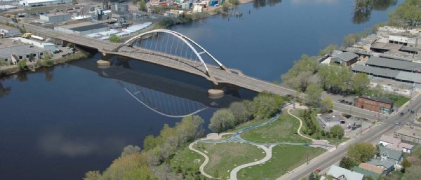
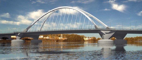
The new Lowry Avenue Bridge will be a basket handle arch bridge. As an arch bridge, it will have two large arches that rise nearly 200 feet above the river. A basket handle arch has the two arches tilted towards each other such that they meet high over the center of the bridge. The 450 foot long main span deck will be suspended under the arch using cables. One interesting feature of the new bridge is that the arches rise up from the river level rather than starting at the level of the deck as in traditional arch designs. The traffic lanes will go through the two arches, but the sidewalks will curve around the outside of the arches.

The basket handle arch design is relatively rare in the US. There are several signature basket handle arch bridges in Asia, notably in Japan. There are no other such bridges in Minnesota or anywhere along the Mississippi River. Interestingly, there is a Lowry Bridge in the United Kingdom, and it also happens to be a basket handle arch bridge.

The remainder of the bridge spans will be concrete of either the prestressed or post-tensioned design. There will be a smaller pier on the east side of the river to allow for a short span to accommodate a future regional trail to cross under the bridge. The west end of the bridge will also have a pier, and then the west abutment will be next to that pier. This is to allow the abutment to be removed at some point in the future to allow for the bridge to be extended to Washington Avenue. This is to provide for the possibility of the land on the west side of the river to be redeveloped and not be divided by the current earthen embankment. The goal is to someday removed that embankment and possibly create a park.

The first bridge at this location was built in 1887. A new bridge was built in 1905 featuring 5 steel truss spans. That bridge carried traffic for 51 years until it was deemed to be unsound. The truss spans were replaced in 1958 with 5 new steel trusses, this time, built much heavier. The new trusses were also wider to allow 4 lanes of traffic. In addition, the 1905 era bridge piers were widened, reinforced, and built 20 feet taller to allow river navigation under the bridge in anticipation of barge traffic on this section of the river with the completion of the locks at Saint Anthony Falls in the 1960s. The 1958 structure was found to have a problem with a pier shifting, resulting in the bridge being closed in 2008 and being demolished in 2009.

Click here for complete coverage of the 1958 era Lowry Avenue Bridge.

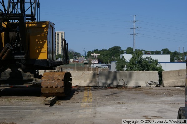
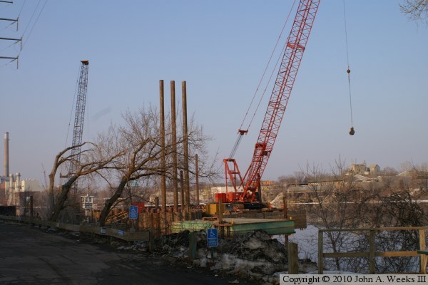
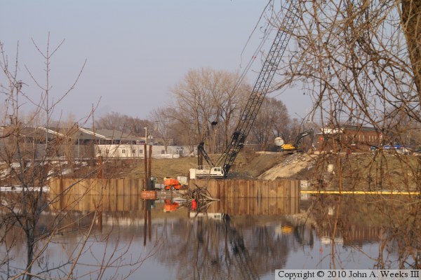
As of June 2009, the 1958 era bridge has been dismantled, but its piers remain in the river channel. A test piling is being sunk into the river to verify the design of the piers. Construction on the bridge is planned to begin in late summer or early fall of 2009, which completion in late summer or early fall of 2011.

Update—the new Lowry Bridge opened on the afternoon of Saturday, October 27, 2012, following a public open house and a short parade. Despite being a year behind schedule and millions over budget, the massive structure is set to become the centerpiece of a riverfront redevelopment now that the Port of Minneapolis is set to close. I have many dozen photos to put up someday, so please check back for updates.


Lowry Avenue Bridge
The rendering above and at the top of the page are from the Lowry Bridge project handouts. The photo below is a view of the start of construction on the new bridge looking west across the Mississippi River from the center of Lowry Avenue on the east side of the river.

Lowry Avenue Bridge
Lowry Avenue Bridge
These two photos are views looking northeast from the west riverbank towards the site of the new Lowry Bridge in mid-March, 2010. The photo above is the site of the west main bridge piers, while the photo below is the site of the east main bridge piers. These piers are large round concrete structures. They are being built inside of cofferdams constructed from a circle of sheet pile.

Lowry Avenue Bridge

Made With Macintosh
Authored by John A. Weeks III, Copyright © 1996—2016, all rights reserved.
For further information, contact: john@johnweeks.com